Information
City: AlgarveCountry: Portugal
Continent: Europe
Algarve, Portugal, Europe
The Algarve is the southernmost region of continental Portugal, situated between the Alentejo region and the Atlantic Ocean. It is a primary European tourism hub, characterized by a high density of maritime limestone cliffs, coastal lagoons, and world-class golf infrastructure.
Visual Characteristics
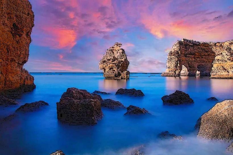
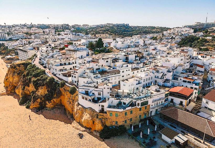
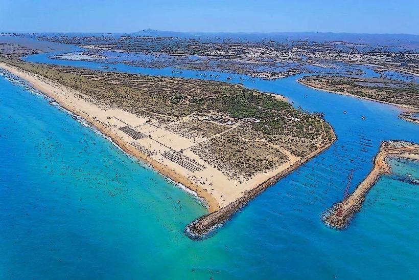
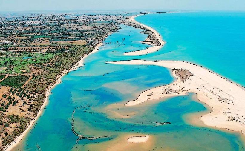
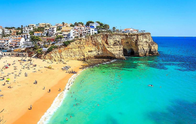
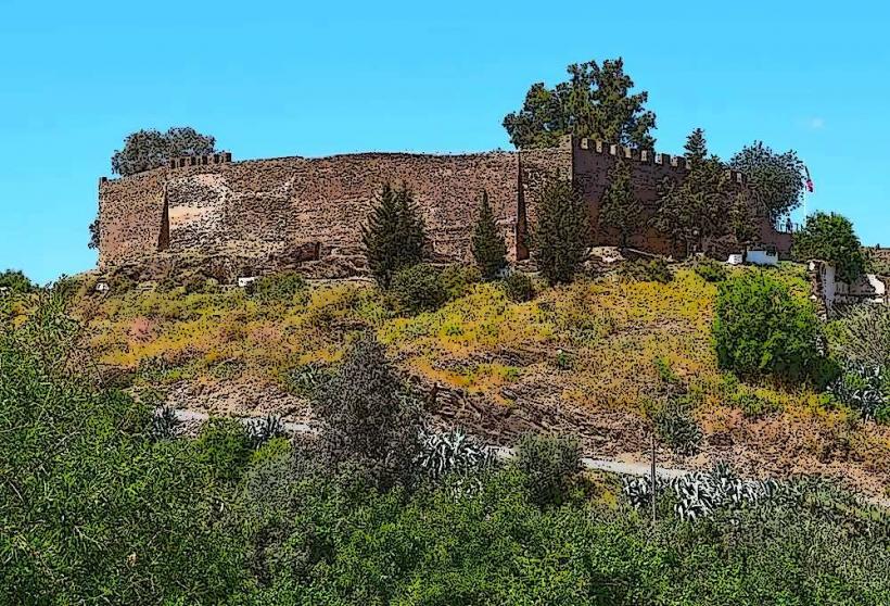
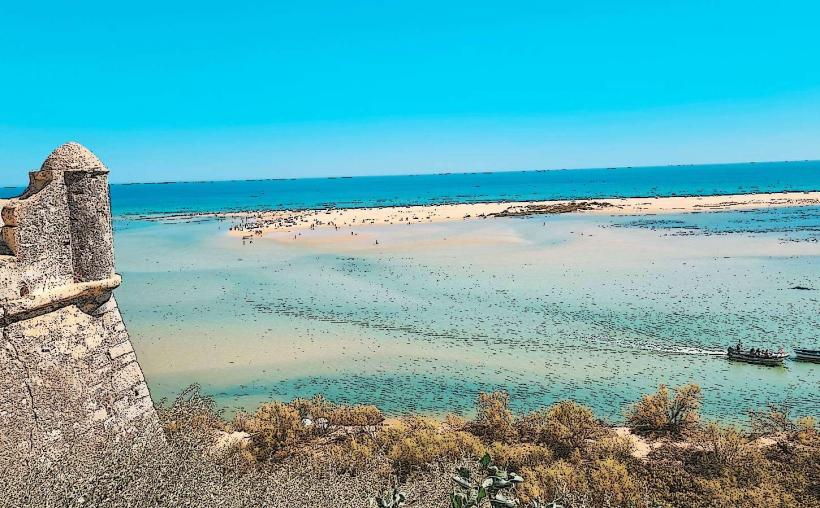
The landscape is bifurcated into two distinct zones: the Barlavento (Western Algarve), featuring dramatic limestone cliffs, sea caves such as Benagil, and turquoise waters; and the Sotavento (Eastern Algarve), defined by flat sandy barrier islands, salt marshes, and the expansive Ria Formosa lagoon system. Architecture typically consists of whitewashed buildings with ornate "Algarve chimneys" and terraced roofs (açoteias), influenced by Moorish design.
Location & Access Logistics
The region spans approximately 155 kilometers from east to west. It is served by Faro International Airport (FAO), the primary gateway located 4 kilometers from Faro city. The A22 motorway (Via do Infante) provides high-speed vehicle access across the entire coastline, while the N125 serves as the slower regional artery. The Linha do Algarve rail service connects Lagos in the west to Vila Real de Santo António in the east. Parking is concentrated in peripheral lots in historic centers like Lagos and Tavira to manage high seasonal vehicle density.
Historical & Ecological Origin
The region was the last part of Portugal to be reconquered from the Moors in 1249, leaving a legacy in the name (derived from the Arabic Al-Gharb, meaning "The West"). Geologically, the western cliffs are composed of Jurassic and Cretaceous limestone, while the east is dominated by Holocene alluvial deposits. The Ria Formosa Natural Park is a critical ecological site, serving as a major stopover for migratory birds and home to one of the world's largest populations of seahorses.
Key Highlights & Activities
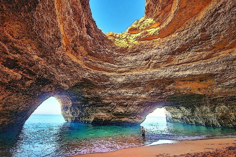
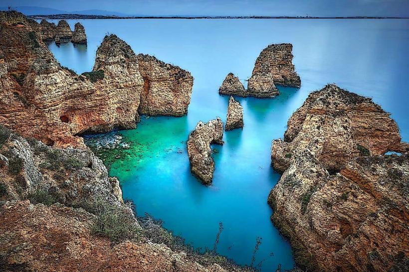
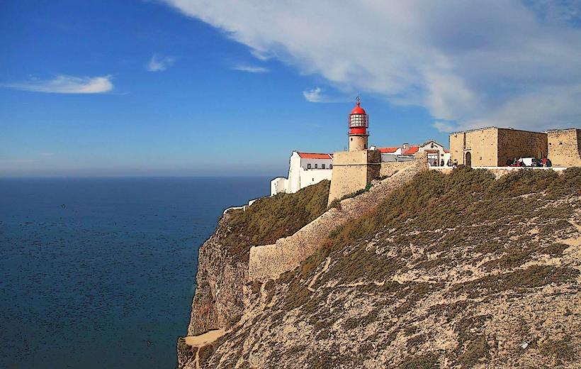
The Ponta da Piedade near Lagos offers high-density viewing of natural rock arches and stacks. Cape Saint Vincent (Sagres) marks the southwesternmost point of Europe, featuring a high-elevation lighthouse and dramatic Atlantic swells. The Benagil Sea Cave is a primary destination for maritime exploration via kayak or boat. The Via Algarviana is a 300-kilometer inland hiking trail traversing the Monchique and Caldeirão mountains. Golf is a major economic driver, with over 40 championship courses concentrated in the Vilamoura and Quinta do Lago areas.
Infrastructure & Amenities
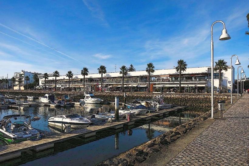
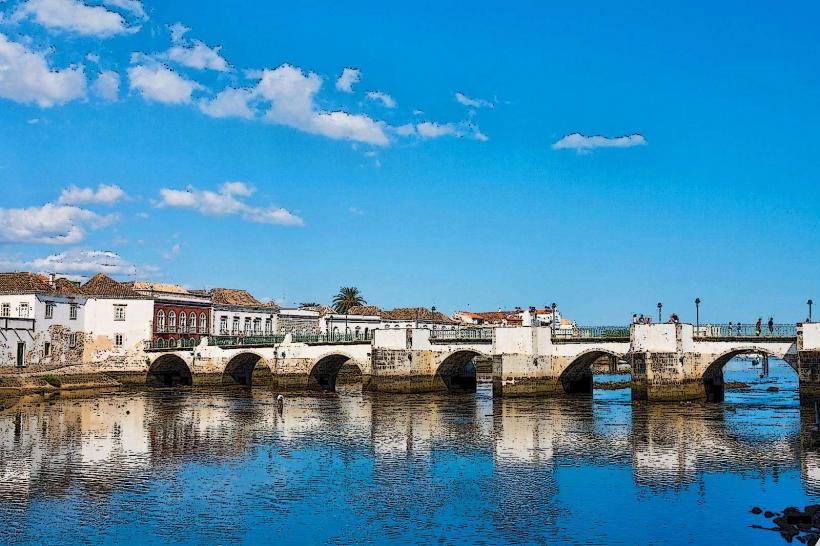
The region features high-density tourist infrastructure, with public restrooms and showers available at all "Blue Flag" certified beaches. 5G cellular coverage is universal in coastal towns but can be intermittent in the northern mountainous regions (Serra). High-capacity desalination plants and wastewater treatment facilities support the seasonal population surge. Retail is concentrated in the MAR Shopping Algarve and Forum Algarve complexes. Dining is densest in the old towns of Lagos, Albufeira, and Tavira, specializing in Cataplana (seafood stew) and grilled sardines.
Best Time to Visit
The climate is Mediterranean, with over 3,000 hours of sunshine per year. June through September is the peak period for beach activities, with temperatures between 25°C and 32°C. Spring (March–May) is optimal for hiking and observing wildflowers. Photography of the cliffs is best during "Golden Hour" at Ponta da Piedade. Winters are mild (10°C to 17°C) and popular with long-term northern European retirees.
Facts & Legends
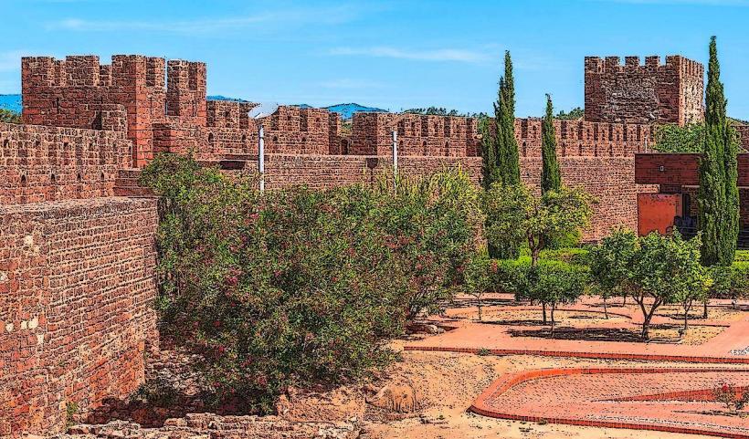
The Algarve produces the majority of Portugal’s salt, harvested from ancient salt pans in Olhão and Castro Marim. A local historical oddity: the Sagres Fortress is associated with Prince Henry the Navigator and the legendary "School of Navigation" that launched the Age of Discovery. Legend holds that the almond trees covering the region were planted by a Moorish King for his Nordic Queen, so the white blossoms would remind her of the snow in her homeland.
Nearby Landmarks
Faro Cathedral: Central hub of the regional capital
Ponta da Piedade: 3km South of Lagos
Benagil Cave: Located between Carvoeiro and Armação de Pêra
Cape Saint Vincent: 6km West of Sagres
Tavira Island: Accessible via ferry from Tavira town center