Information
Landmark: Tavira IslandCity: Algarve
Country: Portugal
Continent: Europe
Tavira Island, Algarve, Portugal, Europe
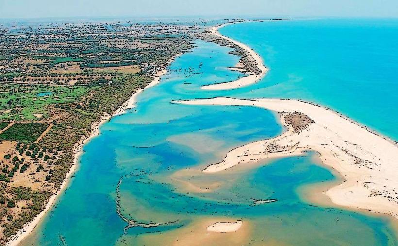
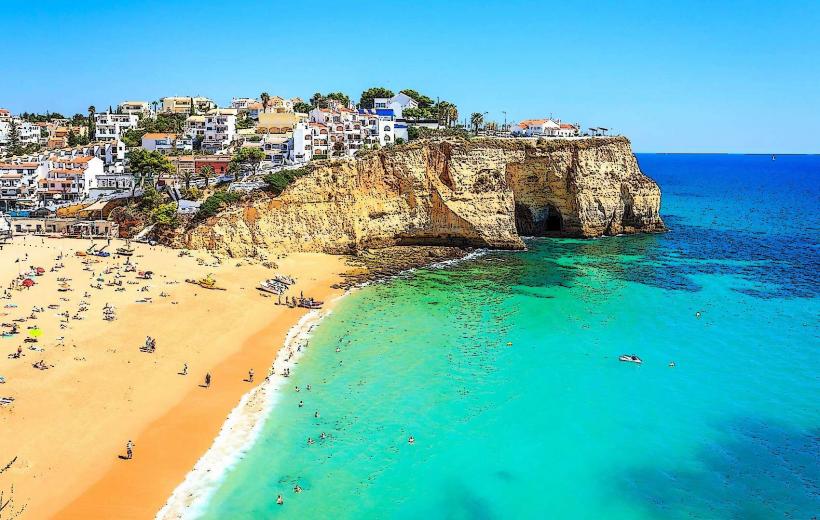
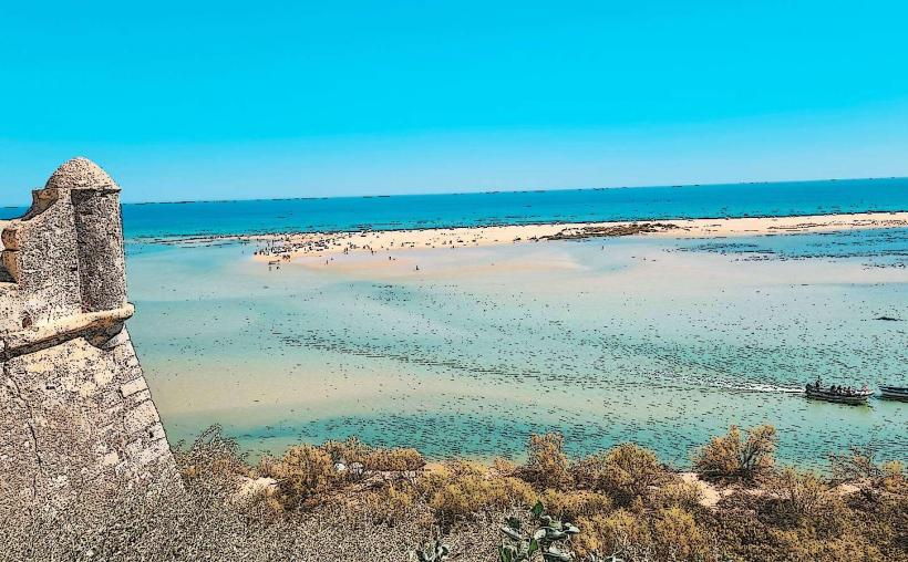
Tavira Island (Ilha de Tavira) is a 11-kilometer-long barrier island located south of the city of Tavira in the Eastern Algarve. It is part of the Ria Formosa Natural Park and is widely regarded as having some of the highest-quality beaches in the region.
Visual Characteristics
The island is a vast sandbar characterized by fine white sand, extensive dune systems, and calm, crystal-clear Atlantic waters. Unlike the rocky cliffs of the Western Algarve, the terrain is flat and windswept. The northern side of the island faces the lagoons and salt pans of the Ria Formosa, while the southern side features continuous beachfront. The vegetation consists of hardy dune-grasses and small pine clusters near the main settlement areas.
Location & Access Logistics
The island is separated from the mainland by a narrow channel. Access is exclusively by water or footbridge:
Ferry from Tavira Center: Departs from the riverside (Rua do Cais) during the summer season.
Ferry from Cais das Quatro Águas: A year-round service located 2km east of the city center.
Floating Bridge at Santa Luzia: A pedestrian bridge at Pedras d'el Rei connects the mainland to the western part of the island. From here, a historic mini-train (the Comboio da Praia do Barril) or a 1.5km walking path takes visitors to Barril Beach.
Historical & Ecological Origin
The island was formed by the accumulation of oceanic sediments and is a dynamic geographical feature that shifts with tides and storms. Historically, the western end (Barril) was home to a seasonal tuna-fishing community. Today, the island is a vital ecological zone within the Ria Formosa, serving as a sanctuary for diverse bird species, including flamingos and spoonbills, and the endangered European chameleon.
Key Highlights & Activities
Praia de Tavira: The most developed beach, located at the eastern end near the ferry terminal.
Anchor Graveyard (Cemitério das Âncoras): Located at Barril Beach, this is a memorial consisting of hundreds of rusting anchors used by former tuna fishermen to hold their nets.
Naturism: Praia do Homem Nú is an officially designated naturist beach located in a more remote central section of the island.
Watersports: The calm lagoon side is used for kayaking and stand-up paddleboarding.
Infrastructure & Amenities
The eastern end near the ferry landing features a campsite, public restrooms, showers, and several restaurants and bars. Barril Beach also has a cluster of cafes housed in converted former fishing huts. 4G/5G cellular coverage is stable across the island. Much of the island is accessible via wooden boardwalks designed to protect the fragile dune ecosystem.
Best Time to Visit
The optimal time for swimming is between June and September, when water temperatures are at their highest (typically reaching 21°C–23°C). For birdwatching and hiking, the shoulder seasons (April–May and October) offer cooler temperatures and fewer crowds. The ferry services and island restaurants operate at reduced capacity or close during the winter months (November–March).
Facts & Legends
The Anchor Graveyard is not a site of shipwrecks but a symbolic "cemetery" of the industrial tuna fishing trade that collapsed in the 1960s. Local tradition holds that the water surrounding the island is slightly warmer than in the rest of the Algarve due to the influence of the shallow Ria Formosa lagoons and Mediterranean currents.
Nearby Landmarks
Ria Formosa Natural Park: 0.0km (Surrounds the island)
Santa Luzia (Octopus Capital): 3.0km West (Mainland)
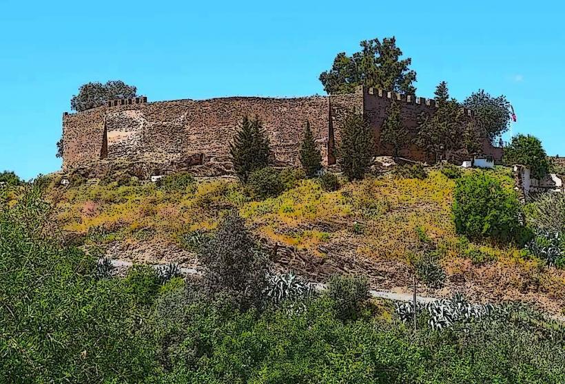
Tavira Castle: 5.0km North (Mainland)
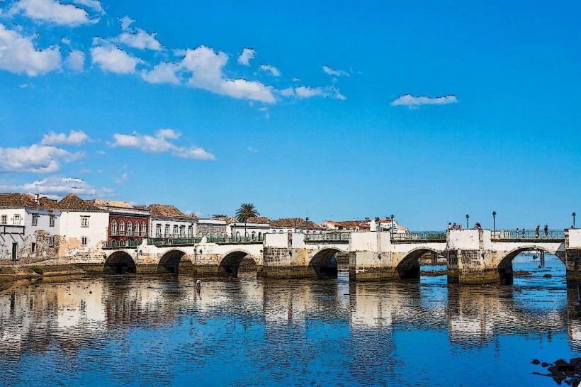
Roman Bridge of Tavira: 4.8km North (Mainland)
Cabanas Island: 2.0km East