Information
City: Calheta de Sao MiguelCountry: Cabo Verde
Continent: Africa
Calheta de Sao Miguel, Cabo Verde, Africa
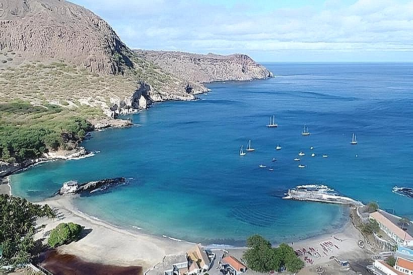
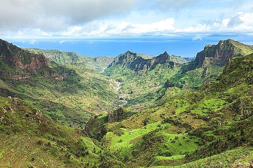
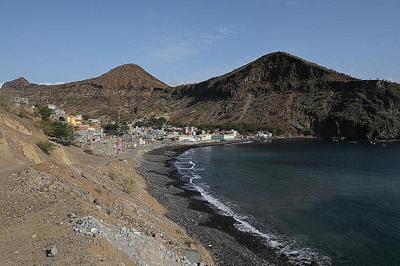
Calheta de São Miguel serves as the administrative seat of the São Miguel municipality and functions as a primary agricultural trade center for the northern interior of Santiago Island. It is situated on the northeast coast, positioned between the foothills of the Serra Malagueta mountain range and the Atlantic Ocean.
Historical Timeline
The town evolved from a small fishing and farming settlement during the Portuguese colonial era. Its primary era of governance followed the administrative reorganization of the island in the 20th century, particularly after Cabo Verde’s independence in 1975. The most significant architectural and infrastructural reconstruction occurred in the late 1990s and early 2000s to support its role as a municipal capital. The current urban form is defined by its transition from a rural outpost to a centralized logistical hub for the surrounding valleys.
Demographics & Population
The town contains approximately 5,500 residents, while the São Miguel municipality totals roughly 15,000. The demographics are predominantly Crioulo (Mestizo). The population is largely engaged in agriculture, fishing, and municipal administration. The median age is approximately 21 years.
Urban Layout & Key Districts
The city is organized along the coastal highway (EN1-ST01) which serves as its primary artery. The most important districts are the Waterfront/Port area, where fishing activity is concentrated, and the Upper Town, which contains the administrative buildings. The town is flanked to the south by the Ribeira de São Miguel valley and to the west by rising volcanic highlands.
Top City Landmarks
Church of São Miguel Arcanjo
Calheta Fishing Port
Municipal Market of São Miguel
Casa da Cultura (Cultural Center)
Calheta Waterfront Promenade
Transportation Network
Internal movement is conducted via walking or local Aluguer (shared minibuses). There is no rail or metro system. Taxis are blue and white and are typically found near the central market or the highway junction. Road infrastructure is a mix of asphalt and cobblestone. Traffic density is low, concentrated primarily around the arrival of Aluguers from Praia or Tarrafal.
Safety & "Red Zones"
The general safety level is high. Violent crime is rare; however, standard precautions against petty theft should be taken during crowded market days. There are no specific "red zones," but the beach areas are unlit and should be avoided after dark.
Digital & Financial Infrastructure
Average internet speed is 20-40 Mbps (4G). Main mobile carriers are CV Móvel and T+. Card acceptance is low; cash (CVE) is the primary medium for local commerce. There are several ATMs (Vinte4 network) located along the main road and near the municipal bank branch.
Climate & Air Quality
Temperatures range from 20°C–26°C in winter to 24°C–31°C in summer. The area is subject to higher humidity than the island’s leeward side. Air quality is high, although the "Bruma Seca" (Saharan dust) can reduce visibility and air quality between December and February.
Culture & Social Norms
Tipping is not mandatory but 5% is standard in seated restaurants. The greeting "Modi ki bu sta?" (How are you?) is common, followed by a handshake. Dress code is casual but modest; beachwear is strictly for the shoreline. Social life is centered around the "Tabanca" musical tradition, which is historically significant in this region.
Accommodation Zones
Coastal Strip: Recommended for proximity to the sea and the main transport route for those traveling across the island.
Administrative Center: Recommended for access to local eateries and proximity to the municipal market.
Local Cost Index
1 Espresso: 90 CVE ($0.88)
1 Standard Lunch: 600 CVE ($5.85)
1 Metro/Bus Ticket: 350 CVE ($3.40) - (Aluguer to Praia)
Nearby Day Trips
Serra Malagueta Natural Park (15 km)
Tarrafal Beach (20 km)
Ribeira Principal (10 km)
Pedra Badejo (18 km)
Facts & Legends
A verified historical oddity of the region is its deep connection to the "Rebelados"-semi-isolated communities that retreated into the mountains in the 1940s to protest religious and colonial reforms, preserving unique social structures. A local legend speaks of the "Feitiço de São Miguel," a belief that the waters of the local ribeira (river) possess the power to ensure that any visitor who drinks from them will eventually return to the island to marry.