Information
City: DilijanCountry: Armenia
Continent: Asia
Dilijan, Armenia, Asia
Dilijan serves as a primary cultural and educational center in Armenia, designated as a mountain spa town and the site of the UWC Dilijan international boarding school. It is situated in the Tavush Province within the Aghstev River valley, surrounded by the Lesser Caucasus mountains.
Historical Timeline
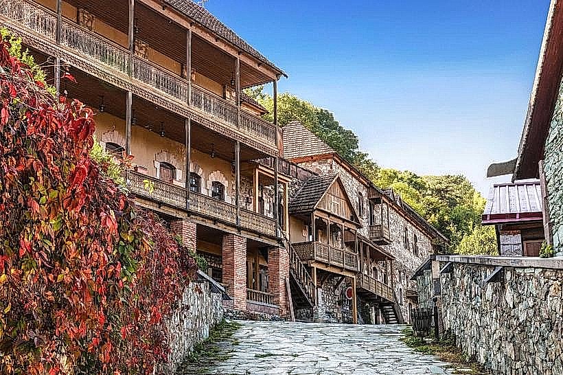
Dilijan was first mentioned in the 4th century but gained prominence in the 19th century as a summer retreat for the wealthy elite of Tiflis. The town transitioned from a rural settlement to a premier Soviet health resort and artistic colony following the 1921 establishment of Armenia's first tuberculosis sanatorium. The most significant architectural preservation occurred in the 1970s with the restoration of the "Old Dilijan" Sharambeyan Street. The primary event shaping the current urban form was the 2000s investment initiative to transform the city into a regional financial and educational hub, marked by the construction of the Central Bank of Armenia’s training center.
Demographics & Population
The population within city limits is approximately 17,000. The primary demographic is Armenian (98%), with small numbers of ethnic Russians (Molokans) residing in nearby villages. The median age is 35.8 years.
Urban Layout & Key Districts
The city is organized along the M4 highway and the Aghstev River. The most important districts are the Town Center (North), containing the main square and markets; Old Dilijan (Central), featuring restored 19th-century timber and stone architecture; and the UWC/International District (West), characterized by modern institutional infrastructure.
Top City Landmarks
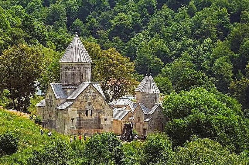
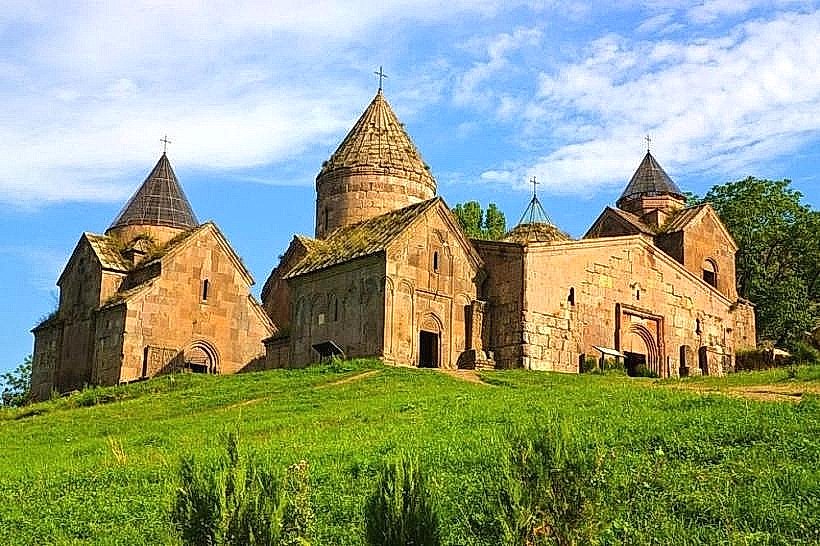
Haghartsin Monastery (13th-century complex)
Sharambeyan Street (Old Dilijan)
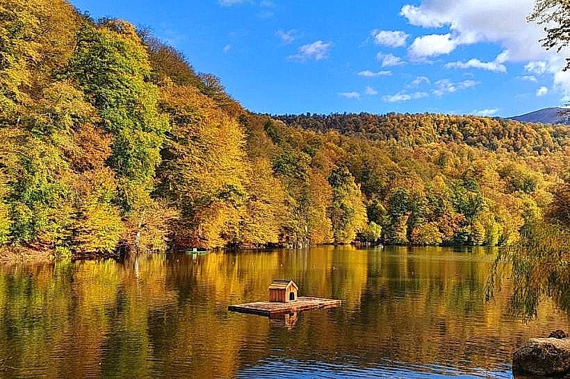
Lake Parz
Matosavank Monastery
Transportation Network
Movement within Dilijan is conducted via private vehicles or "Marshrutkas" (minibuses). There is no metro or tram system. Ride-sharing is highly reliable via the Yandex Go and GG apps. Taxis are abundant, typically silver or white, and it is standard to use app-based pricing to avoid negotiation. Intercity transit to Yerevan is serviced by vans departing from the central bus stop. Traffic density is low, though the M4 tunnel can experience delays due to heavy freight transit.
Safety & "Red Zones"
The general safety level is very high. There are no designated "red zones." Common scams are rare, though visitors should verify prices for private jeep tours to Lake Parz. The primary safety risk is geographical, involving unpredictable weather and dense fog on mountain hiking trails.
Digital & Financial Infrastructure
Average internet speed is 50–100 Mbps via Ucom or Team Telecom. Main mobile carriers are Viva-MTS, Team, and Ucom. Card acceptance is high in hotels and modern cafes; however, cash (Armenian Dram) is mandatory for local craft shops and forest-based vendors. ATMs are concentrated in the town center and at the Central Bank facility.
Climate & Air Quality
Temperatures range from -6°C in January to 24°C in July. The city is characterized by high humidity and a temperate alpine climate. Air quality is among the highest in the Caucasus due to the surrounding 34,000 hectares of the Dilijan National Park; there are no major industrial pollutants.
Culture & Social Norms
Tipping is expected at 10% in restaurants. Handshakes are the standard greeting. Dress code is casual, but conservative attire (covered shoulders/legs) is strictly required for entering Haghartsin and Goshavank monasteries. Public smoking is permitted in many outdoor areas but banned in some modern cafes.
Accommodation Zones
Stay on Sharambeyan Street for historic atmosphere and proximity to central dining.
Stay in the mountain-side guesthouses (Upper Dilijan) for seclusion and direct trail access.
Local Cost Index
1 Espresso: 1,000 AMD ($2.50)
1 Standard Lunch: 5,000 AMD ($12.50)
1 Intra-city Minibus: 100 AMD ($0.25)
Nearby Day Trips
Ijevan (35 km northeast)
Lake Sevan (25 km south)
Lastiver Caves (50 km northeast)
Odzun Church (85 km northwest)
Facts & Legends
Dilijan is frequently referred to as "Armenian Switzerland" due to its forested alpine landscape. A local legend, popularized by the Soviet film Mimino, claims that the tap water in Dilijan is the second best in the world (after San Francisco) because of its high mineral purity. The "Hidden Waterfall" near Haghartsin is the site of various local myths regarding forest spirits said to protect the monastery’s water source.