Information
City: El NidoCountry: Philippines
Continent: Asia
El Nido, Philippines, Asia
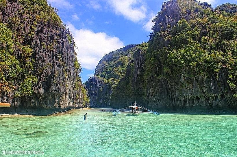
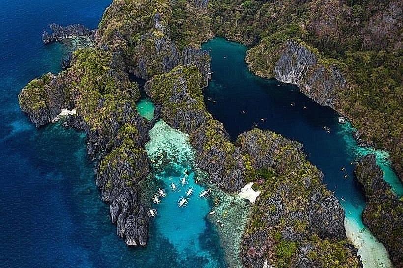
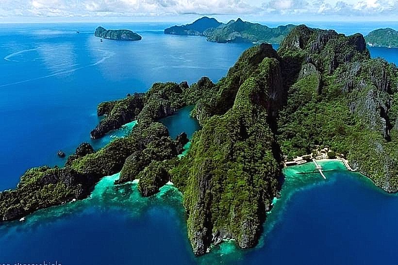
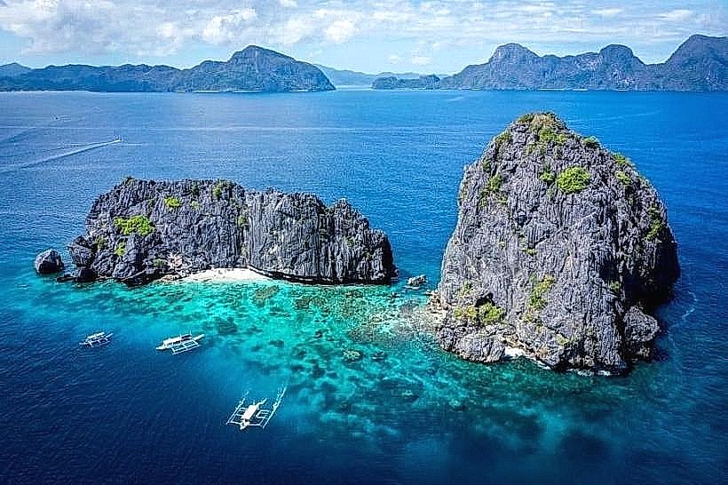
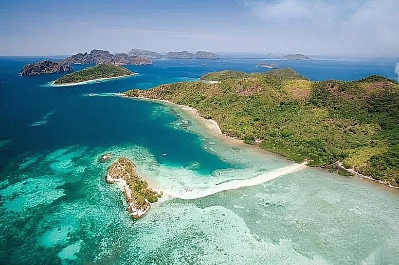
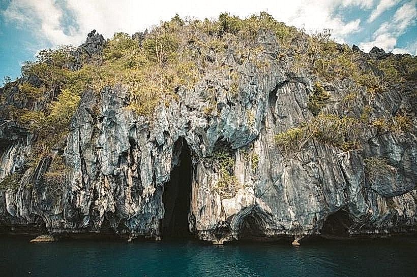
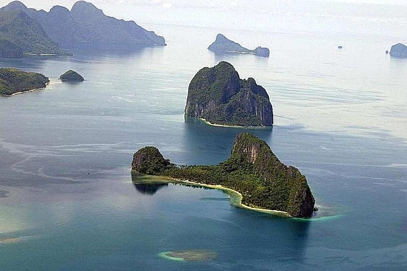
El Nido serves as the primary tourism and conservation node of northern Palawan. It functions as a critical gateway to the Bacuit Archipelago and is categorized as a protected managed resource area due to its high biodiversity and limestone karst ecosystems.
Historical Timeline
The area was inhabited by the Tagbanua people before Spanish arrival. It was originally named Bacuit but was renamed "El Nido" (The Nest) in 1954, referencing the edible swiftlet nests found in its limestone cliffs. The primary event shaping its current urban form was the 1980s shift from a remote fishing village to an international luxury destination, followed by the 2018-2019 government rehabilitation efforts to implement stricter environmental carrying capacities for its lagoons.
Demographics & Population
The population is approximately 50,000. The demographic consists of native Cuyonons and Tagalogs, supplemented by a significant seasonal population of European and North American expatriates. The median age is 25 years.
Urban Layout & Key Districts
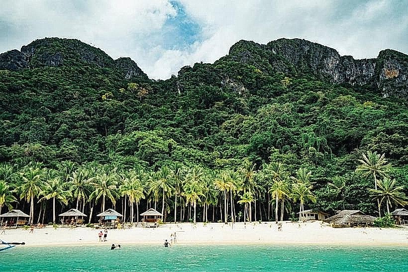
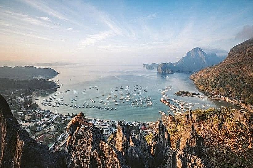
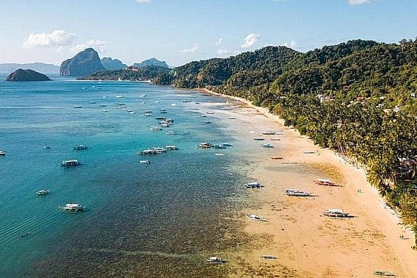
The municipality is mountainous with a narrow coastal strip. Key districts include El Nido Town (Poblacion), the high-density commercial and ferry hub; Corong Corong, the primary sunset beach and residential expansion area; and Lio, a master-planned eco-estate near the airport.
Top City Landmarks
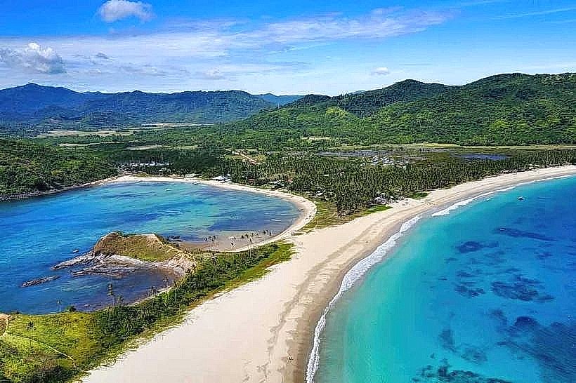
Nacpan Beach (North of the town center)
Transportation Network
Movement is facilitated by tricycles and rented scooters. There is no rail or large-scale bus transit within the town. Air travel is serviced by Lio Airport (ENI) via AirSwift, while ferries connect to Coron and San Fernando. Road access from Puerto Princesa is via a 5-6 hour van or bus trip. Traffic is dense in the narrow streets of the Poblacion during morning boat departures.
Safety & "Red Zones"
The safety level is high. Avoid unlit sections of the road toward Nacpan after dark due to poor road conditions. Common scams include "hidden fees" for environmental permits (ETDF); always ensure permits are issued by the official municipal office. Water safety is critical; do not ignore warnings regarding jellyfish or strong currents in the deeper channels.
Digital & Financial Infrastructure
Average internet speed is 10-30 Mbps, with frequent localized outages during storms. Main carriers are Globe and Smart. Card acceptance is increasing in high-end resorts and the Lio Estate, but the town remains heavily cash-dependent. ATMs are now available in the town center but frequently run out of cash during peak tourist weekends; carrying backup PHP is mandatory.
Climate & Air Quality
Temperatures range from 24°C to 32°C. The region is susceptible to typhoons and heavy rain from June to November, which often leads to the cancellation of boat tours. Air quality is excellent, as there is no heavy industry and the geography allows for constant oceanic ventilation.
Culture & Social Norms
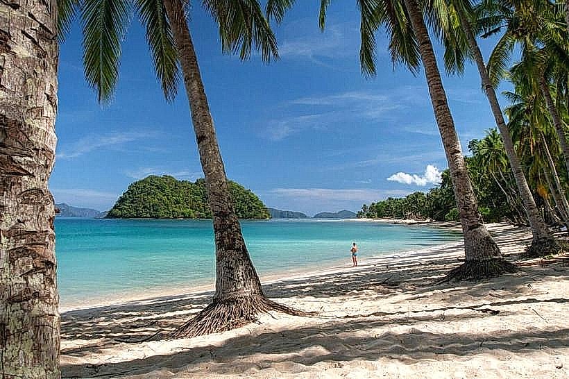
Tipping of 10% is standard in restaurants. The culture is centered on "Environmental Stewardship"; the use of single-use plastics is strictly banned, and tourists are expected to follow "No Trace" principles in the lagoons. Dress code is beach-casual, but modest clothing is required for municipal offices.
Accommodation Zones
Stay in El Nido Town for proximity to ferry terminals, nightlife, and budget dining.
Stay in Corong Corong for sunset views and mid-range boutique stays.
Stay in Lio Estate for luxury, high-speed internet, and secluded beaches.
Local Cost Index
1 Espresso: 150 PHP ($2.60 USD)
1 Standard Lunch (Island Hopping Buffet included in tours): 1,200-1,500 PHP per day tour ($21 - $26 USD)
1 Tricycle Ride: 50-150 PHP ($0.85 - $2.60 USD)
Nearby Day Trips
Nacpan and Calitang Twin Beaches: 20 km (45 minutes)
Nagkalit-kalit Falls: 12 km (30 minutes)
Sibaltan Village: 40 km (1 hour)
Las Cabanas Beach: 3 km (10 minutes)
Facts & Legends
El Nido is the source of "Bird's Nest Soup," made from the saliva of swiftlets; these nests are among the most expensive animal products in the world. Local legend suggests the limestone formations are petrified giants, while a verified historical fact is that the Bacuit Bay area served as a filming location for the climax of the 2012 film The Bourne Legacy.