Information
City: FloresCountry: Guatemala
Continent: North America
Flores, Guatemala, North America
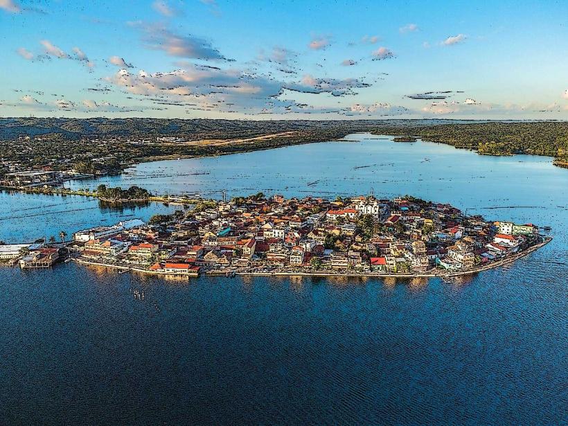
Flores is the administrative capital of the Petén Department and serves as the primary logistical gateway to the Maya Biosphere Reserve. It is situated on an island within Lake Petén Itzá, connected to the mainland towns of Santa Elena and San Benito by a 500-meter causeway.
Historical Timeline
The island was the site of Noh Petén, the capital of the Itza Maya, founded in the 13th century after the collapse of Chichén Itzá. Its primary era of governance shifted in 1697 when it became the last indigenous stronghold in Mesoamerica to fall to Spanish forces. The most significant architectural reconstruction occurred in the mid-20th century as the city transitioned from a chicle-exporting outpost to a tourism hub. The 1697 conquest and subsequent destruction of Maya temples to build the colonial church is the primary event that defined the current circular urban form.
Demographics & Population
The population of the island itself is approximately 3,000, while the greater Flores-Santa Elena-San Benito urban area contains roughly 80,000 residents. The demographics are predominantly Mestizo (88%), with significant minority groups of Itza Maya (7%) and Q'eqchi' Maya (3%). The median age is approximately 23.5 years.
Urban Layout & Key Districts
The city is organized in a radial pattern on a small limestone island.
The Summit: The highest point of the island, housing the central plaza and the Cathedral.
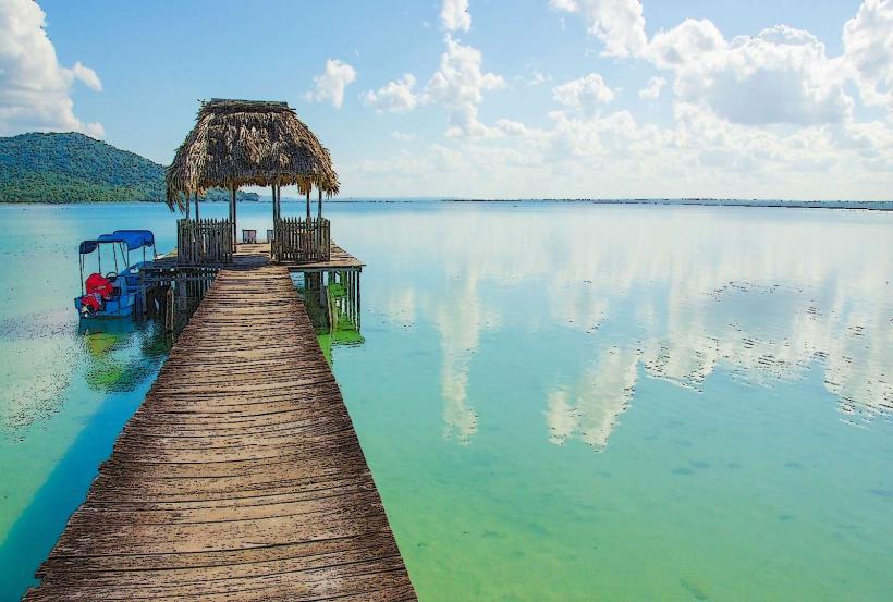
The Malecón: A perimeter road encircling the island, containing the majority of hotels and restaurants.
Santa Elena (Mainland): The commercial and transport hub housing the airport and bus terminals.
San Benito (Mainland): A primary residential and market district west of the causeway.
Top City Landmarks
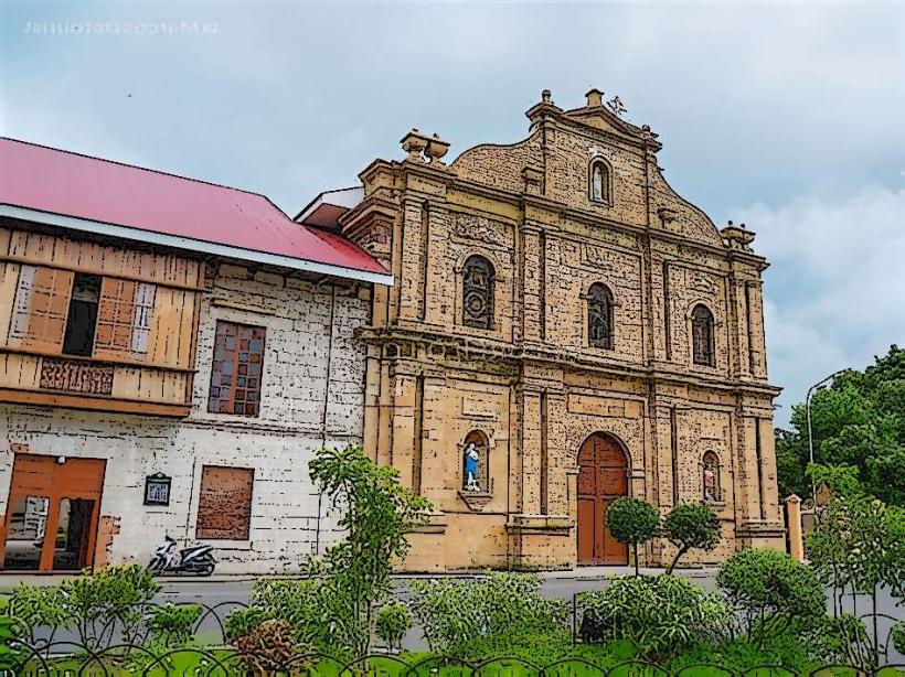
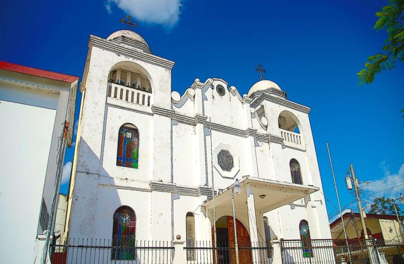
Catedral de Nuestra Señora de los Remedios y San Pablo: The white-washed colonial church at the island's peak.
Plaza Central: The elevated historic square featuring Mayan stelae and local government buildings.
The Malecón: The waterfront promenade used for transit and social activity.
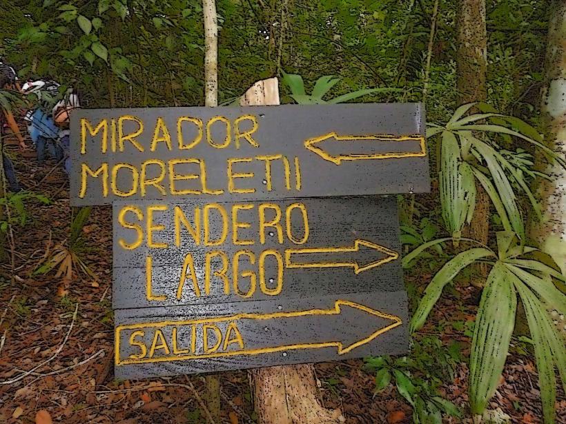
ARCAS Wildlife Center: Located a short boat ride across the lake.
Actún Kan: A network of caves located on the southern outskirts of the mainland.
Transportation Network
Movement within the island is conducted entirely on foot due to its 15-minute walking diameter. Tuk-tuks are the primary motorized transport for transit across the causeway to Santa Elena. There is no metro or city bus system. Uber has limited availability; private taxis and "InDrive" are more common. Boat taxis (lanchas) provide transit to lakeside villages. Mundo Maya International Airport (FRS) is located 3 kilometers east of the island. Traffic density is low on the island but high on the causeway during afternoon hours.
Safety & "Red Zones"
The general safety level on the island is very high. Visitors should avoid walking in the outskirts of San Benito after dark. Common scams include "freelance" tour operators at the bus station promising discounted Tikal tours that involve hidden costs or unverified transport. Utilize established agencies on the island for archaeological site logistics.
Digital & Financial Infrastructure
Average internet speed is 30 Mbps. Main mobile carriers are Tigo and Claro. Card acceptance is high in island hotels and restaurants, though a 5–10% fee is frequently added. ATMs (5B and BI) are located at the entrance to the causeway and within the Maya Mall in Santa Elena; there are limited ATMs on the island itself.
Climate & Air Quality
The climate is tropical and humid. Temperatures range from 21°C at night to 35°C during the day. The rainy season (June–November) brings intense afternoon deluges and high humidity. Air quality is generally high, though seasonal agricultural burning (Roza y Quema) in March and April can create a significant haze over the lake.
Culture & Social Norms
Tipping of 10% is standard in restaurants. Greetings are casual; a verbal "Buenas" is the standard acknowledgement. Dress code is highly casual due to the heat, though swimwear is discouraged away from the waterfront. Public behavior is relaxed, but noise levels are regulated at night to accommodate the dense residential-hotel mix on the island.
Accommodation Zones
Flores Island: Recommended for aesthetics, safety, and walking access to dining and sunset views.
Santa Elena: Recommended for budget travelers needing immediate access to the bus terminals or airport.
Local Cost Index
1 Espresso: Q20.00 ($2.60)
1 Standard Lunch: Q55.00 ($7.15)
1 Tuk-Tuk Trip (to Mainland): Q10.00 ($1.30)
Nearby Day Trips
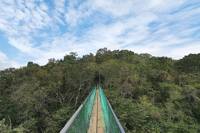
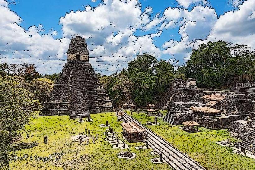
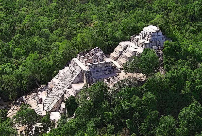
Tikal National Park: 64 km (1 hour 15 mins)
Yaxhá Archaeological Site: 75 km (1.5 hours)
El Remate: 30 km (40 mins - lakeside village)
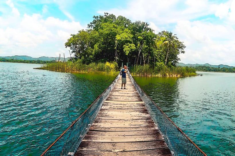
Tayasal: 5 mins by boat (Maya ruins and viewpoint across the water)
Facts & Legends
A prominent local legend concerns the Black Horse of Cortés. During Hernán Cortés's 1525 expedition to Honduras, his injured horse was left with the Itza Maya. The Itza, unfamiliar with horses, fed it flowers and meat, leading to its death. Legend says they built a stone statue of the horse (Tzimin Chac) and placed it in the lake; locals claim that when the water is low and clear, the stone horse can still be seen on the lake floor near the island.