Information
City: KotorCountry: Montenegro
Continent: Europe
Kotor, Montenegro, Europe
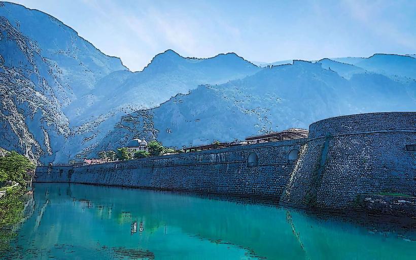
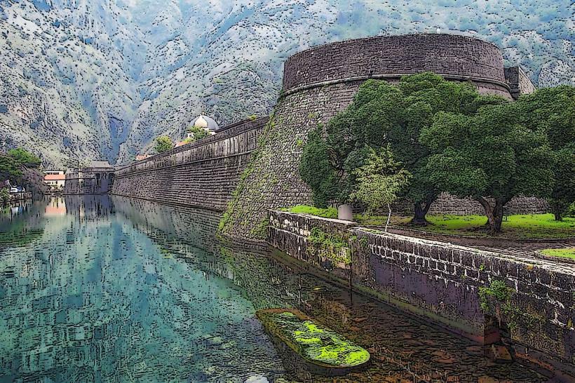
Kotor functions as the primary cultural and historical node of the Montenegrin coast and the administrative center of the Kotor Municipality. Situated at the innermost tip of the Bay of Kotor (Boka Kotorska), it serves as a specialized node for international cruise tourism, maritime education, and heritage conservation. It is defined by its UNESCO World Heritage status, its 4.5 km of Venetian-era fortifications, and its "cat-centric" street culture.
Historical Timeline
Kotor’s urban origins date to the Illyrian and Roman eras (as Acruvium). The primary era of governance was the Venetian period (1420–1797), which established the city’s defensive walls and Renaissance-Baroque aesthetic. The primary event shaping its modern preservation was the 1979 earthquake, which caused massive structural damage and led to its immediate inscription on the UNESCO World Heritage list. Historically, the city functioned as a semi-autonomous maritime republic and a vital artistic center for masonry and iconography.
Demographics & Population
The population of the town proper is approximately 13,300, with roughly 23,000 in the broader municipality (2026 estimate). The demographic profile is specialized toward the tourism and maritime sectors. The city hosts the University of Montenegro's Faculty of Maritime Studies, maintaining a high density of naval engineers and master mariners.
Urban Layout & Key Districts
The city is squeezed into a narrow strip between the limestone cliffs of Mount Lovćen and the sea.
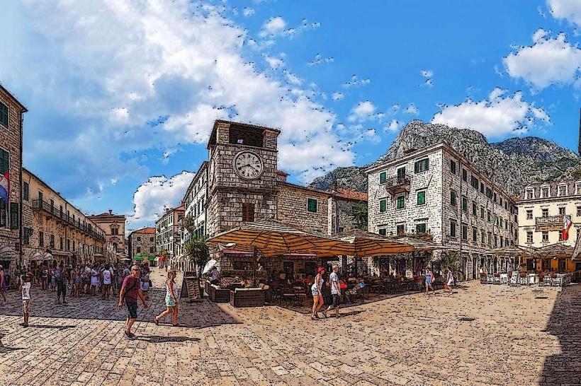
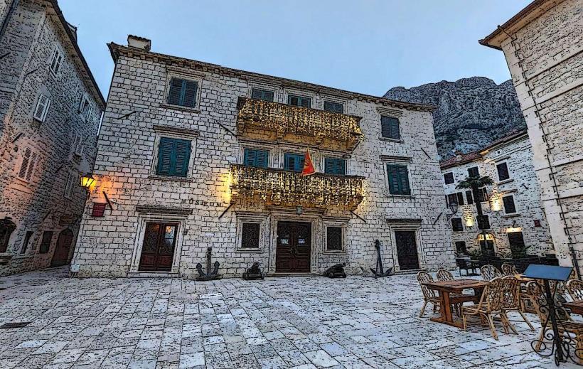
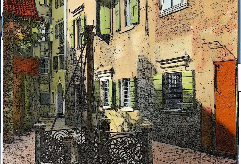
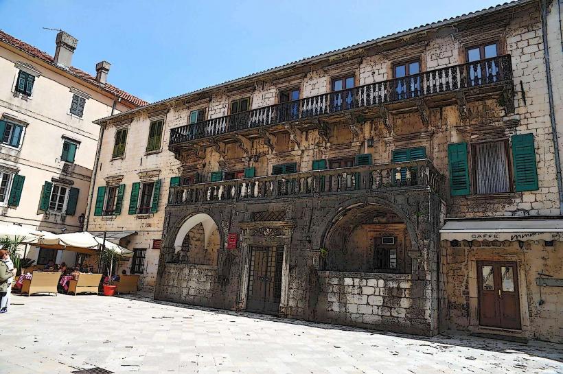
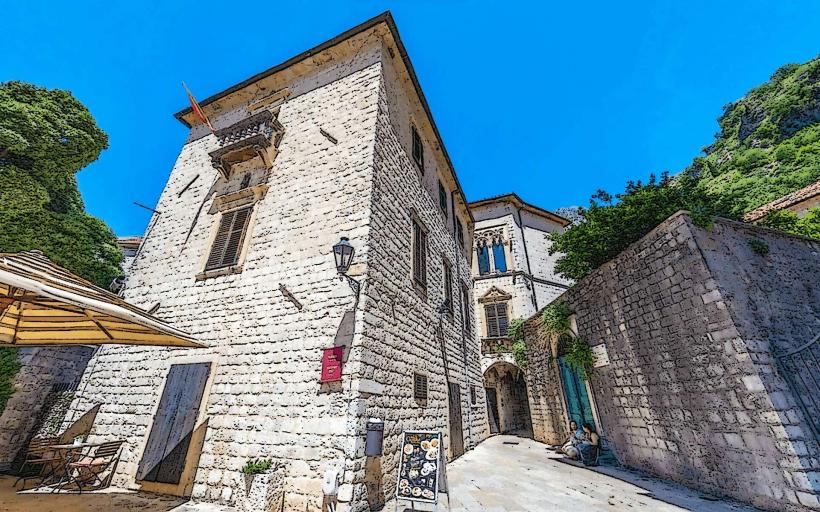
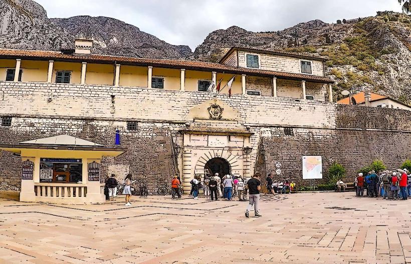
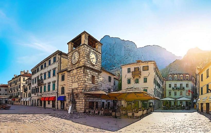
Stari Grad (Old Town): A specialized medieval triangle enclosed by thick stone walls; it is entirely pedestrian and contains the city’s highest concentration of historical palaces and churches.
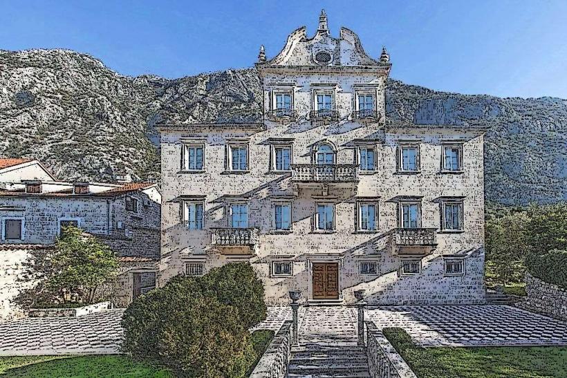
Dobrota: A specialized northern suburb stretching several kilometers along the coast, known for waterfront stone palaces and high-end residential development.
Škaljari: A specialized southern district located at the base of the Vrmac tunnel, serving as a primary residential and transport artery.
Muo & Prčanj: Specialized fishing villages on the opposite side of the bay, characterized by "quiet luxury" and supply-constrained property markets.
Top City Landmarks
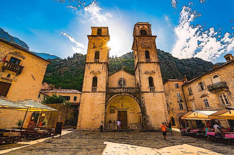
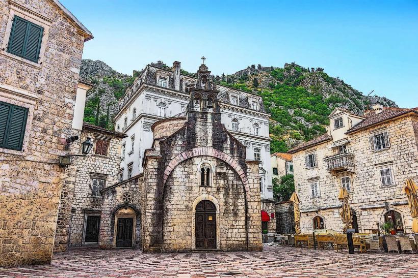
St. Tryphon Cathedral: A specialized Romanesque cathedral consecrated in 1166; it houses the city's treasury and the silver-encased relics of St. Tryphon, the patron saint of Kotor.
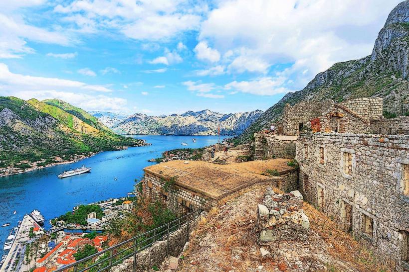
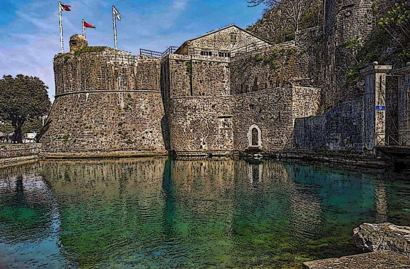
Fortifications & San Giovanni Castle: A specialized 4.5 km defensive system; the trail consists of 1,350 steps leading 280 meters above sea level to the citadel for the primary view of the fjord.
Maritime Museum: Housed in the specialized 18th-century Grgurina Palace, documenting Kotor’s history as a world-leading naval power.
Our Lady of Health (Gospa od Zdravlja): A specialized 15th-century votive church located halfway up the San Giovanni cliffs, built by survivors of the plague.
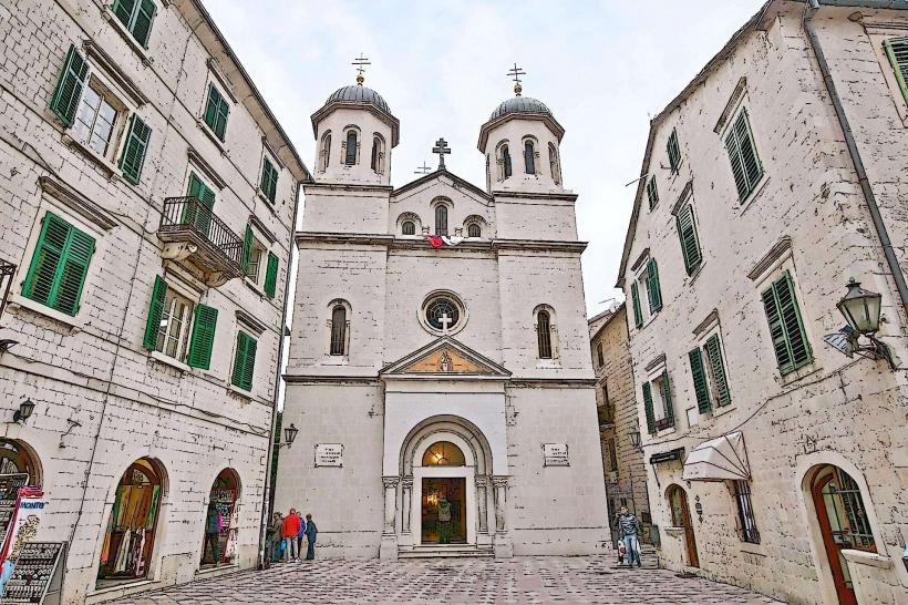
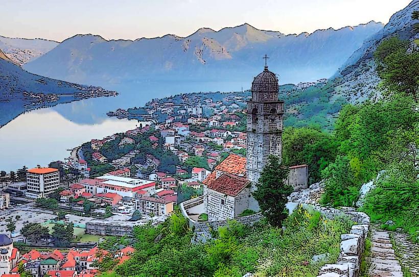
St. Nicholas Church: A specialized Orthodox church (built 1909) with a distinct large dome and two bell towers, dominating the northern section of the Old Town.
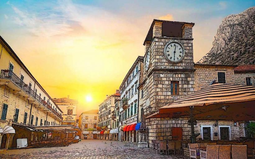
Clock Tower & Column of Shame: Located at the specialized "Piazza of the Arms"; the stone pillar was historically used to publicly shame local criminals.
Transportation Network
Kotor is a specialized maritime-road junction with significant seasonal density.
Port of Kotor: A specialized international cruise terminal; in 2026, it maintains a high-frequency schedule with arrivals from major lines like MSC and Royal Caribbean.
Vrmac Tunnel: A specialized 1.6 km engineering link connecting Kotor directly to Tivat Airport (10 mins) and the Adriatic Highway.
Kotor–Lovćen Cable Car: A specialized aerial link opened in 2023, connecting the Dub area to the Kuk plateau on Mount Lovćen in 11 minutes.
Safety & "Red Zones"
The general safety level is exceptionally high. Kotor is statistically very secure. There are no "red zones." The primary safety concerns are environmental: slippery stone pavement in the Old Town when wet and the risk of heat exhaustion when climbing the fortress walls in summer.
Digital & Financial Infrastructure
In 2026, the city operates as a Smart Heritage Node. Internet speeds average 400–1000 Mbps. 5G is universal within the Old Town and Dobrota. The city utilize a specialized digital "Kotor Pass" for integrated contactless access to museums, the city walls, and the cable car.
Climate & Air Quality
Kotor has a Mediterranean climate with high rainfall due to the surrounding mountains (Orjen/Lovćen). Average temperatures range from 7°C in January to 26°C in July. Air quality is generally high, though winter months can see moderate PM2.5 levels in the bay due to temperature inversions.
Local Cost Index (2026 Estimates)
1 Espresso: €1.80 – €2.50
1 Portion of Black Risotto: €15.00 – €22.00
Fortress Entry: €15.00
Property Price (Dobrota Waterfront): €7,500 per $m^2$
Nearby Day Trips
Perast: 15 mins away; a specialized Baroque town featuring the artificial island church of Our Lady of the Rocks.
Lovćen National Park: 45 mins away; home to the specialized Njegoš Mausoleum at the summit of Jezerski Vrh (1,657m).
Blue Cave (Plava Špilja): 30 mins by speedboat; a specialized maritime cave known for its iridescent blue light effects.
Facts & Legends
Kotor is home to a specialized population of urban cats, which are considered symbols of good luck and protectors of the city; they even have a dedicated museum. Legend states that the city walls were built by three brothers who had to enchant the mountain to allow the stone to stick. A verified fact is that the San Giovanni Fortress was never taken by force throughout its long history. Historically, the city’s "Boka Navy" (Bokeljska mornarica) is one of the oldest maritime organizations in the world, founded in 809 AD.
Would you like me to analyze the economic shift in Kotor following the 2026 property price surge or provide a logistics breakdown for the Tivat–Kotor transit corridor?