Information
City: MayaroCountry: Trinidad and Tobago
Continent: North America
Mayaro, Trinidad and Tobago, North America
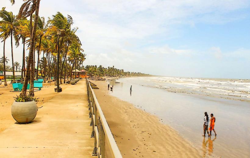
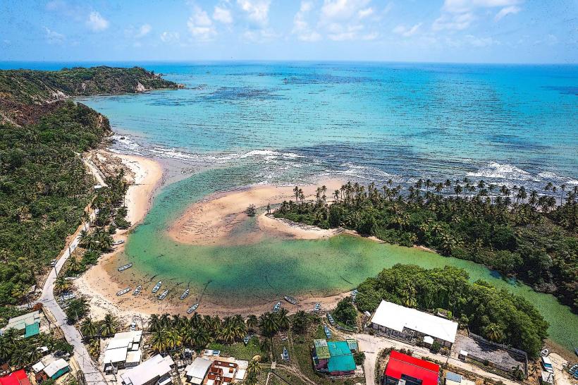
Mayaro serves as the primary holiday and recreational hub of Trinidad’s southeastern coast, famous for its nine-mile stretch of coconut-lined beach. It is part of the Mayaro–Rio Claro Regional Corporation, functioning as a remote retreat from the industrialized centers of western Trinidad.
Historical Timeline
The name "Mayaro" originates from the Arawakan word maya (a local plant) and ro (place), meaning "place of maya." In 1783, Spanish Governor José Maria Chacón granted land to French Royalist planters fleeing the French Revolution, establishing the first cotton and sugar estates. For over a century, the area remained isolated, accessible only by sea via round-island steamers. In the 1860s, a land trace was finally cut to connect the district to the interior. By the 20th century, the economy shifted from sugar to coconut plantations and eventually to offshore oil and gas production.
Demographics & Population
The broader Mayaro–Rio Claro region has a population of approximately 36,000, while the Mayaro coastal strip itself is composed of a series of small villages (Pierreville, Plaisance, St. Joseph, and Radix). The demographic is a synthesis of Afro-Trinidadians and Indo-Trinidadians, with a high percentage of residents employed in the energy sector, commercial fishing, or tourism.
Urban Layout & Key Districts
Mayaro is not a single city but a linear collection of villages along the Manzanilla–Mayaro Road.
Pierreville: The commercial center of the district, containing the market, police station, and major retail shops.
The Cocal: A 24-kilometer stretch of road north of Mayaro flanked by thousands of coconut palms and the Nariva Swamp.
Guayaguayare: Located south of Mayaro, serving as a major onshore base for the offshore oil and gas industry.
Ortoire: A fishing village at the mouth of the Ortoire River.
Top Landmarks
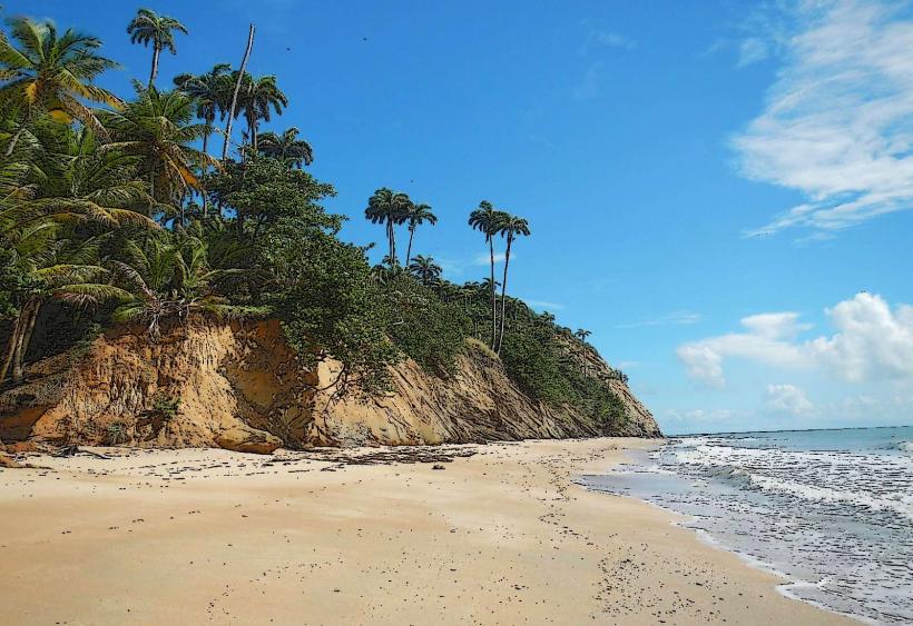
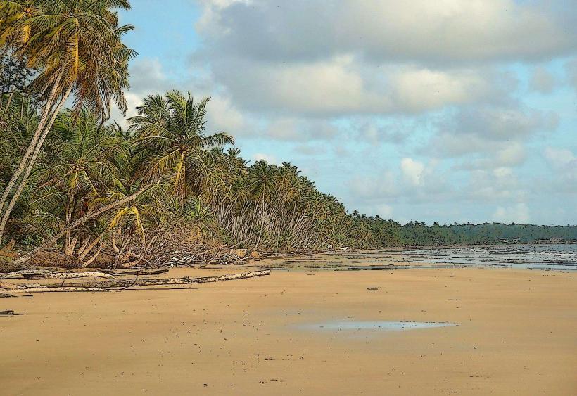
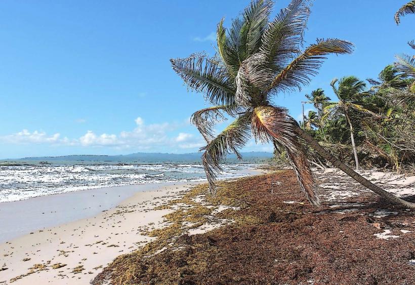
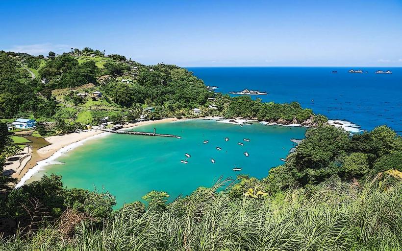
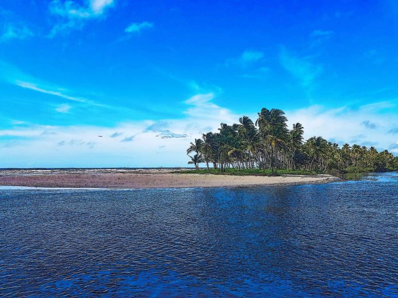
Mayaro Beach: The longest beach in Trinidad, characterized by brown sand, high waves, and extensive coconut groves.
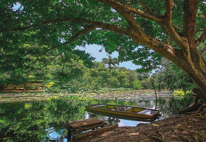
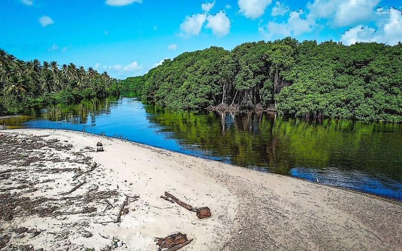
Ortoire River: A major river used for kayaking and fishing, known for the "mystery" of its changing current.
Brigand Hill Lighthouse: Offering panoramic views of the Atlantic coast and the Nariva Swamp.
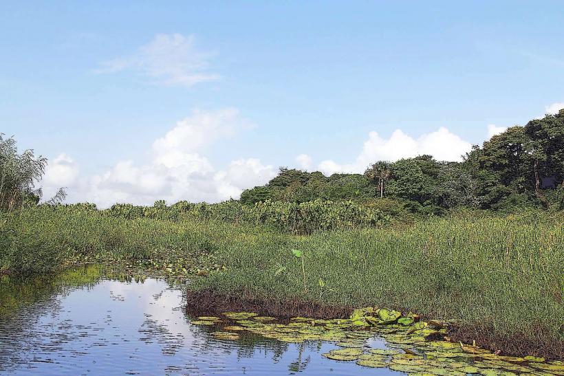
Nariva Swamp: A UNESCO Ramsar site and the largest freshwater wetland in Trinidad, home to red howler monkeys and West Indian manatees.
The Mayaro Post Office: A historic 1913 structure representing the town's early 20th-century development.
Transportation Network
Access is primarily via the Mayaro–Naparima Road (from San Fernando) or the Manzanilla–Mayaro Road (from the north). Public transit consists of Maxi Taxis (blue-banded) and private shared taxis. There is no metro. Most international visitors rent private vehicles, as internal village transit is infrequent. The coastal road is frequently subject to flooding and erosion, particularly near the Nariva River.
Safety & "Red Zones"
Mayaro is generally considered a "safe pocket" compared to Port of Spain, but caution is required. Avoid Mayaro Beach after dark, as it is unlit and isolated. Strong Atlantic undercurrents make swimming hazardous for inexperienced swimmers; always check for local weather advisories. Use only "H" registered taxis. Petty theft from rental villas and parked cars is the most common crime reported by visitors.
Digital & Financial Infrastructure
4G/LTE mobile coverage is robust in the village centers but can be spotty along the Cocal. Internet in guesthouses is standard but slower than in urban centers. The economy is heavily cash-reliant (Trinidad and Tobago Dollar - TTD). ATMs are located in Pierreville (Republic Bank, FCB), but they often experience long queues or cash shortages during long holiday weekends.
Climate & Air Quality
The area has a tropical marine climate. Temperatures range from 24°C to 31°C. Air quality is excellent, with constant ventilation from Atlantic trade winds. However, the region faces increasing environmental stress from coastal erosion and seasonal flooding.
Culture & Social Norms
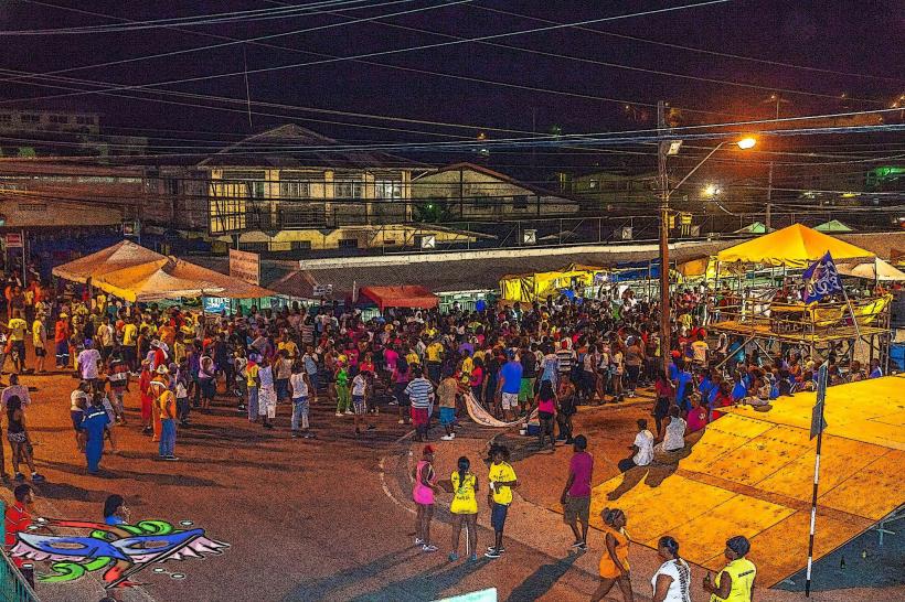
The culture is the epitome of "island time," centered on fishing and beach "liming." Mayaro is the traditional destination for Trinidadians during Easter and mid-year school holidays. Tipping is 10%. Dress is highly casual (beachwear is standard). It is customary to purchase "chip-chip" (local shellfish) or fresh watermelon from roadside vendors.
Accommodation Zones
Beachfront: Scores of private holiday homes (beach houses) available for short-term rental.
Pierreville: Small guesthouses and "resorts" like My Pearl or Moondrop.
Local Cost Index (TTD)
1 Espresso: 25–40 TTD
1 Standard Lunch (Curried Cascadura/Seafood): 50–120 TTD
1 Taxi Ride (to Rio Claro): 15–25 TTD
Nearby Day Trips
Rio Claro: 20 minutes west, the main commercial hub of the inland region.
Devil’s Woodyard: 45 minutes west, a site of active mud volcanoes.
Bush Bush Wildlife Sanctuary: Within the Nariva Swamp, for viewing primates and exotic birds.
Facts & Legends
A local legend states that if you eat the Cascadura fish (an armored catfish found in local ponds), you are destined to end your days in Trinidad. A geographic fact: Mayaro produces the majority of the coconuts sold in Trinidad, though the industry has declined significantly due to "Red Ring" disease in the palms. Historically, Mayaro was the site of the first major oil discovery in Trinidad (1866) near the Guayaguayare area.