Information
City: Rapid CityCountry: USA South Dakota
Continent: North America
Rapid City, USA South Dakota, North America
Rapid City is an independent city and the seat of Pennington County, situated on the eastern edge of the Black Hills. Known as the "Gateway to the Black Hills" and the "City of Presidents," it is defined by its role as the primary service and tourism hub for the Mount Rushmore region, its proximity to Ellsworth Air Force Base, and its high-density concentration of life-size bronze presidential statues.
Historical Timeline
Inhabited by the Lakota Sioux. Founded in 1876 by a group of disappointed gold miners; named for the limestone-fed Rapid Creek that bisects the city. A critical historical event occurred in June 1972, when a catastrophic flash flood killed 238 people and destroyed significant portions of the city, leading to a permanent transformation of the riverfront into a greenway. In the 20th century, the city’s economy was solidified by the 1942 opening of the air base. In the 21st century, it has become one of the fastest-growing cities in the Midwest, fueled by an influx of remote workers and retirees seeking the Black Hills lifestyle.
Demographics & Population
The population is approximately 78,000 (Metro area ~145,000). The demographics are White (75%), Native American (11%), and Hispanic or Latino (6%). The economy is driven by tourism, healthcare (Monument Health), government/military, and regional retail.
Urban Layout & Key Districts
Rapid City is organized with a historic core and radial expansion into the foothills.
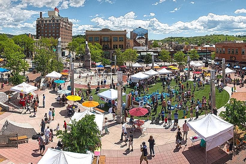
Downtown: The revitalized commercial hub featuring Main Street Square, independent boutiques, and the Presidential Statues on every corner.
The Gap: A natural break in the hogback ridge that separates the western and eastern portions of the city.
West Rapid: An established residential area providing direct access to the Black Hills National Forest and Canyon Lake.
The Greenway: A massive, 8-kilometer linear park system along Rapid Creek, established on the footprint of the 1972 flood zone.
Rushmore Crossing: The primary high-density retail and "big box" corridor on the city's northeast side.
Top City Landmarks
City of Presidents: A series of 44+ life-size bronze statues of U.S. Presidents positioned on street corners throughout downtown.
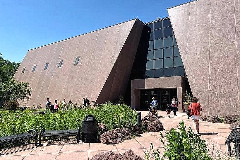
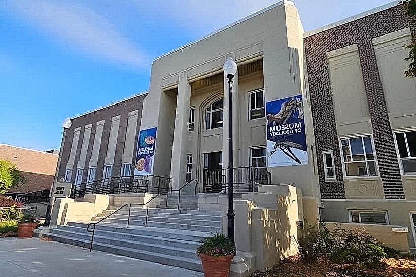
Journey Museum & Learning Center: An expansive facility documenting the geology of the Black Hills and the history of the Lakota people.
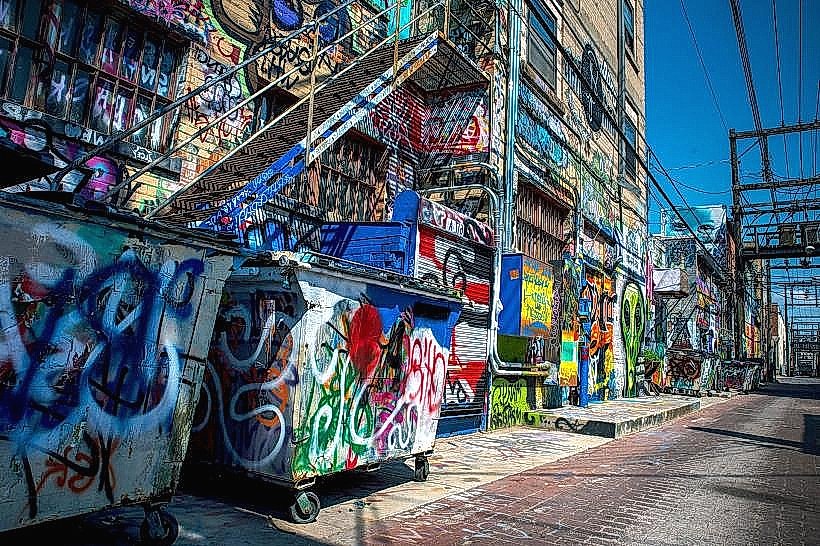
Art Alley: A sanctioned graffiti and street art corridor located between 6th and 7th Streets in the downtown core.
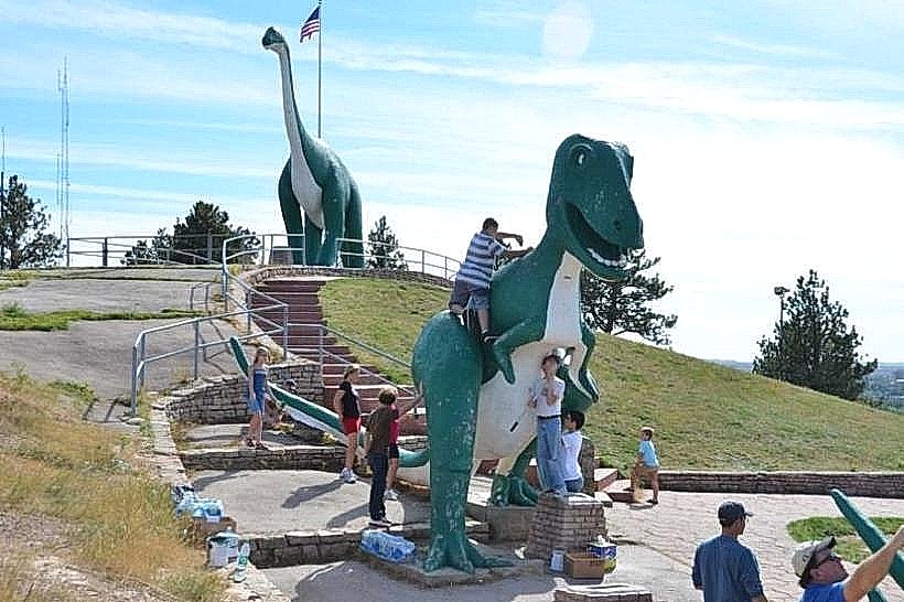
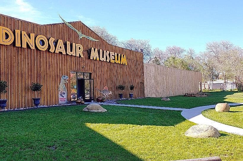
Dinosaur Park: A historic 1936 hilltop park featuring massive green concrete dinosaurs and panoramic views of the city and Badlands.
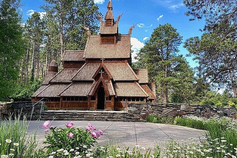
Chapel in the Hills: An exact wooden replica of the Borgund Stave Church in Norway, representing the area’s Scandinavian heritage.
Canyon Lake Park: One of the city’s oldest parks, offering fishing, boating, and access to the wilderness of the Black Hills.
Transportation Network
Movement is automotive-centric. The city is a major stop on I-90 and is the northern terminus of US-16 (The Mount Rushmore Road). Public transit is provided by Rapid Ride. Commercial air service is via Rapid City Regional (RAP), the gateway for nearly all Black Hills tourism.
Safety & "Red Zones"
The general safety level is moderate. Rapid City has higher crime rates than other South Dakota cities, primarily in property crime and aggravated assault. Caution is advised at night in the North Rapid area (neighborhoods north of Omaha Street) and along parts of the Maple Avenue corridor. Environmental hazards include extreme winter storms, localized flash flooding, and high wildfire risk in the western residential fringes.
Digital & Financial Infrastructure
Internet speeds average 1 Gbps+ with fiber availability via Midco and Bluepeak. Main mobile carriers are Verizon and AT&T. Card acceptance is universal. South Dakota has no state income tax. Sales tax is 4.2% (plus 2% city tax).
Climate & Air Quality
Temperatures range from -12°C to 2°C in winter and 14°C to 30°C in summer. The city is famous for its "Chinook Winds," which can raise temperatures by 20°C in a matter of hours during winter. Air quality is high.
Culture & Social Norms
The standard tipping percentage is 20%. A "Rugged-Midwestern" greeting is standard. Dress codes are "Outdoor-Casual." The city is culturally defined by its Western Heritage, its proximity to Native American Lands (Pine Ridge and Rosebud), and its identity as the basecamp for Black Hills exploration.
Local Cost Index
1 Espresso: $4.50 (USD)
1 Standard Lunch: $16.00 (USD)
1 Journey Museum Admission: $12.00.
Nearby Day Trips
Mount Rushmore National Memorial: (38 km southwest).
Badlands National Park: (100 km east).
Deadwood, SD: (65 km northwest; a historic gambling town).
Crazy Horse Memorial: (45 km southwest).
Facts & Legends
Rapid City is located on the same latitude as the French Riviera. Historically, it was the site where the Stratobowl hosted record-breaking high-altitude balloon launches in the 1930s. A local legend involves the "Thirteen Steps to Hell," a rumored haunted staircase in a local cemetery. Another legend concerns the "Secret Gold Tunnels" alleged to have been dug during the 1870s to move Black Hills gold into the city away from outlaws.