Information
City: SantoriniCountry: Greece
Continent: Europe
Santorini, Greece, Europe
Santorini (Thira) is a volcanic island in the southern Aegean Sea, part of the Cyclades archipelago. It is the remnant of a caldera created by one of the largest volcanic eruptions in recorded history.
Historical Timeline
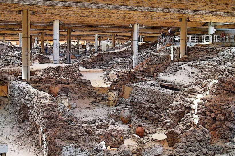
The island was home to the advanced Minoan-era civilization of Akrotiri until the massive Theran eruption (c. 1600 BC), which collapsed the center of the island and created the present-day caldera. It was later settled by Dorians, Byzantines, and Latins. The name "Santorini" is a Venetian corruption of "Santa Irene." The island was devastated by a major earthquake in 1956 but was subsequently rebuilt into a global luxury tourism destination.
Geomorphology & Urban Layout
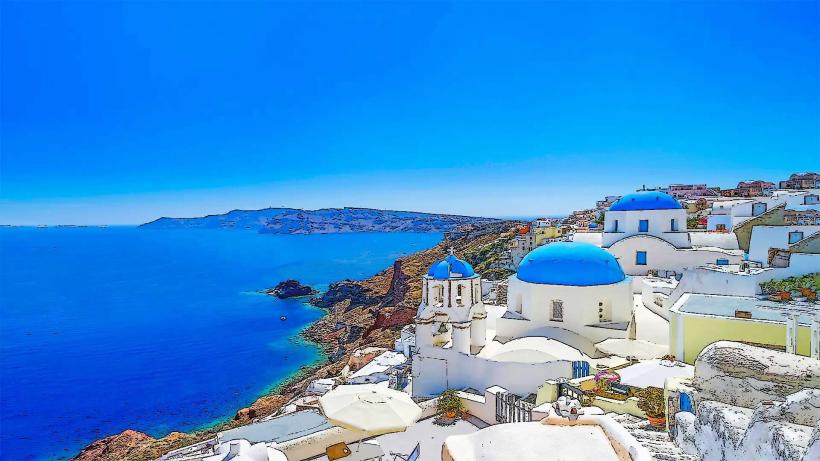
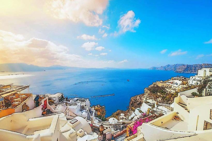
Santorini is defined by its crescent shape and vertical volcanic cliffs (up to 300m) topped by whitewashed villages.
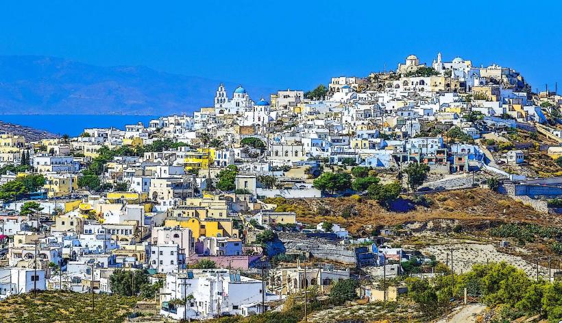
Fira (Thira): The administrative capital, situated on the caldera rim; the hub for transport and nightlife.
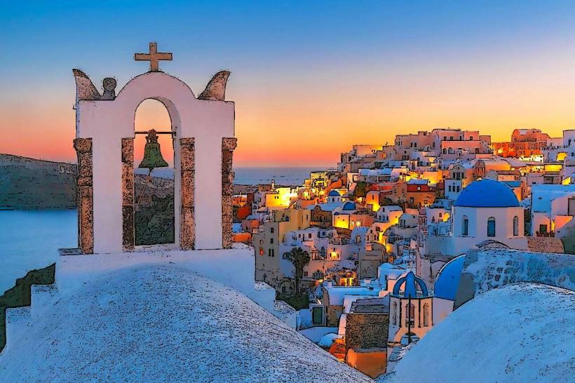
Oia: Located at the northern tip; world-renowned for its blue-domed churches and sunset views.
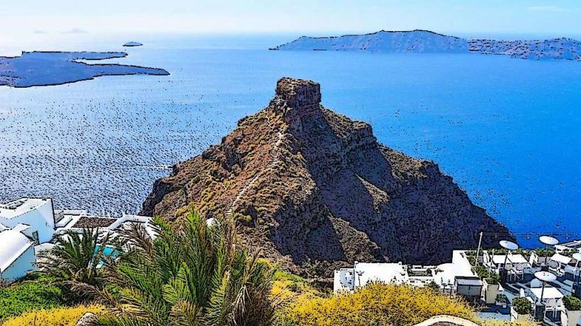
Imerovigli: The highest point of the caldera rim, known for its quiet atmosphere and "Skaros Rock."
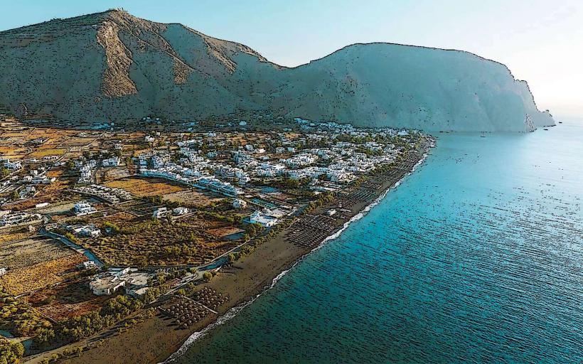
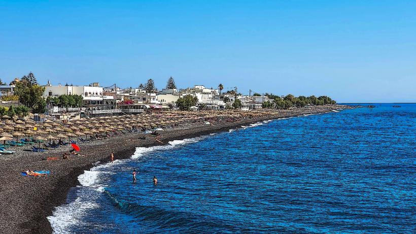
Kamari & Perissa: Coastal villages on the eastern side featuring black volcanic sand beaches.
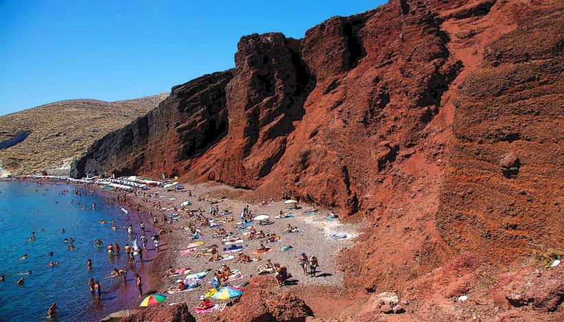
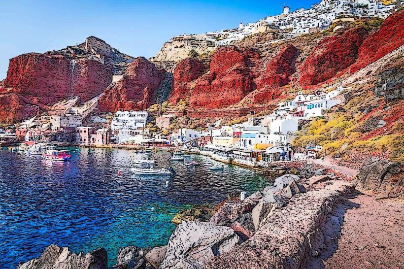
Akrotiri: The southern tip, housing the prehistoric archaeological site and the "Red Beach."
Top Landmarks
Akrotiri Archaeological Site: Often called the "Minoan Pompeii," featuring remarkably preserved three-story buildings and frescoes from 3,600 years ago.
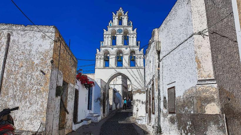
The Blue Domes of Oia: Specifically the churches of Agios Spiridonas and Anastaseos.
Ancient Thera: A hilltop site featuring ruins from the Hellenistic, Roman, and Byzantine periods.
Nea Kameni: The uninhabited volcanic island at the center of the caldera, accessible by boat for hiking to the active craters.
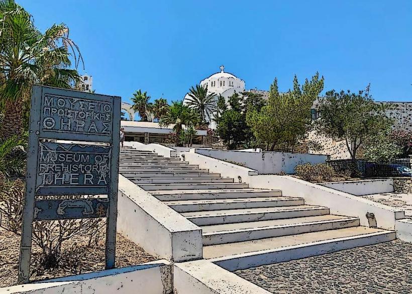
Museum of Prehistoric Thera: Located in Fira, housing the gold ibex figurine and Akrotiri frescoes.
Transportation Network
Air: Santorini (Thira) International Airport (JTR) serves as a major hub for charter and domestic flights.
Sea: Athinios Port is the primary ferry terminal. It is connected to the rim by a steep, winding road.
Urban: Public KTEL buses connect Fira to all major villages. Taxis are limited (approx. 40 on the whole island); the primary app is Free Now.
Cable Car: Connects the "Old Port" (Skala) to Fira to facilitate cruise ship passengers.
Safety & Environmental Concerns
Santorini is exceptionally safe from crime. The primary risks are:
Heat & Dehydration: Particularly during the Fira-to-Oia hike.
Traffic: Roads are narrow, steep, and highly congested during peak season (June–September).
Overtourism: Crucial sites like Oia can become impassable between 17:00 and 20:00.
Digital & Financial Infrastructure
Average fixed broadband speed is 90 Mbps, though many hotels use satellite links. 5G is universal in the caldera villages via Cosmote and Vodafone. Card acceptance is 100%. The currency is the Euro (€).
Climate & Viticulture
The climate is semi-arid Mediterranean. Summers are hot and extremely windy (Meltemi winds). Winters are mild but very humid.
Assyrtiko Wine: The island produces world-class white wines. Due to the wind, vines are grown in Kouloura (basket-shaped) low to the ground to protect the grapes.
Local Cost Index
1 Espresso (Freddo): €4.00–€7.00 (Caldera view pricing varies significantly)
1 Souvlaki/Gyros: €4.50–€6.00
1 Standard Dinner (with view): €45.00–€100.00 per person
1 Bus Ticket: €1.60–€2.20
Nearby Day Trips
Thirassia: The "quiet" island across the caldera, reflecting Santorini before the tourism boom.
Paleo Kameni: Known for its volcanic hot springs and orange-colored sulfuric water.
Anafi: A remote island to the east for those seeking total isolation.
Facts & Legends
Legend frequently associates the eruption of Thera with the disappearance of the lost city of Atlantis. A verified geological fact: The volcano is still active; the last significant eruption occurred in 1950, and the magma chamber continues to be monitored by the Institute for the Study and Monitoring of the Santorini Volcano (ISMOSAV).