Information
Landmark: Santorini CalderaCity: Santorini
Country: Greece
Continent: Europe
Santorini Caldera, Santorini, Greece, Europe
The Santorini Caldera is a large, mostly submerged volcanic crater located in the southern Aegean Sea. It is the defining geological feature of the Santorini (Thera) archipelago, formed by a series of massive explosive eruptions over the last 400,000 years.
Visual Characteristics
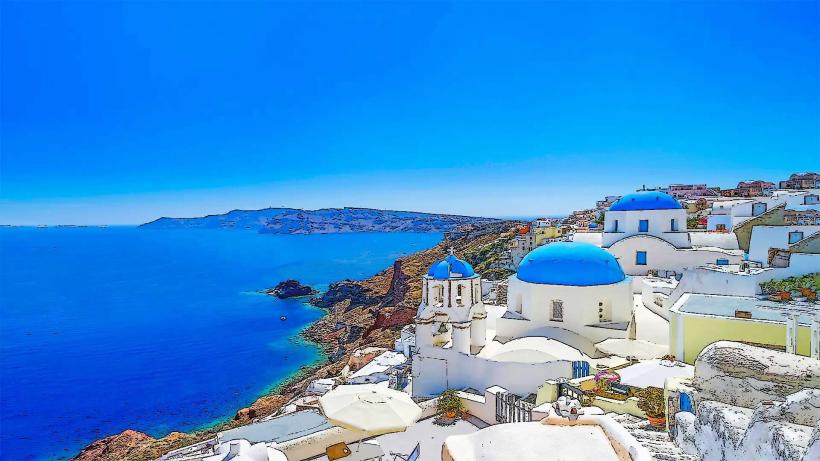
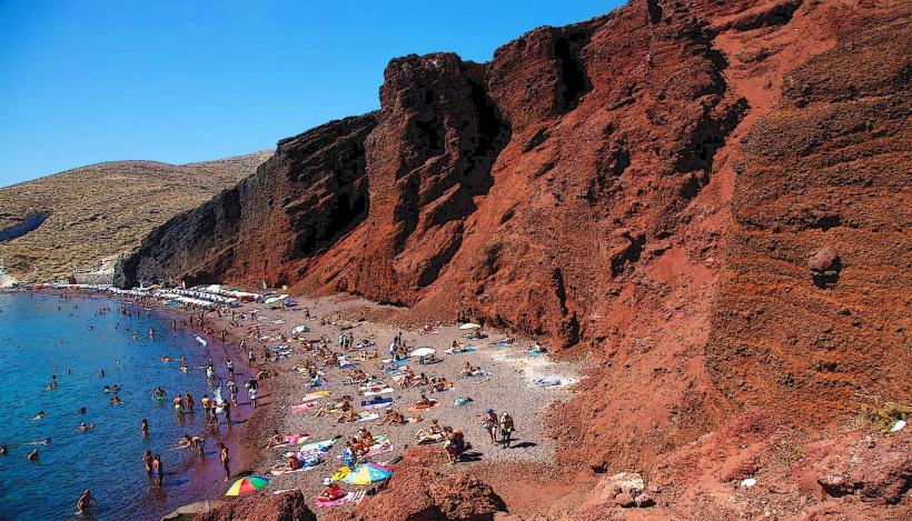
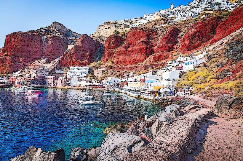
The caldera is an oval-shaped basin measuring approximately 12km by 7km. It is enclosed by steep, multi-colored cliffs (the caldera rim) that rise between 150 and 300 meters above sea level. These cliffs display distinct geological strata: white pumice, red scoria, and black basaltic lava. At the center of the flooded basin lie the dark, rugged islands of Nea Kameni and Palaia Kameni, which are active volcanic vents.
Location & Access Logistics
The caldera is the central void around which the islands of Santorini, Thirassia, and Aspronisi are arranged.
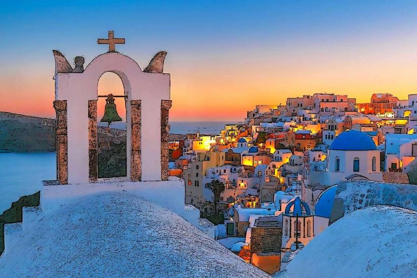
Observation: The primary viewpoints are the "Caldera Brow" villages: Fira, Firostefani, Imerovigli, and Oia.
Marine Access: The basin is navigable by boat. Tours depart daily from Athinios Port, the Old Port of Fira, and Ammoudi Bay.
Depth: The water within the caldera reaches depths of nearly 400 meters, making it one of the few natural harbors in the world where large cruise ships cannot anchor and must instead use mooring buoys or stay dynamic.
Historical & Ecological Origin
The current caldera was primarily shaped by the Minoan Eruption (Theran Eruption) circa 1600 BC, one of the largest volcanic events in human history. This eruption caused the center of the island to collapse into the empty magma chamber, allowing the sea to rush in. The central "Kameni" islands are much younger, formed by subsequent subaqueous eruptions between 197 BC and 1950 AD.
Key Highlights & Activities
Volcano Hiking: Walking the trails on the lava shield of Nea Kameni to observe active sulfurous steam vents (fumaroles).
Hot Springs: Swimming in the iron-rich, orange-tinted thermal waters at Palaia Kameni.
Caldera Trail: A 10km hiking path from Fira to Oia that follows the rim, providing continuous views of the volcanic morphology.
Geological Boat Tours: Specialized excursions focused on the volcanology and bathymetry of the basin.
Infrastructure & Amenities
There is no human infrastructure within the caldera basin itself, save for the small piers on the Kameni islands and Thirassia. 5G cellular signal is strong throughout the basin due to the surrounding rim's elevation. Marine traffic is strictly regulated by the Santorini Port Authority. Emergency services are coordinated from Fira and Athinios.
Best Time to Visit
For boat tours, late morning (10:00–14:00) provides the highest water visibility. For rim viewing, the hour before sunset is optimal as the low-angle light emphasizes the different colors and textures of the volcanic strata on the opposing cliffs.
Facts & Legends
The caldera's sudden formation is the primary source of the Atlantis myth, as the destruction of the Minoan civilization on the island parallels Plato's description of a sunken kingdom. Geologically, the caldera is part of the South Aegean Volcanic Arc and remains active; the magma chamber is currently being monitored by the Institute for the Study and Monitoring of the Santorini Volcano (ISMOSAV).
Nearby Landmarks
Nea Kameni (Active Volcano): Central basin
Palaia Kameni (Hot Springs): Central basin
Thirassia Island: Western rim
Imerovigli (Highest Rim Point): Eastern rim
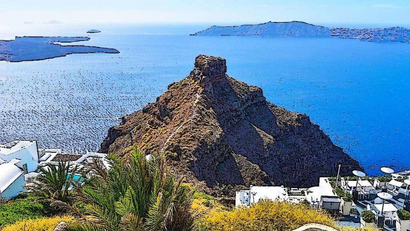
Skaros Rock: Protrusion on the eastern rim