Information
Landmark: Fira TownCity: Santorini
Country: Greece
Continent: Europe
Fira Town, Santorini, Greece, Europe
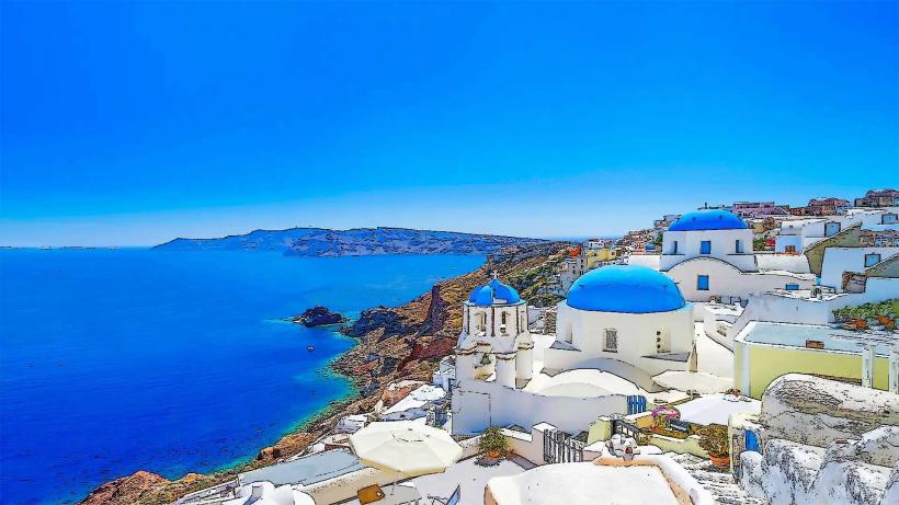
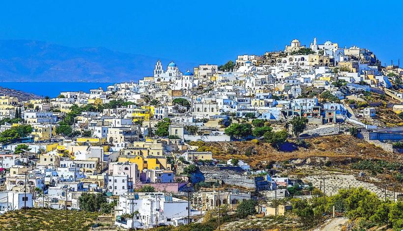
Fira (Thira) is the capital of Santorini, situated on the western edge of the island atop a 400-meter volcanic cliff. It serves as the central transportation, commercial, and administrative hub of the archipelago.
Visual Characteristics
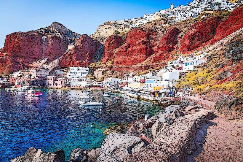
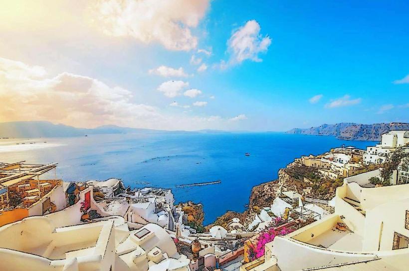
The town is a dense vertical cluster of whitewashed cubic houses, blue-domed churches, and narrow cobblestone alleys. Its architecture is characterized by "yposkafa" (cave-style dwellings) and neoclassical mansions. The town offers a direct western view of the Nea Kameni volcano and the Thermaic Gulf. Unlike Oia, Fira features a more developed urban profile with higher-density commercial storefronts and multi-level viewing terraces.
Location & Access Logistics
Fira is the island's central node, located 6km from Santorini Airport (JTR) and 8km from Athinios Ferry Port.
Central Bus Station: All KTEL bus lines (to Oia, Akrotiri, Kamari, Perissa) originate and terminate here.
Cable Car (Teleferik): Connects the town center to the Old Port (Gialos) at the base of the cliff.
Karavolades Stairs: A stone zigzag path of 588 steps connecting the port to the town.
Parking: Limited public parking is available at the town’s northern (near the Hospital) and southern (near the Post Office) perimeters. The interior is strictly pedestrian.
Historical & Ecological Origin
Fira became the capital in the late 18th century, succeeding the former capital at Skaros Rock due to seismic instability. The town was significantly rebuilt following the 1956 Amorgos earthquake, which destroyed a large portion of the original Venetian and local structures. It sits directly on the caldera rim, composed of layered volcanic tephra and basalt.
Key Highlights & Activities
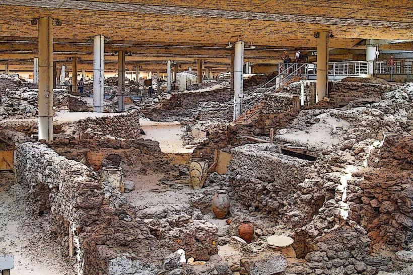
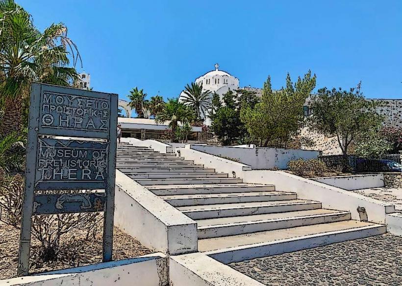
Museum of Prehistoric Thera: Houses the original 3,600-year-old frescoes and artifacts from Ancient Akrotiri.
Archaeological Museum of Thera: Focuses on the island's history from the Geometric to the Roman periods.
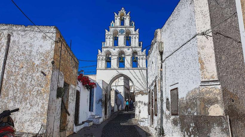
Three Bells of Fira (Agios Theodoros): One of the most iconic blue-domed churches, located in the northern Firostefani district.
The Gold Street (Ypapantis): A high-density corridor of luxury jewelry shops and boutiques.
Infrastructure & Amenities
As the capital, Fira provides the highest level of infrastructure on the island, including the General Hospital, major banks, and the central post office. 5G cellular signal is the most stable on the island. The "Caldera Brow" is lined with high-end bars and restaurants, while more affordable dining is concentrated around the main square (Plateia Theotokopoulou).
Best Time to Visit
To observe the sunset without the extreme congestion of Oia, Fira's northern walkways toward Firostefani offer similar views with more space. Visit the museums between 12:00 and 15:00 to escape the midday heat. Early morning (07:00–09:00) is the only time the narrowest alleys are free of cruise ship passenger traffic.
Facts & Legends
A verified historical oddity is the Cable Car, which was funded by the Shipowner Evangelos Nomikos specifically to provide an alternative to the traditional donkey rides, with the proceeds still benefiting the local donkey drivers' union. Local lore often cites Fira as the best vantage point to see the "green ray" phenomenon during sunset over the Aegean.
Nearby Landmarks
Firostefani: 0.8km North (continuous pedestrian path)
Imerovigli: 2km North
Old Port of Fira: 400m below (via stairs or cable car)
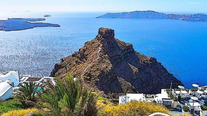
Skaros Rock: 2.5km North