Information
City: ScottsbluffCountry: USA Nebraska
Continent: North America
Scottsbluff, USA Nebraska, North America
Scottsbluff is the largest city in the Nebraska Panhandle and serves as the primary retail and medical hub for Western Nebraska and Eastern Wyoming. It is situated in the North Platte River Valley, characterized by its proximity to the iconic Scotts Bluff National Monument.
Historical Timeline
Founded in 1899 and incorporated in 1900, the city was named after the nearby bluff, which was a vital landmark for travelers on the Oregon, Mormon, and California Trails. Its development was driven by the Great Western Sugar Company, which established a beet processing factory in 1910, catalyzing the agricultural economy that still defines the region. The city’s urban form was influenced by its late founding relative to its "twin" city, Gering (1887), positioning Scottsbluff as the more modern, rail-centric commercial center of the valley.
Demographics & Population
The 2026 estimated population within city limits is 14,242. The primary ethnic demographics are White (67.4%), Hispanic or Latino (29.2%), and Native American (2.1%). The median age is 37.8 years.
Urban Layout & Key Districts
The city is organized on a north-south grid divided by the North Platte River from the city of Gering.
Downtown (Central): Located along Broadway, featuring historic 20th-century commercial architecture and local retail.
North Village: A modern retail expansion zone featuring national chains and Western Nebraska Community College (WNCC).
The River Corridor: The southern edge of the city containing recreational trails and industrial processing sites.
Top City Landmarks
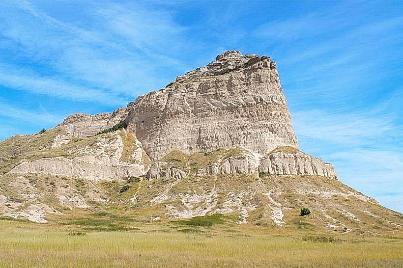
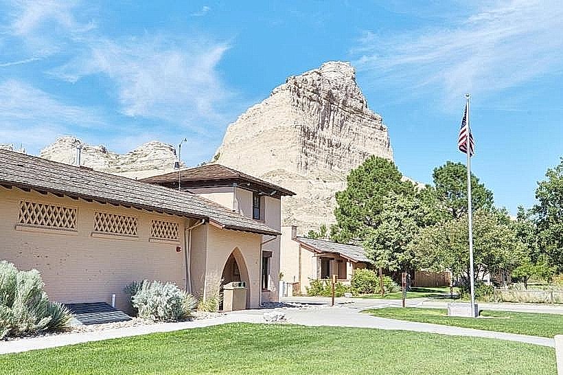
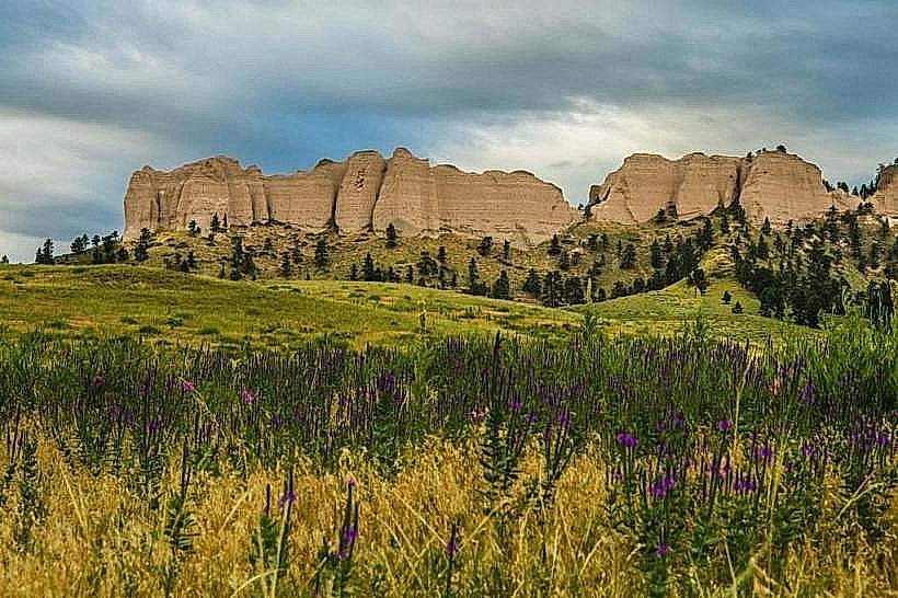
Scotts Bluff National Monument: A massive 800-foot geological feature and historic trail landmark.
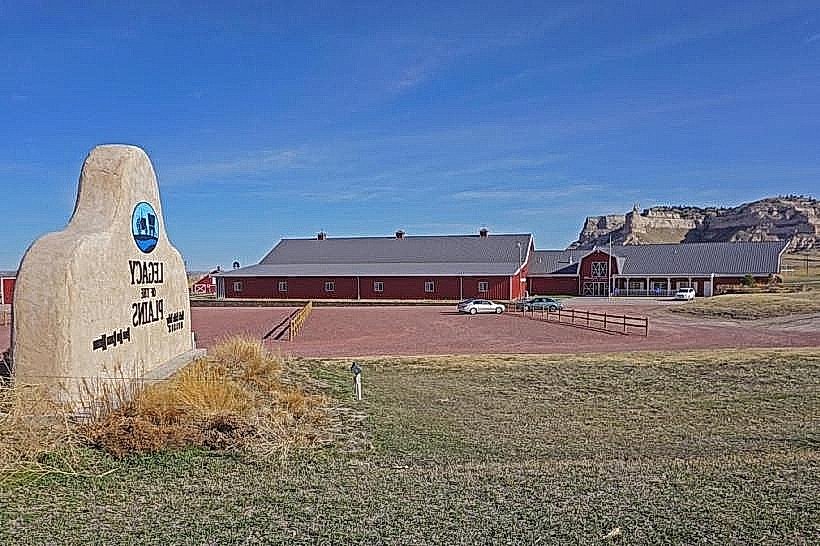
Legacy of the Plains Museum: Dedicated to the history of agriculture and westward pioneer travel.
Riverside Discovery Center: A regional zoo and park system.
Midwest Theater: A restored 1946 movie palace in the downtown core.
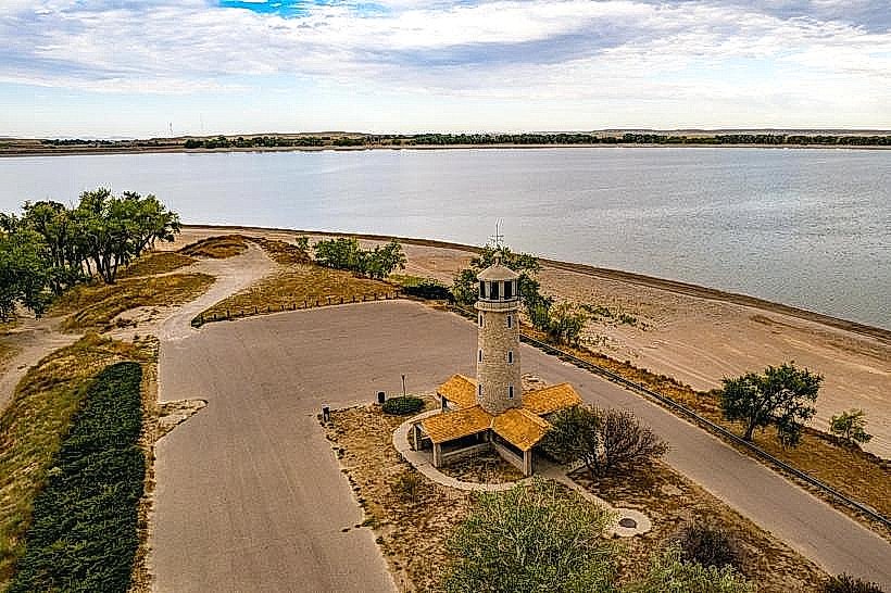
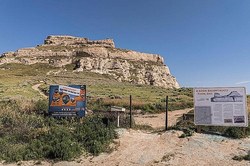
Chimney Rock National Historic Site: (35 km east) The most mentioned landmark on the Oregon Trail.
Transportation Network
Internal movement is served by Tri-City Roadrunner, which operates fixed-route and demand-response bus services between Scottsbluff, Gering, and Terrytown. Most transit is dependent on private vehicles. Traffic density is low, with the majority of volume concentrated on Highway 26. Western Nebraska Regional Airport (BFF) provides daily flights to Denver.
Safety & "Red Zones"
The general safety level is high. Property crime is the primary statistical issue, specifically within the retail corridors of North Village. There are no designated "red zones," though visitors should exercise standard caution in the older residential neighborhoods southeast of the downtown core at night.
Digital & Financial Infrastructure
Average internet speeds reach 1 Gbps via Vistabeam (Wireless/Fiber) or Allo Fiber. Main mobile carriers are Verizon and T-Mobile; AT&T has coverage but can be inconsistent in the rural outskirts. Card acceptance is 100% in commercial zones. ATMs are concentrated along Broadway and 27th Street.
Climate & Air Quality
Summers (June–August) are hot and semi-arid, with temperatures between 16°C and 33°C. Winters (December–February) are cold and dry, ranging from -10°C to 4°C. The region experiences high wind speeds and occasional severe hailstorms in early summer. Air quality is consistently "Good," with rare haze from regional wildfires in Wyoming or Colorado.
Culture & Social Norms
Tipping of 15–20% is standard. Social interactions are direct and reflect a blend of Western ranching and Midwestern agricultural values. Dress code is highly casual, often involving functional western or outdoor gear. Smoking is prohibited in public indoor spaces. Alcohol is sold in grocery and liquor stores; Sunday sales are permitted.
Accommodation Zones
Highway 26/North Scottsbluff: Stay here for modern hotel chains and proximity to WNCC.
Downtown: Stay here for boutique-style local lodging and historic district access.
Local Cost Index
Espresso: $4.25
Standard Lunch: $13.50
Bus Ticket: $1.50
Nearby Day Trips
Chimney Rock: 35 km (25 mins).
Fort Robinson State Park: 115 km (1.2 hours) – Site of Crazy Horse's death.
Carhenge (Alliance): 90 km (1 hour).
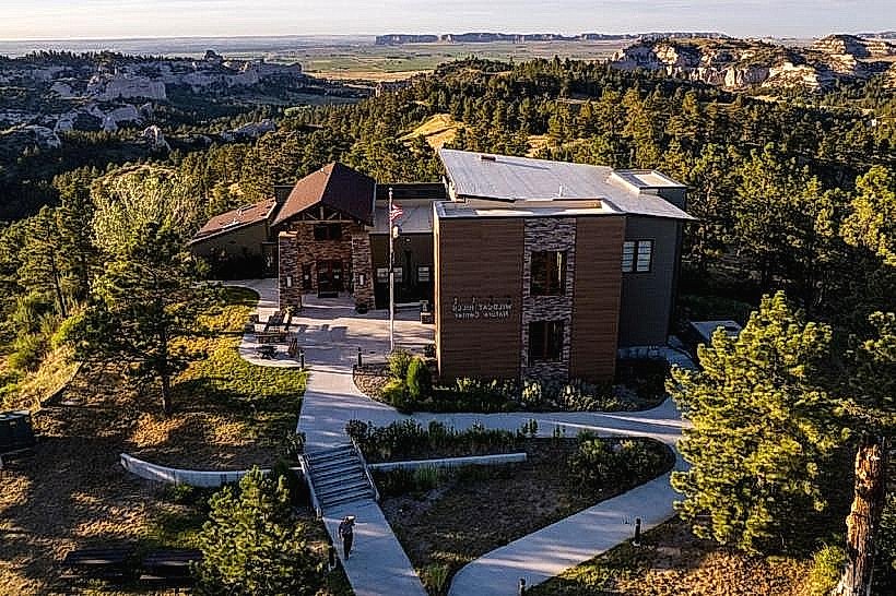
Wildcat Hills SRA: 15 km (15 mins) – Pine-covered ridges and canyon vistas.
Facts & Legends
The bluff itself is named after Hiram Scott, a fur trapper who was allegedly abandoned by his party in 1828 while ill and crawled nearly 100 km before dying at the foot of the landmark. A local legend involves "The Lady in the Rocks," a natural formation on the bluff face that some claim resembles a grieving woman looking over the valley. Historically, Scottsbluff is unique for being a "sugar town," with its original development almost entirely predicated on the irrigation-fed sugar beet industry.