Information
Landmark: Ano PoliCity: Thessaloniki
Country: Greece
Continent: Europe
Ano Poli, Thessaloniki, Greece, Europe
Ano Poli (Upper Town) is the historic district located on the northern, highest elevation of Thessaloniki. It is the only neighborhood that remained largely intact following the Great Fire of 1917, preserving the city's Byzantine and Ottoman urban fabric.
Visual Characteristics
The area is defined by steep, narrow winding alleys, stone-paved streets (kalderimia), and traditional "Macedonian" architecture-characterized by overhanging timber-framed upper stories (sachnisia), vibrant pastel-colored lime washes, and clay-tiled roofs. It is enclosed by the massive, crenelated Byzantine Walls and culminates at the Heptapyrgion fortress.
Location & Access Logistics
Ano Poli is situated north of Agiou Dimitriou Street. Access is via a steep uphill walk from the city center or by OASTH Bus Line 22 (the "Ano Poli" circular route) and Line 23. Vehicle access is restricted by narrow one-way streets and limited parking; visitors are advised to park in the lower city or near the Porta Latria gate.
Historical & Ecological Origin
The district corresponds to the ancient and medieval acropolis of Thessaloniki. Most standing structures date from the late 18th to early 20th centuries, though they sit upon foundations from the Roman and Byzantine eras. In 1980, the entire neighborhood was declared a protected traditional settlement.
Key Highlights & Activities
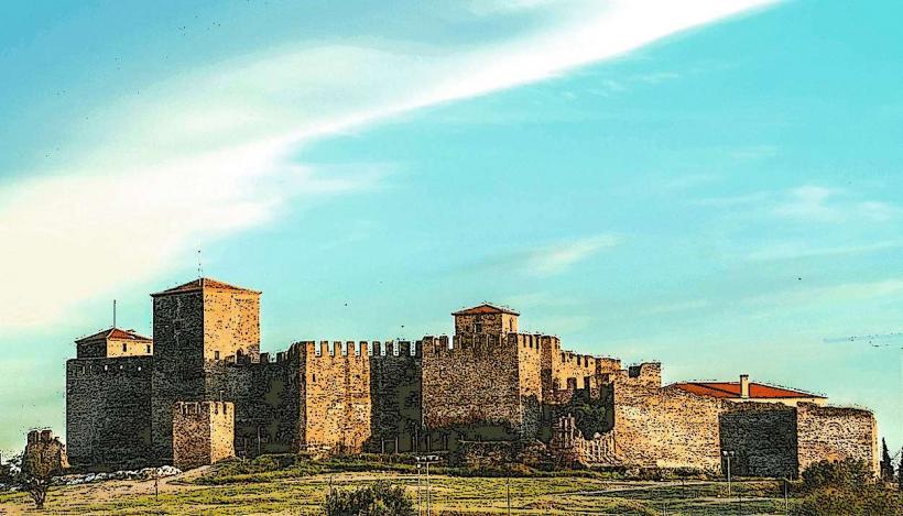
Heptapyrgion (Yedi Kule): The Byzantine/Ottoman fortress and former prison at the summit.
Trigoniou Tower: A massive circular defensive tower offering 360-degree views of the city and the Thermaic Gulf.
Monastery of Vlatadon: The only active Byzantine monastery in the city.
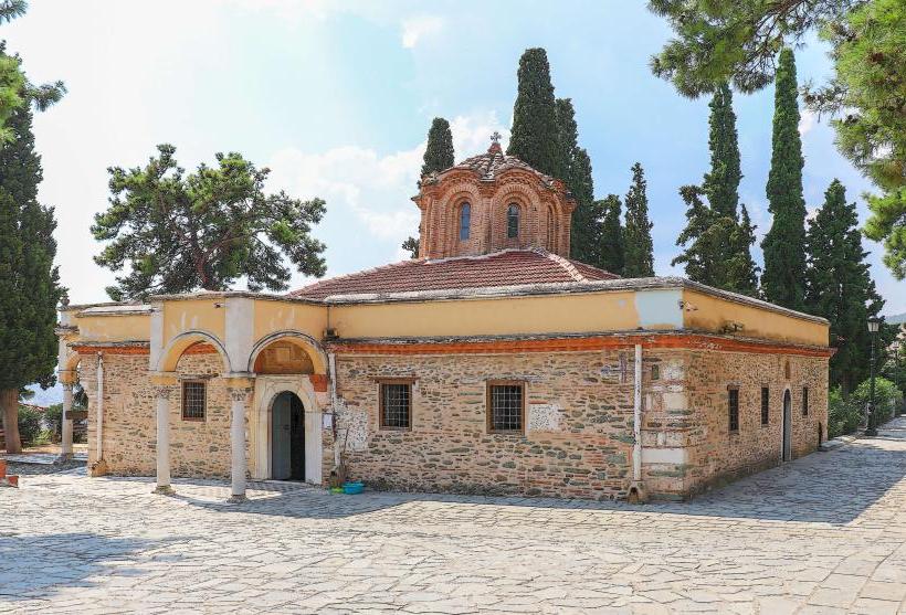
Hosios David (Latomos Monastery): A small 5th-century church containing rare early Christian mosaics.
Pasha’s Gardens: An early 20th-century park featuring unique stone "fantastic" architecture.
Infrastructure & Amenities
The district is residential and lacks the high-density infrastructure of the lower city. Restrooms are available in cafes and museums like the Heptapyrgion. 5G signal is stable, though topography can cause occasional drops in narrow alleys. The area is known for traditional "mezedopolia" (tavernas) concentrated around Tsinari Square.
Best Time to Visit
Sunset is the optimal time for visiting Trigoniou Tower to view the city lights and the sea. Morning is preferred for exploring the churches and the Heptapyrgion to avoid the steep climb during peak heat.
Facts & Legends
Local lore suggests the narrow, labyrinthine layout was intentionally designed to confuse invaders and provide cover for residents. A verified historical oddity is the presence of the Musa Baba Mausoleum, a 16th-century Ottoman tomb located in a small square, which remains a rare surviving example of religious funerary architecture in the city.
Nearby Landmarks
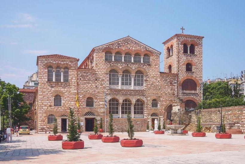
Church of Agios Dimitrios: 0.6km South (at the base of the hill)
Atatürk Museum: 0.4km East
Roman Forum: 0.7km Southwest
Byzantine Walls: Integrated throughout the northern perimeter