Information
Landmark: Balos LagoonCity: Crete
Country: Greece
Continent: Europe
Balos Lagoon, Crete, Greece, Europe
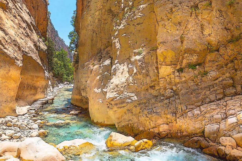
Balos Lagoon is a highly specialized coastal ecosystem located on the northwestern tip of Crete, situated between the Gramvousa Peninsula and Cape Tigani. It is characterized by its shallow, turquoise waters and white-to-pink shell-sand.
Visual Characteristics
The lagoon is a geomorphological phenomenon. It features an expansive area of shallow, warm water that transitions from vivid emerald to deep sapphire. The sand contains crushed seashells (biogenic sediment), giving it a distinct pink hue at the shoreline. To the west, the lagoon is framed by the steep, rocky mass of Cape Tigani, which is connected to the mainland by a narrow sandbar.
Location & Access Logistics
Position: Approximately 56km west of Chania and 17km northwest of Kissamos.
Vessel Access (Recommended): Daily ferry services depart from Kissamos Port (Kavonisi). This method provides views of the Gramvousa coastline and typically includes a stop at Imeri Gramvousa island.
Vehicle Access: Requires traversing an 8km unpaved, high-gradient gravel road from Kaliviani. This route is characterized by steep drops and no safety barriers. Standard rental car insurance typically voids coverage for this road.
Hiking Access: Following the drive, a 1.2km steep descent on a stone path is required to reach the sand. The ascent on return is physically demanding under high thermal loads.
Historical & Ecological Origin
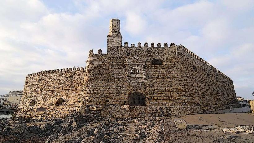
The area is a protected Natura 2000 zone. It serves as a habitat for rare flora and fauna, including the Caretta caretta sea turtle and the Monachus monachus (Mediterranean monk seal). Historically, the neighboring Gramvousa island features a Venetian fortress built in 1579 to defend against Ottoman forces and was later used as a pirate stronghold.
Key Highlights & Activities
Wading: The central lagoon remains extremely shallow (below knee-depth), making it a stable environment for non-swimmers.
Cape Tigani Ascent: A trail leads to the peak of the cape for a 360-degree topographical view of the lagoon system.
Snorkeling: The outer edges of the lagoon, where the water meets the open sea, contain rocky reefs with high marine biodiversity.
Infrastructure & Amenities
Infrastructure is intentionally minimal to preserve the ecosystem.
Facilities: Basic chemical toilets are available near the path entrance.
Catering: A small seasonal canteen operates on the beach, but supplies are limited. Ferries usually provide full catering services for their passengers.
Shade: Parasol rentals are available but often reach capacity by 11:00. Natural shade is non-existent.
Best Time to Visit
08:00–10:00: Period before ferry arrivals, accessible only via the mountain road.
After 17:00: The period after the final ferry departure, though hikers must account for the 30-minute ascent before sunset.
Shoulder Season (May, June, September): High-summer (July–August) sees extreme visitor density that compromises the ecological and visual integrity of the site.
Facts & Legends
A verified operational fact is that the Gramvousa-Balos ferry route is the most frequent maritime excursion in Western Crete. Local lore suggests that the cave on Gramvousa island once hid a massive pirate treasure that remains undiscovered.
Nearby Landmarks
Imeri Gramvousa Island: 2km North (accessible by ferry)
Falassarna Beach: 15km South (via road)
Kissamos: 17km Southeast