Information
Landmark: Cedar Creek State Recreation AreaCity: Nebraska City
Country: USA Nebraska
Continent: North America
Cedar Creek State Recreation Area, Nebraska City, USA Nebraska, North America
Cedar Creek State Recreation Area is a public park located in Otoe County, Nebraska, near Nebraska City.
It encompasses approximately 2,400 acres of land and water, primarily focused on the conservation and recreational use of the Cedar Creek watershed.
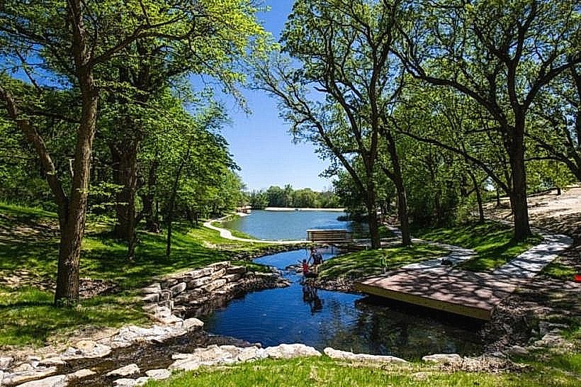
Visual Characteristics
The area features rolling hills covered in mixed deciduous and coniferous trees, including oak, hickory, and pine species. The terrain is characterized by steep ravines and bluffs carved by Cedar Creek. The creek itself is a shallow, clear waterway with a gravel and rock bed. Several small ponds and wetlands are also present within the recreation area.
Location & Access Logistics
Cedar Creek State Recreation Area is situated approximately 10 miles west of Nebraska City, Nebraska. Access is via State Highway 2, turning south onto County Road 10 (also known as Cedar Creek Road). The entrance is clearly marked. Parking is available at designated lots throughout the park, including near the main office, boat ramp, and trailheads. Public transport is not available to the recreation area.
Historical & Ecological Origin
The land was acquired by the Nebraska Game and Parks Commission through various purchases and land exchanges starting in the mid-20th century. The area's ecological significance lies in its preservation of a riparian ecosystem within the generally prairie landscape of eastern Nebraska. The geological formations are primarily sedimentary rock, shaped by erosion from Cedar Creek over millennia.
Key Highlights & Activities
Activities include hiking on marked trails, fishing in Cedar Creek and the ponds (catch and release is encouraged for certain species), birdwatching, and primitive camping. Kayaking and canoeing are possible on Cedar Creek when water levels are sufficient. Archery hunting is permitted during designated seasons.
Infrastructure & Amenities
Restrooms are available at the main office and at designated camping areas. Limited shade is provided by the tree canopy. Cell phone signal is intermittent to non-existent in most areas of the park. No food vendors are located within the recreation area; visitors should bring their own supplies.
Best Time to Visit
For hiking and general exploration, spring (April-May) and fall (September-October) offer moderate temperatures and visible foliage changes. Summer (June-August) can be hot and humid. Fishing is generally best in the early morning and late evening. Water levels for kayaking are typically highest in spring.
Facts & Legends
A local historical note is that the area was once part of a larger agricultural and timber operation before its designation as a state recreation area. A specific tip for visitors is to be aware of the steep terrain on many trails, requiring sturdy footwear.
Nearby Landmarks
- Arbor Day Farm (3.5km East)
- Wildwood Golf Course (4.2km Southeast)
- Missouri River (12km East)
- Indian Cave State Park (25km Southwest)