Information
Landmark: Meriwether Lewis ParkCity: Nebraska City
Country: USA Nebraska
Continent: North America
Meriwether Lewis Park, Nebraska City, USA Nebraska, North America
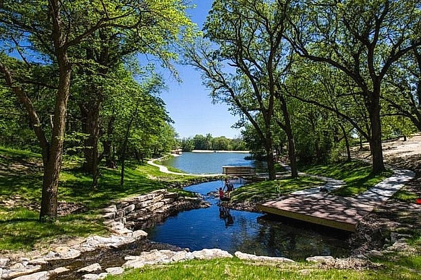
Meriwether Lewis Park is a public recreational area situated in Nebraska City, Nebraska, USA.
The park encompasses approximately 10 acres of developed land along the Missouri River.
Visual Characteristics
The park features a predominantly flat terrain with mature deciduous trees providing canopy cover. A paved pathway system runs throughout the park. The Missouri River forms the eastern boundary, with a visible current. A concrete boat ramp is present at the river's edge.
Location & Access Logistics
Meriwether Lewis Park is located at 1000 River Road, Nebraska City, NE 68401. It is approximately 2 miles east of the Nebraska City city center. Access is via River Road, which is a paved county road. Parking is available in a designated gravel lot adjacent to the main entrance, with capacity for approximately 50 vehicles. No public transport directly serves the park; access requires private vehicle or taxi.
Historical & Ecological Origin
The park was established in the mid-20th century as a public access point to the Missouri River. Its ecological origin is alluvial plain, formed by sediment deposition from the Missouri River over millennia. The area is part of the Great Plains grassland ecosystem.
Key Highlights & Activities
Activities include fishing from the riverbank or boat ramp, picnicking at designated tables, and walking the paved trails. Birdwatching is a common activity due to the riparian habitat. Boat launching is permitted.
Infrastructure & Amenities
The park contains 10 picnic tables, 5 of which are covered by permanent shelters. Restrooms are available near the main parking area. Cell phone signal (4G) is generally available. No food vendors are located within the park; nearest services are in Nebraska City.
Best Time to Visit
For optimal lighting for photography, early morning (07:00-09:00) and late afternoon (16:00-18:00) offer softer light. The months of April through October provide the most favorable weather conditions for outdoor activities. River levels can fluctuate, but access is generally maintained year-round.
Facts & Legends
A specific historical marker within the park commemorates the Lewis and Clark Expedition's passage through this region in 1804. Local lore suggests that during periods of low water, remnants of old steamboat pilings can be observed near the riverbank.
Nearby Landmarks
- Arbor Day Farm (1.5km West)
- Wildwood Historic Center (2.0km West)
- Missouri River State Historical Park (3.5km South)
- Otoe County Historical Museum (2.5km West)