Information
Landmark: Choro TrekCity: La Paz
Country: Bolivia
Continent: South America
Choro Trek, La Paz, Bolivia, South America
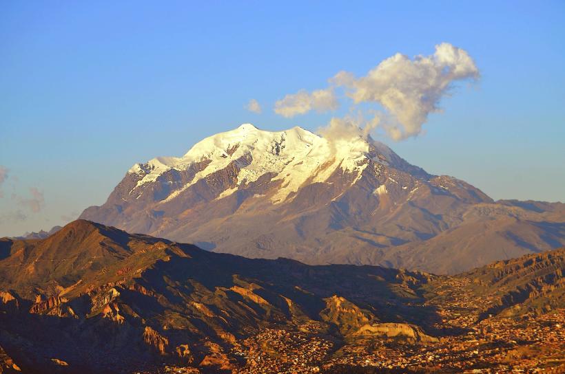
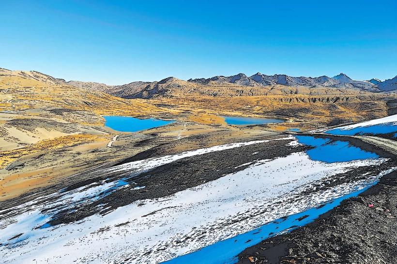
The Choro Trek is a multi-day hiking route in Bolivia that descends from the Altiplano to the Yungas cloud forest. It is located approximately 30 kilometers northwest of La Paz.
Visual Characteristics
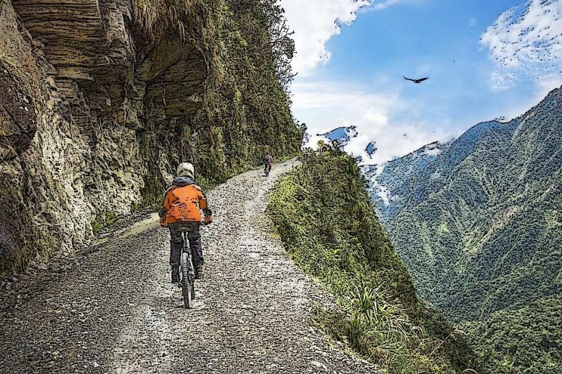
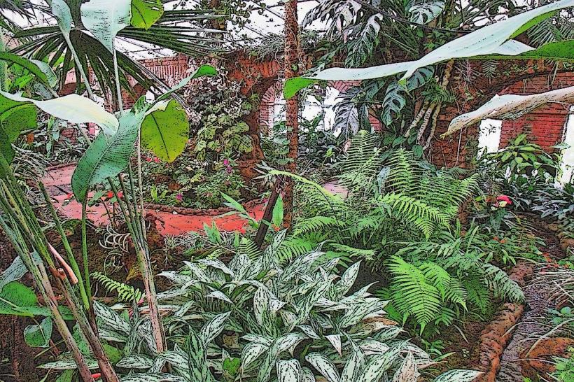
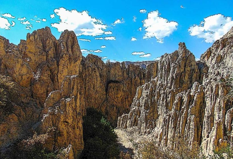
The trek traverses varied terrain. Initial sections feature high-altitude puna grassland with sparse, low-lying vegetation. As elevation decreases, the landscape transitions to dense cloud forest characterized by moss-covered trees, ferns, and epiphytes. Rock formations are prevalent, with exposed sedimentary layers visible in steeper sections. Water sources include clear, fast-flowing streams and occasional waterfalls.
Location & Access Logistics
The trek typically begins at La Cumbre Pass, accessible via the Ruta 3 highway, approximately 25 kilometers from La Paz. Private vehicle transport or organized tour buses are the primary means to reach the starting point. Public transport to La Cumbre is limited. Parking is available at La Cumbre Pass, though it is informal and unsupervised. The trek concludes in the town of Chairo, from which transport back to La Paz can be arranged, often involving a combination of local buses and shared taxis.
Historical & Ecological Origin
The Choro Trek follows an ancient Inca trail, originally constructed to connect the Andean highlands with the Amazon basin. The trail's purpose was trade and communication. Ecologically, the route descends through distinct altitudinal zones, from the high Andean puna (above 4,000 meters) to the subtropical cloud forest (around 1,200 meters), showcasing a significant biodiversity gradient.
Key Highlights & Activities
Hiking the full length of the trail is the primary activity. Specific points of interest include the descent through varied vegetation zones, observing local flora and fauna, and experiencing the transition in climate. Camping is required at designated or suitable flat areas along the route. Water collection and purification are necessary.
Infrastructure & Amenities
Infrastructure is minimal. Basic campsites may be found, but amenities are absent. There are no restrooms, designated shade structures, or food vendors along the trek. Cell phone signal is intermittent and generally unavailable in deeper forest sections. Basic supplies must be carried by hikers.
Best Time to Visit
The dry season, from May to October, is recommended for optimal trekking conditions. During this period, rainfall is less frequent, and trails are less prone to mud and landslides. The best time of day for photography is generally mid-morning or late afternoon when sunlight penetrates the forest canopy, though cloud cover is common in the Yungas.
Facts & Legends
The Inca trail segment of the Choro Trek is a testament to their engineering capabilities in challenging terrain. A local legend suggests that certain ancient stones along the path were used for astronomical observations by the Incas. Hikers should be aware of potential encounters with local wildlife, including various bird species and insects.
Nearby Landmarks
- 0.5km East: La Cumbre Pass viewpoint
- 2.0km Southwest: Small Inca ruins (unmarked)
- 15.0km Southeast: Unduavi waterfall
- 20.0km South: Coroico town (accessible via road from Chairo)