Information
Landmark: Coastal BeltwayCity: Panama City
Country: Panama
Continent: North America
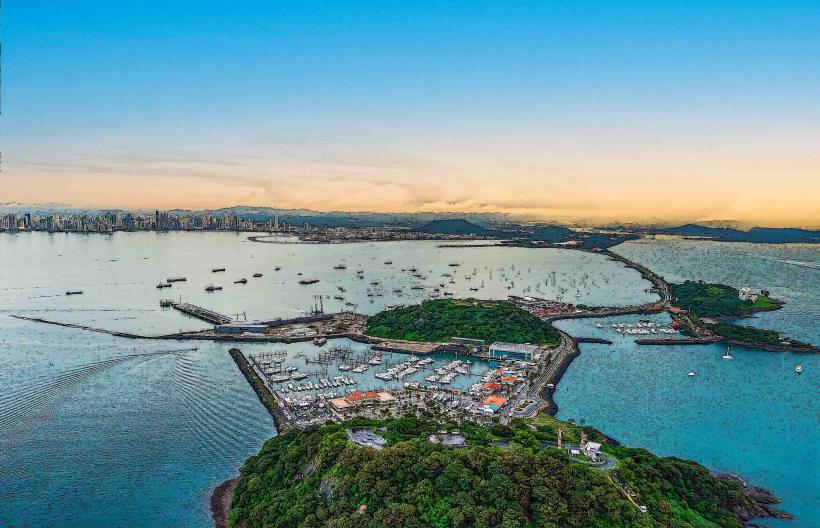
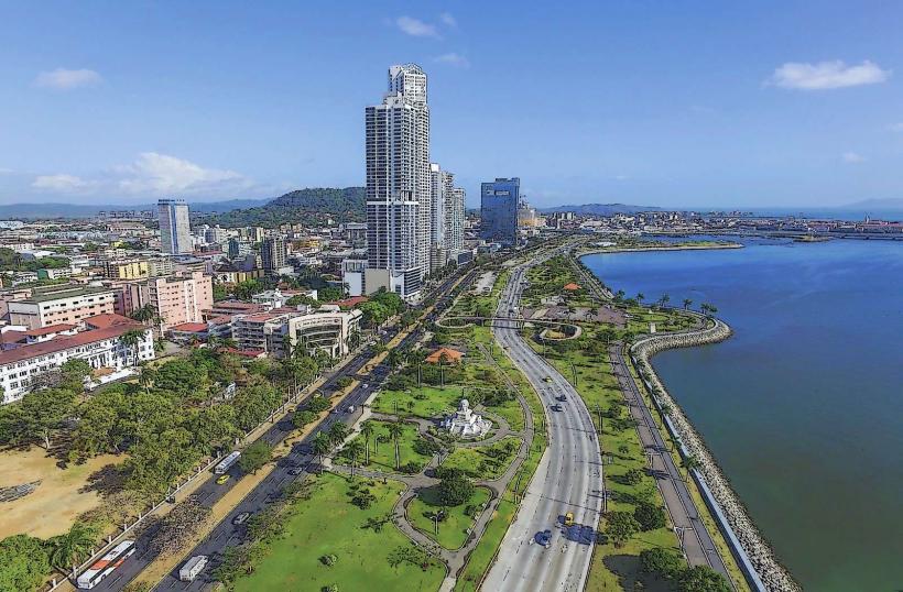
Coastal Beltway, Panama City, Panama, North America
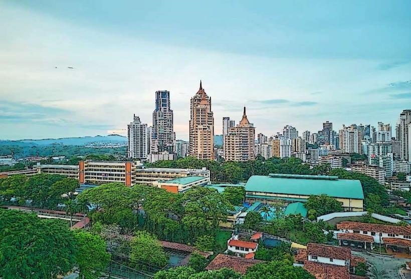
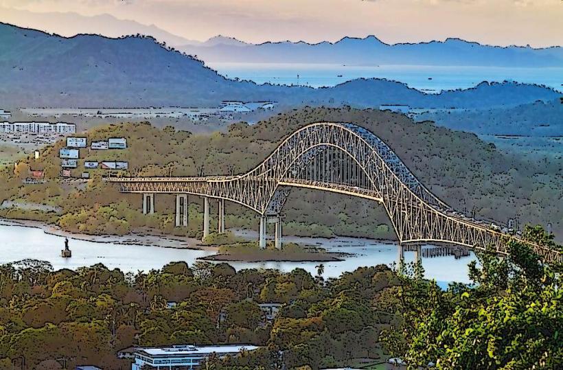
The Coastal Beltway is a multi-lane roadway encircling the southern edge of Panama City, Panama. It provides a direct route along the Pacific coastline.
Visual Characteristics
The beltway consists of multiple paved lanes with concrete barriers separating opposing traffic. It features elevated sections and bridges spanning over water bodies and urban intersections. Street lighting is present along its entire length. The surrounding landscape transitions from urban development to coastal views.
Location & Access Logistics
The Coastal Beltway begins at the Balboa Avenue area and extends approximately 15 kilometers eastward, connecting to the Tocumen International Airport access road. It is accessible directly from major city arteries such as Avenida Balboa and Calle 50. Parking is generally not available directly on the beltway itself; users are directed to utilize parking facilities in adjacent commercial or residential areas. Public transport options include numerous city bus routes that traverse sections of Avenida Balboa, with stops near beltway access points.
Historical & Ecological Origin
Construction of the Coastal Beltway began in phases, with significant portions completed in the early 2000s. Its primary purpose was to alleviate traffic congestion in the city center and provide a more efficient transportation corridor. The land it occupies was reclaimed from the Pacific Ocean in some sections.
Key Highlights & Activities
The beltway's primary function is vehicular transit. It offers panoramic views of the Panama Bay and the city skyline. Designated pedestrian and bicycle paths are present on sections of the adjacent Avenida Balboa, allowing for recreational use during specific hours.
Infrastructure & Amenities
Restrooms are not available directly on the beltway. Shade is limited to overpasses and bridges. Cell phone signal (4G/5G) is generally strong throughout the route. Food vendors are located in adjacent urban areas, not directly on the beltway.
Best Time to Visit
For vehicular transit, traffic is heaviest during morning (7:00 AM - 9:00 AM) and evening (4:00 PM - 7:00 PM) rush hours. For recreational use on adjacent paths, early morning or late afternoon provides optimal lighting and cooler temperatures. The dry season (December to April) generally offers clearer skies.
Facts & Legends
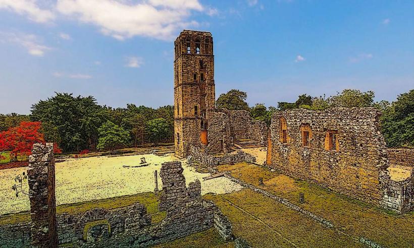
The construction of the beltway involved significant land reclamation, altering the natural coastline. A specific section is known for its proximity to the historic ruins of the original Panama City (Panama Viejo), though the beltway itself does not directly pass through the archaeological site.
Nearby Landmarks
- Panama Viejo Historical Monument (1.5km East)
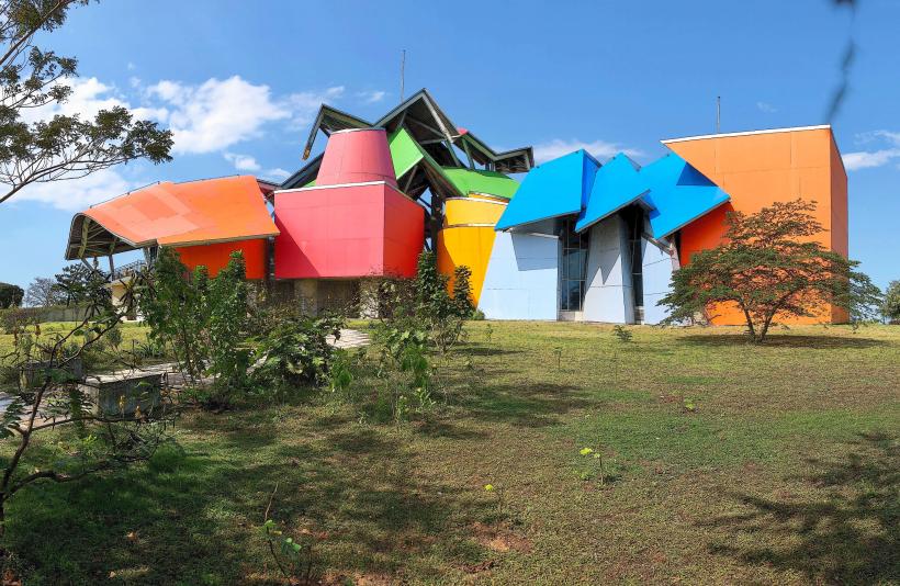
- Biomuseo (0.8km North)
- Multiplaza Pacific Mall (2.0km Northwest)
- Metropolitan Natural Park (4.0km North)
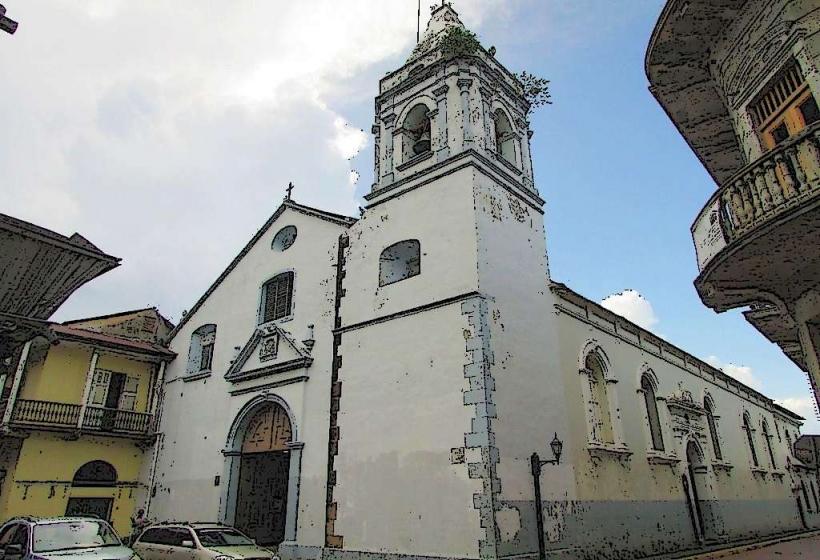
- Casco Viejo (2.5km Northwest)