Information
Landmark: Glover's Reef Marine ReserveCity: Placencia
Country: Belize
Continent: North America
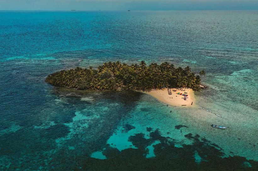
Glover's Reef Marine Reserve, Placencia, Belize, North America
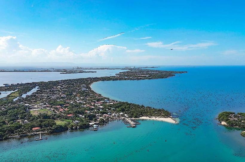
Glover's Reef Marine Reserve is a protected marine area located off the coast of Belize, approximately 50 kilometers southeast of the mainland town of Dangriga.
Visual Characteristics
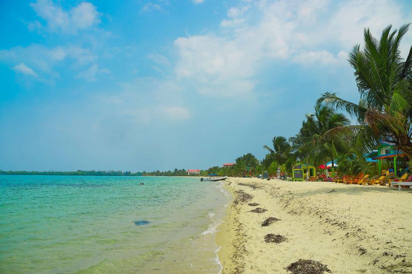
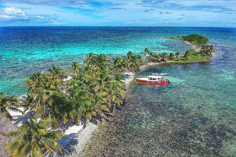
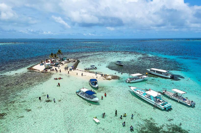
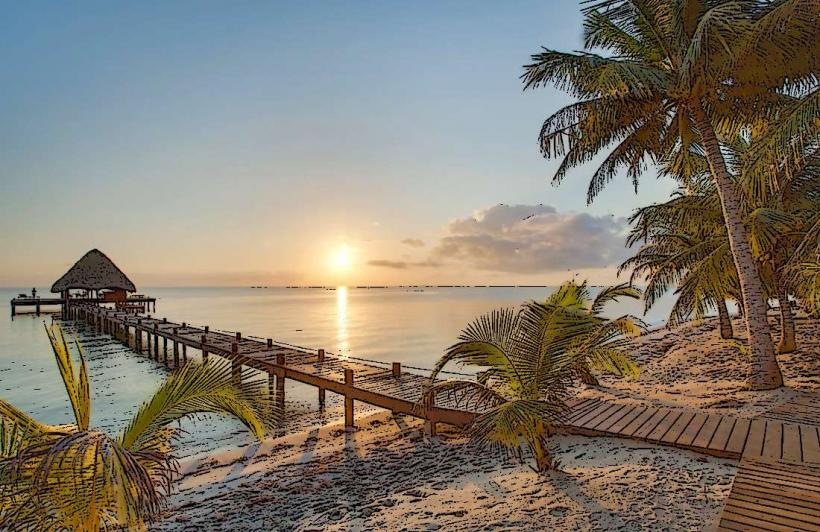
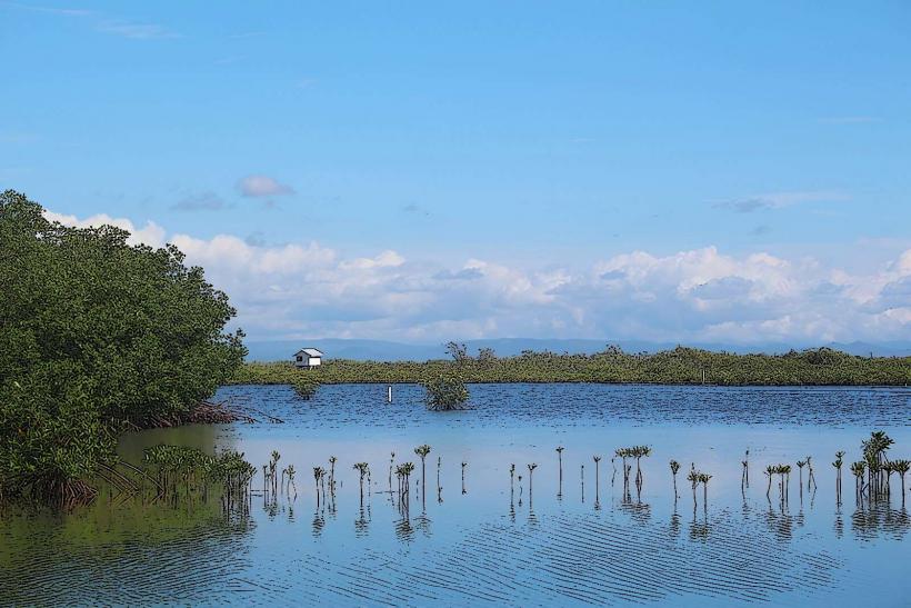
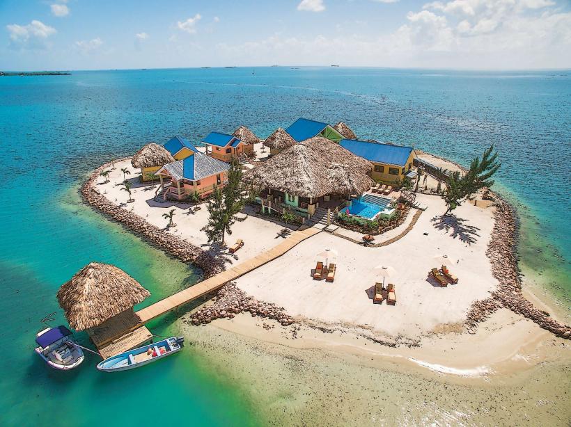
The reserve encompasses a large barrier reef system characterized by a central lagoon, numerous coral cays (islands), and extensive coral formations. The lagoon water varies in depth, with shallow areas exhibiting clear turquoise hues and deeper channels appearing darker blue. The cays are typically low-lying, covered with coconut palms and other coastal vegetation, and fringed by white sand beaches.
Location & Access Logistics
Access to Glover's Reef is primarily via boat from mainland Belize. The closest mainland departure points are Placencia and Dangriga. Boat transfers typically take 1.5 to 2 hours. There are no public roads or direct road access to the reserve. Limited docking facilities are available on some of the larger cays, primarily for tour operators and private vessels. No public parking is available within the reserve itself; parking is at the departure point on the mainland.
Historical & Ecological Origin
Glover's Reef is part of the larger Belize Barrier Reef Reserve System, a UNESCO World Heritage Site. Its formation is a result of geological processes involving the accumulation of coral skeletons over millennia. Ecologically, it is a complex reef ecosystem supporting a high diversity of marine life, including various coral species, fish, sea turtles, and marine mammals.
Key Highlights & Activities
Activities include snorkeling and scuba diving on the reef walls and within the lagoon, with specific dive sites like "The Wall" and "Amigos" known for their marine biodiversity. Kayaking and paddleboarding are possible within the sheltered lagoon. Fishing is permitted in designated areas, subject to regulations. Birdwatching is also a notable activity on the cays.
Infrastructure & Amenities
Infrastructure is minimal and primarily consists of eco-lodges and dive resorts located on several of the cays. These facilities typically offer basic accommodations, dining, and dive services. Restrooms are available at these establishments. Shade is provided by natural vegetation and structures at resorts. Cell phone signal can be intermittent and is generally limited to areas near the resorts.
Best Time to Visit
The dry season, from December to May, generally offers the most favorable weather conditions with lower rainfall and calmer seas. The best time of day for underwater photography is typically between 10:00 AM and 2:00 PM when sunlight penetration is optimal. Tidal variations can affect access to certain shallow reef areas.
Facts & Legends
Glover's Reef is named after the pirate John Glover, who reportedly used the reef as a base in the 17th century. A specific tip for visitors is to be aware of the strong currents that can occur in the deeper channels, especially during tidal changes.
Nearby Landmarks
- Silk Cay: 2km Southwest
- Southwest Cay: 3km Southwest
- Middle Cay: 4km Northwest
- Oyster Bed Cay: 4.5km West