Information
Landmark: Île à VacheCity: Les Cayes
Country: Haiti
Continent: North America
Île à Vache, Les Cayes, Haiti, North America
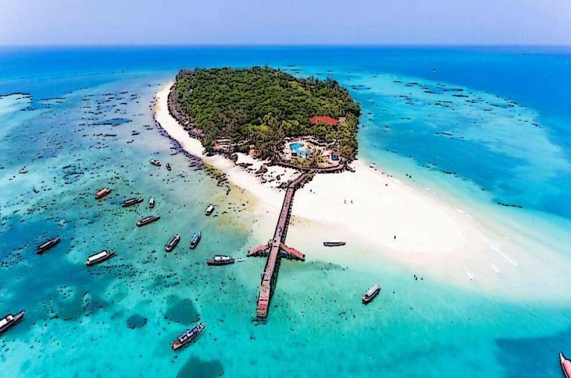
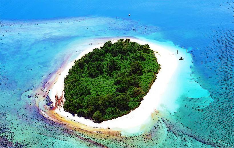
Île à Vache is a small island located off the southern coast of Haiti, near the city of Les Cayes.
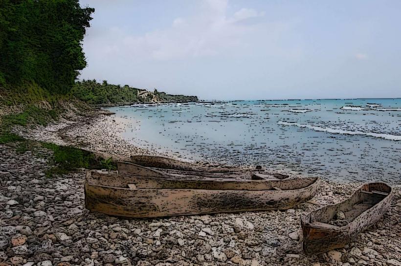
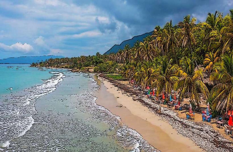
It is a low-lying coral island with a predominantly flat topography, characterized by sandy beaches and scattered coconut palm groves.
Visual Characteristics
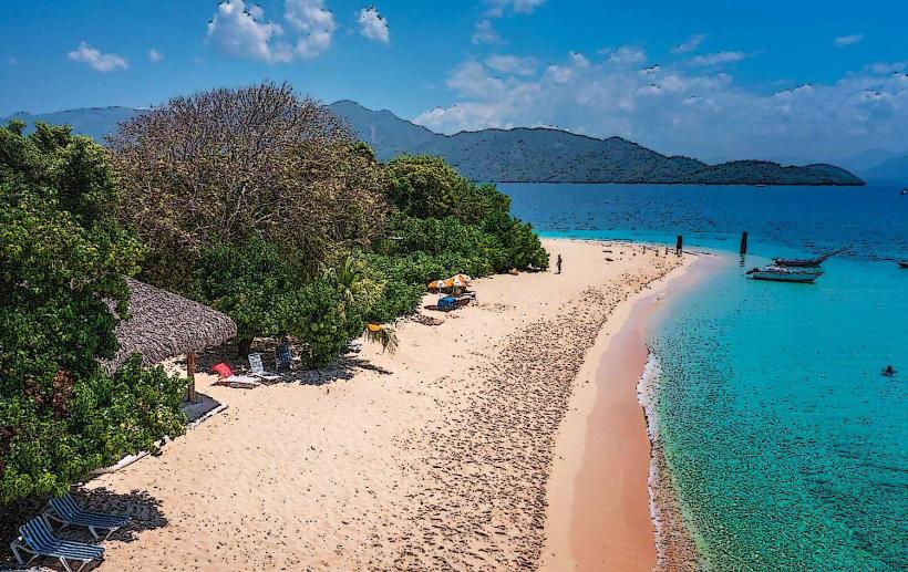
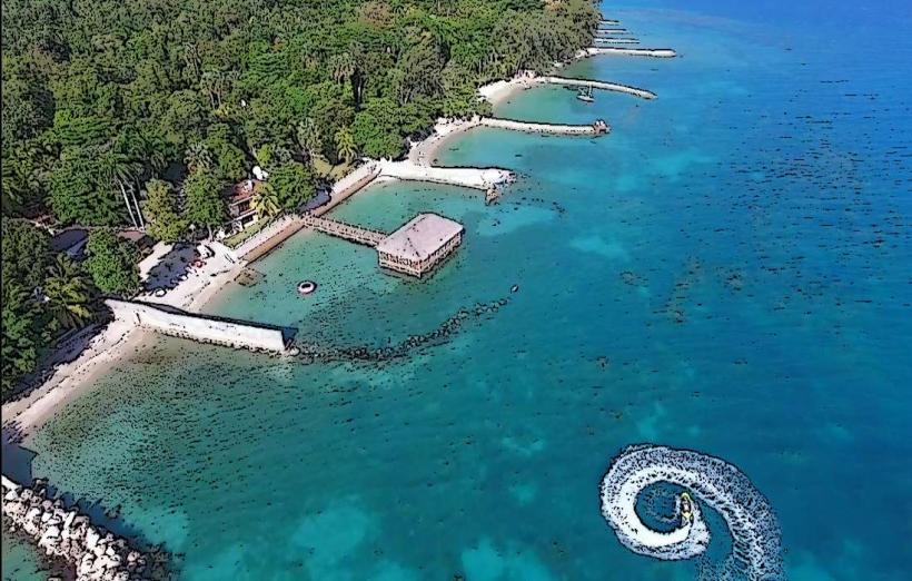
The island's coastline consists of white sand beaches. Inland, vegetation is dominated by coconut palms and scrub brush. The waters surrounding the island are shallow and turquoise, with visible coral formations in clearer areas. The highest elevation is minimal, not exceeding 10 meters above sea level.
Location & Access Logistics
Île à Vache is situated approximately 8 kilometers south of Les Cayes. Access is primarily via boat from the port of Les Cayes. Several local boat operators offer regular transfers, with journey times averaging 30-45 minutes depending on sea conditions. There is no direct road access. Limited parking is available at the port of Les Cayes.
Historical & Ecological Origin
The island is a coral atoll, formed over millennia by the accumulation of marine organisms. Historically, it served as a refuge and a base for pirates and buccaneers in the 17th and 18th centuries. It was also a site for cotton and sugarcane cultivation during the colonial period.
Key Highlights & Activities
Activities include swimming, sunbathing on the beaches, and snorkeling in the shallow reef areas. Boat tours around the island are available. Visitors can observe local fishing practices and explore the small villages. Hiking is limited due to the flat terrain.
Infrastructure & Amenities
Basic amenities are available in the main village, including small local eateries selling grilled fish and drinks. Restrooms are rudimentary and may not be available at all beach locations. Shade is provided by coconut palms. Cell phone signal is intermittent and generally weak.
Best Time to Visit
The dry season, from November to April, offers the most favorable weather conditions with less rainfall and calmer seas. The best time of day for photography is generally mid-morning or late afternoon to avoid harsh overhead sunlight. High tide is preferable for swimming and snorkeling to ensure adequate water depth over coral.
Facts & Legends
A local legend states that the island was named "Île à Vache" (Cow Island) due to a large herd of wild cattle that once roamed its shores, though historical evidence for this is scarce. A more verifiable fact is that the island was a key location for the filming of the 1957 film "The Old Man and the Sea."
Nearby Landmarks
- Port de Les Cayes (0.8km North)
- Citadelle Les Makes (4.5km Northwest)
- Jardin Botanique des Cayes (3.2km Northwest)
- Fort Saint-Louis (3.8km Northwest)