Information
Landmark: KjeragboltenCity: Stavanger
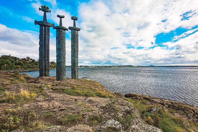
Country: Norway
Continent: Europe
Kjeragbolten, Stavanger, Norway, Europe
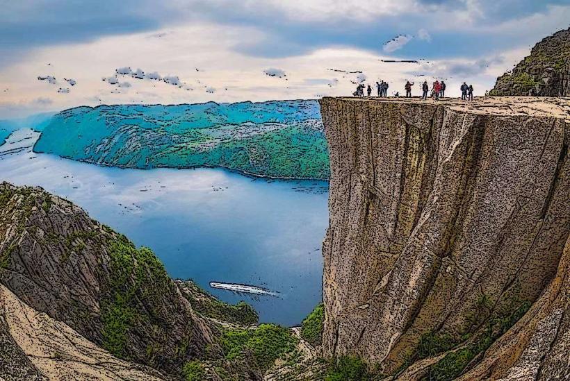
Kjeragbolten is a large, rounded boulder wedged firmly in a mountain crevice at an elevation of approximately 984 meters above the Lysefjorden, situated in the municipality of Sandnes, near Stavanger, Norway. It serves as a prominent natural landmark and a destination for hikers.
Visual Characteristics
The landmark consists of a 5-cubic-meter glacial erratic boulder, composed of dark grey granite, suspended between two vertical rock faces of the Kjerag mountain. The boulder itself is smooth and rounded, contrasting with the rugged, sheer granite cliffs that form the crevice. The surrounding mountain landscape is characterized by exposed rock, sparse alpine vegetation, and dramatic drops into the fjord below.
Location & Access Logistics
Access to Kjeragbolten typically begins from the parking area at Øygardstøl, located at the end of Lysevegen (Road 500). From Stavanger, the drive to Øygardstøl is approximately 2.5 to 3 hours, covering about 140 kilometers via RV13 and Lysevegen. Alternatively, a ferry service operates from Lauvvik or Forsand into Lysefjorden, disembarking at Lysebotn, from which a shuttle bus or taxi can transport visitors up the winding Lysevegen to Øygardstøl. Parking is available at Øygardstøl for a fee. Public transport options are limited to seasonal bus services connecting Stavanger to Øygardstøl or shuttle services from Lysebotn.
Historical & Ecological Origin
Kjeragbolten is a geological formation classified as a glacial erratic. It was deposited during the last ice age, approximately 10,000 years ago, when glaciers retreated and left the boulder in its current position. The subsequent post-glacial rebound of the landmass, following the melting of the ice sheet, lifted the surrounding bedrock, leaving the boulder suspended in the crevice above the fjord.
Key Highlights & Activities
The primary activity is the challenging 6-10 hour round-trip hike to the boulder. The trail involves three steep ascents and descents, marked with red 'T's. Visitors can stand directly on the Kjeragbolten boulder for photography, though this requires navigating a short, exposed section. Base jumping and wingsuit flying are also permitted from designated points on the Kjerag plateau, requiring specific permits and experience.
Infrastructure & Amenities
At the trailhead in Øygardstøl, there is a restaurant, restrooms, and a small shop. Along the hiking trail to Kjeragbolten, there are no permanent facilities. Shade is minimal on the exposed mountain trail. Cell phone signal (4G/5G) is intermittent and unreliable along the hiking route and at the boulder itself, improving near Øygardstøl.
Best Time to Visit
The hiking season for Kjeragbolten typically runs from early June to late September or early October, depending on snow conditions. Lysevegen (Road 500) is closed outside of this period due to snow. The best time of day for photography on the boulder is generally mid-morning to early afternoon for optimal light, though early morning can offer fewer crowds. No specific high/low tide requirements apply as the landmark is far above the fjord.
Facts & Legends
Despite its precarious appearance, Kjeragbolten is stable and has not moved since its discovery. There are no known local legends or myths specifically associated with the boulder itself, beyond its status as a natural wonder. A practical tip for visitors is to start the hike early in the morning to avoid crowds, especially during peak summer months, and to carry sufficient water and windproof clothing due to rapid weather changes.
Nearby Landmarks
- Kjerag Plateau: 0.5km East
- Kjeragfossen (waterfall): 2km South-East (visible from parts of the trail)
- Lysebotn (village at the end of Lysefjorden): 6km South (via Lysevegen)
- Øygardstøl (trailhead and service center): 5km North-West (via hiking trail)