Information
Landmark: Las Tunas BeachCity: San Miguel
Country: El Salvador
Continent: North America
Las Tunas Beach, San Miguel, El Salvador, North America
Las Tunas Beach is a coastal area situated in the municipality of San Miguel, El Salvador.
This location serves as a point of access to the Pacific Ocean for the region.
Visual Characteristics
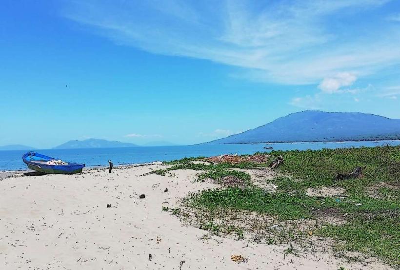
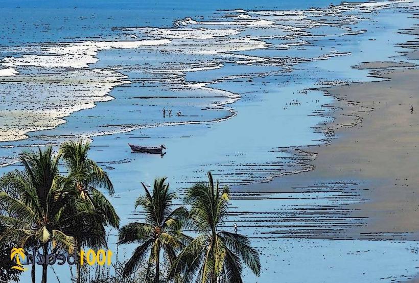
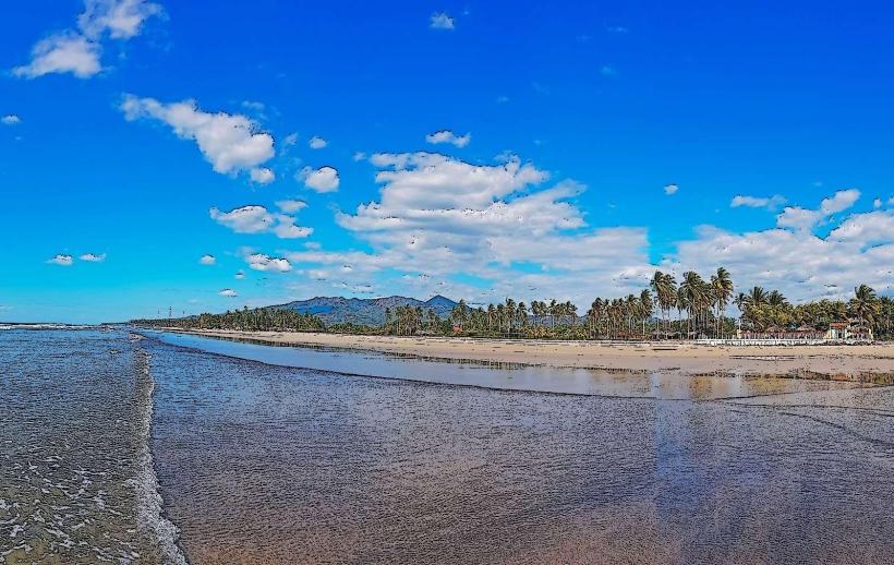
The beach consists of dark volcanic sand. The shoreline is approximately 1.5 kilometers in length. The water color is typically a deep blue, influenced by ocean currents. Vegetation along the immediate coastline is sparse, primarily consisting of salt-tolerant grasses and low shrubs.
Location & Access Logistics
Las Tunas Beach is located 25 kilometers south of the city center of San Miguel. Access is via Highway CA-2, turning south onto the unpaved road marked for Playa Las Tunas. The unpaved road is approximately 3 kilometers long and can be rough, especially after rainfall. Limited informal parking is available near the beach access points. Public transport options are infrequent; local buses serving the San Miguel to El Delirio route may drop passengers at the Highway CA-2 junction, requiring a walk or local taxi for the remaining distance.
Historical & Ecological Origin
The beach is a product of volcanic activity from the nearby Usulután volcanic chain, with its sand composed of eroded basaltic rock. Ecologically, it is part of the Central American Pacific coastal zone, characterized by marine and coastal ecosystems.
Key Highlights & Activities
Swimming is possible, though currents can be strong. Beachcombing for shells and volcanic rock fragments is a common activity. Fishing from the shore occurs, particularly during early morning and late afternoon.
Infrastructure & Amenities
There are no permanent restroom facilities or shade structures directly on the beach. Informal food vendors may be present on weekends and holidays, offering local seafood and beverages. Cell phone signal (2G/3G) is generally available, but can be intermittent closer to the water's edge.
Best Time to Visit
The best time for photography is during sunrise or sunset for softer lighting conditions. The dry season, from November to April, offers more consistent weather. Ocean conditions are generally calmer during the morning hours before potential afternoon winds develop.
Facts & Legends
Local fishermen report occasional sightings of sea turtles nesting during the months of July and August, though official monitoring is not in place.
Nearby Landmarks
- Playa El Espino (2.8km Southwest)
- Laguna El Jute (4.1km Northwest)
- Puerto El Triunfo (4.9km West)