Information
Landmark: Mount BaldyCity: Eagar
Country: USA Arizona
Continent: North America
Mount Baldy, Eagar, USA Arizona, North America
Mount Baldy is the highest peak in Arizona outside the San Francisco Peaks near Flagstaff, standing at an elevation of 11,409 feet. It is located in the White Mountains of eastern Arizona within the Fort Apache Indian Reservation. The mountain is an extinct stratovolcano, with its last eruption occurring approximately 2 million years ago. Mount Baldy holds deep cultural and spiritual significance for the White Mountain Apache Tribe, who reside in the area and manage access to certain parts of the mountain.
Geography and Environment
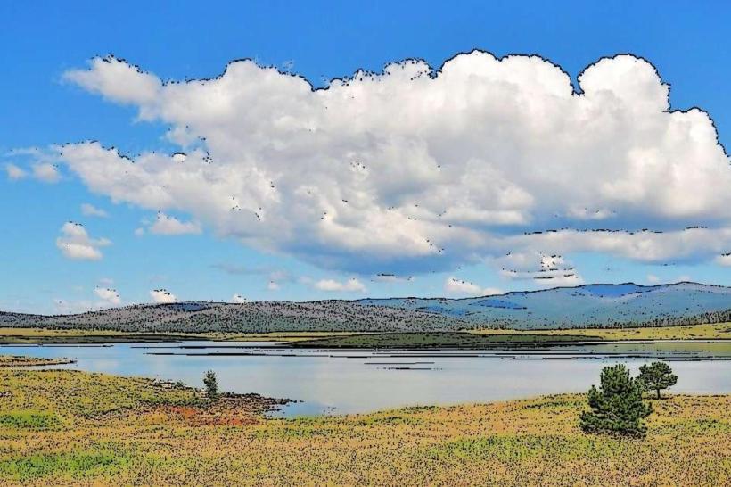
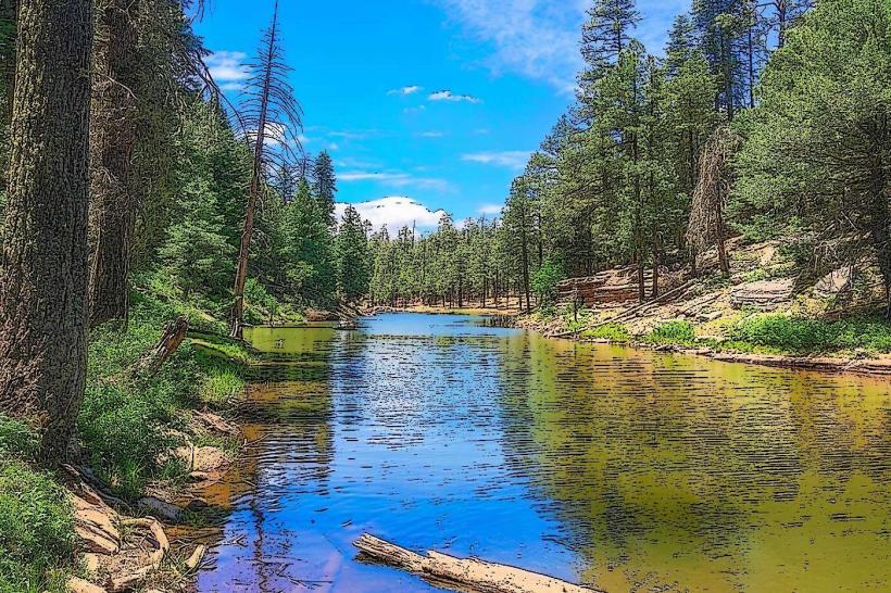
Mount Baldy is part of the larger Mount Baldy Wilderness Area, which covers more than 21,000 acres of protected land within the Apache-Sitgreaves National Forest. The mountain and surrounding wilderness feature a diverse landscape, including dense mixed conifer forests dominated by ponderosa pine, Douglas fir, and aspen trees at higher elevations. Meadows and alpine wetlands are scattered throughout the area, supporting rich biodiversity.
The climate here is typical of high-elevation mountains in the Southwest, with cool summers, cold winters, and substantial snowfall during winter months. The elevation creates distinct ecological zones, with montane forest giving way to subalpine environments near the summit areas.
Hiking and Trail System
While direct access to Mount Baldy’s summit is restricted due to its location on the Fort Apache Indian Reservation, several well-established hiking trails offer extensive exploration opportunities in the surrounding wilderness. These trails provide access to spectacular vistas, alpine meadows, streams, and wildlife habitats.
1. West Baldy Trail (Trail #94):
Length & Duration: Approximately 14.2 miles round trip, usually taking 6 to 8 hours to complete.
Elevation Gain: About 3,200 feet.
Trail Features: Starting near the West Baldy Trailhead, the trail follows the West Fork of the Little Colorado River and winds through thick forests of ponderosa pine and mixed conifers. Along the way, hikers encounter mountain meadows, seasonal wildflowers, and the chance to see wildlife like elk, deer, and a variety of bird species. The trail offers solitude, as it is less crowded compared to other popular Arizona hikes. The terrain varies between forested pathways and open meadows, with some rocky sections requiring steady footing.
2. East Baldy Trail:
Length & Duration: About 7 miles one way.
Elevation: Moderate to significant gain depending on exact route.
Trail Features: The East Baldy Trail begins near the East Baldy Trailhead on State Road 273 and climbs through mixed conifer forests. Hikers enjoy sweeping views of valleys and surrounding peaks as they ascend. The trail is well-maintained but moderately strenuous, with sections that offer panoramic viewpoints and diverse flora, including aspen groves and mountain wildflowers during spring and summer.
3. Crossover Trail:
Length: Approximately 3.5 miles.
Trail Function: Connects the West Baldy and East Baldy Trails, allowing hikers to create a loop hike of about 17.5 miles.
Trail Features: The trail passes through lush meadows and along small streams, providing a peaceful and scenic hiking experience. It is moderately challenging and excellent for those looking to extend their hike and experience more of the wilderness.
Mount Baldy Loop Hike
A popular route for experienced hikers is the Mount Baldy Loop, which combines the West Baldy Trail, East Baldy Trail, and Crossover Trail into a circuit of approximately 17.5 miles with a total elevation gain of roughly 2,500 feet. This loop showcases diverse ecosystems, from dense forest to open alpine meadows, along with impressive views of the White Mountains. The loop typically takes a full day or two to complete, with options to camp overnight at designated sites along the trails.
Access and Regulations
Trailheads:
West Baldy Trailhead is accessible near the town of Eagar, off Forest Road 25.
East Baldy Trailhead lies on State Road 273 between the Sunrise Ski Resort and Big Lake areas.
Permits and Restrictions:
While the trails within the Apache-Sitgreaves National Forest are generally open to the public without permits, Mount Baldy’s summit is on the Fort Apache Indian Reservation. Access to the summit and certain nearby areas is restricted and requires permission from the White Mountain Apache Tribe. Visitors should respect tribal lands and regulations.
Best Time to Visit:
The ideal hiking season runs from late spring through early fall (May to October). Summer provides the most favorable weather, although afternoon thunderstorms can occur. Winter brings heavy snow and icy conditions, making hiking challenging and suitable only for experienced winter adventurers.
Safety and Preparation
Weather: Mountain weather can change rapidly. Temperatures can drop suddenly, and storms may develop quickly, especially in summer afternoons. Hikers should carry rain gear and warm layers.
Water and Supplies: Natural water sources are limited along the trails, so carrying sufficient water is critical. Filtering or purifying water from streams is recommended if used.
Navigation: Trails are marked but can be faint in some sections. A detailed map, compass, or GPS device is essential. Cell phone coverage is limited in this remote area.
Wildlife Awareness: The area is home to elk, deer, black bears, and mountain lions. Hikers should practice wildlife safety measures, including making noise while hiking, storing food properly, and maintaining distance if animals are spotted.
Altitude Considerations: The high elevation may cause altitude sickness for some visitors. It is important to acclimate gradually and recognize symptoms such as headaches, nausea, or dizziness.
Ecological and Cultural Significance
Mount Baldy is not only a striking natural landmark but also a place of deep cultural importance. The White Mountain Apache Tribe considers the mountain sacred and integral to their heritage and spiritual practices. The mountain and surrounding wilderness support a variety of plant and animal species, some unique to the region’s alpine environment.
Summary
Mount Baldy in Arizona’s White Mountains offers an exceptional wilderness experience with its high elevation, diverse forests, and alpine meadows. Although summit access is restricted, the extensive trail network around the mountain allows hikers to explore pristine natural areas, enjoy breathtaking scenery, and immerse themselves in a landscape rich with ecological and cultural value. Preparation, respect for tribal lands, and attention to safety are essential to fully appreciate this majestic peak and its surroundings.