Information
Landmark: Needles HighwayCity: Custer
Country: USA South Dakota
Continent: North America
Needles Highway, Custer, USA South Dakota, North America
Overview and Setting
Winding through the rugged granite spires of Custer-state-park_custer" class="underline">Custer State Park in South Dakota, the Needles Highway (Highway 87) is one of America’s most scenic mountain drives. Completed in 1922 as part of Governor Peter Norbeck’s ambitious vision for a road system that would showcase the beauty of the Black Hills, the route stretches for about 14 miles between Sylvan Lake and Needles Eye Tunnel, continuing north toward Legion Lake.
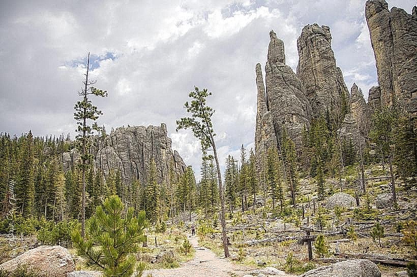
The highway’s name comes from the slender granite formations that rise like stone spires from the forest-narrow, tall, and needle-like in shape. These formations, sculpted by millions of years of erosion, create an almost cathedral-like landscape where pine forests meet dramatic peaks of pink and gray stone.
Road Design and Engineering
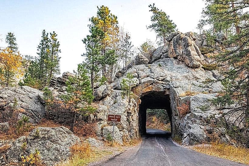
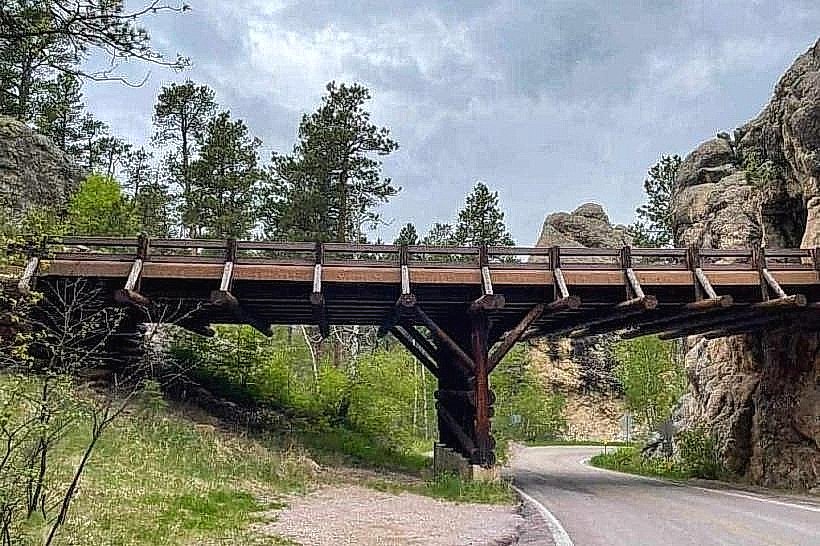
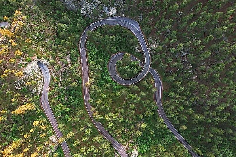
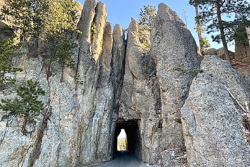
Built at a time when automobiles were still a novelty, the Needles Highway is a marvel of early 20th-century engineering. The road was intentionally designed with sharp curves, narrow lanes, and hairpin turns that follow the natural contours of the terrain. It climbs steeply through rocky corridors and passes through two famous tunnels-the Iron Creek Tunnel and the Needles Eye Tunnel.
The latter is the highlight: only 8 feet 4 inches wide and 11 feet 3 inches high, it barely accommodates modern vehicles. Drivers often stop to take turns squeezing through, applauded by spectators waiting at the other end. The tunnel opens suddenly to sweeping mountain views, creating one of the most photographed scenes in South Dakota.
Scenic Highlights Along the Route
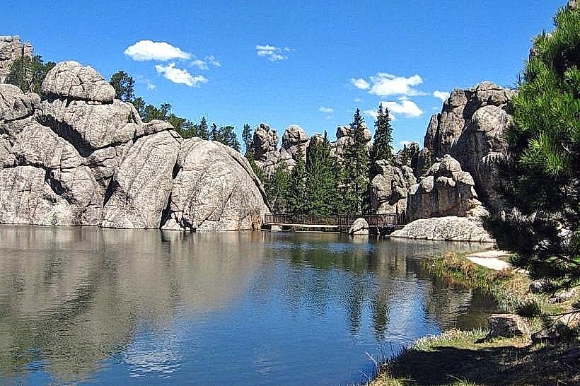
The drive offers constant visual drama. At Sylvan Lake, the road begins gently, winding past shimmering water and dense stands of ponderosa pine. Soon, the landscape transforms-granite pinnacles appear at every bend, some so close they seem to brush against the car windows.
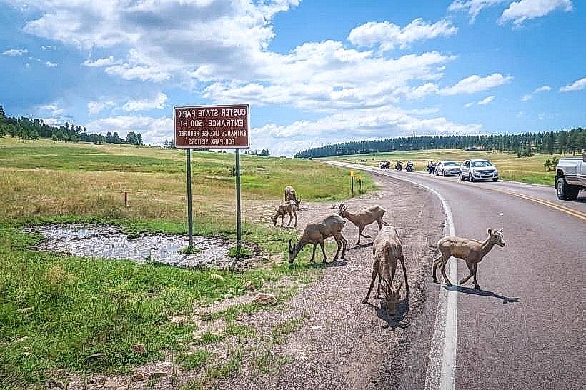
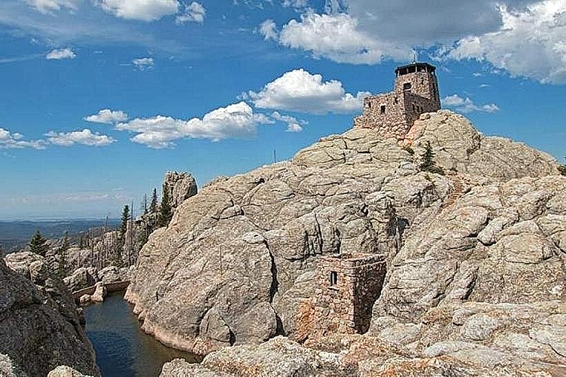
Pullouts along the route reveal panoramic views of the Black Hills, the Cathedral Spires, and even distant glimpses of Black Elk Peak-the highest point east of the Rockies. Wildlife sightings are common: bighorn sheep often graze along the rocky slopes, and chipmunks dart across the roadside.
Visitor Experience and Best Time to Drive
The Needles Highway is open seasonally, typically from late May through mid-October, depending on snow conditions. The road is closed during winter, as icy conditions make the curves and tunnels unsafe. Driving the full length takes about 45 minutes without stops, though most visitors spend 1–2 hours allowing for photos and short hikes.
It’s best experienced at sunrise or late afternoon, when the granite formations glow in shades of amber and rose. The quiet hours also make it easier to stop safely and enjoy the viewpoints without crowds.
Hiking and Recreation
Several trailheads begin near the highway. The Cathedral Spires Trail leads hikers deep into the granite formations, offering close encounters with the spires that gave the road its name. Nearby, the Little Devil’s Tower Trail connects with the Black Elk Peak Trail, allowing ambitious hikers to ascend to panoramic vistas of the Black Hills Wilderness.
Atmosphere and Legacy
The Needles Highway feels like a journey through nature’s own sculpture garden-a twisting ribbon of asphalt surrounded by stone towers and whispering pines. Governor Norbeck once said he designed the route “for people who are willing to take their time,” and that advice still holds true.
Even today, with all its tight turns and narrow tunnels, the Needles Highway remains an unforgettable drive-equal parts thrilling and peaceful-perfectly capturing the wild, enduring spirit of the Black Hills.