Information
Landmark: OslofjordCity: Oslo
Country: Norway
Continent: Europe
Oslofjord, Oslo, Norway, Europe
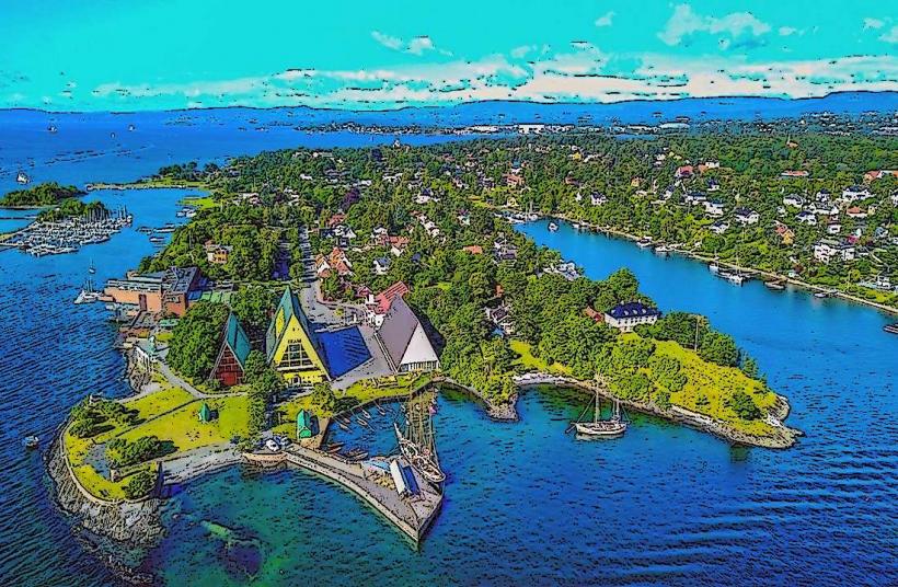
The Oslofjord is a 100-kilometer-long inlet of the Skagerrak strait, extending northwards to the city of Oslo in southeastern Norway. It is characterized by numerous islands and a varied coastline, serving as a vital recreational and transport artery for the region.
Visual Characteristics
The fjord's waters typically present a deep blue-green hue, reflecting the surrounding environment. Its shores are defined by a mix of ancient Precambrian bedrock, forming rocky outcrops and low cliffs, interspersed with areas of coniferous and deciduous forests. Numerous islands, known as holmer, dot the fjord, varying in size from small rocky islets to larger landmasses covered in vegetation. The width of the fjord varies considerably, from narrow passages to broad expanses.
Location & Access Logistics
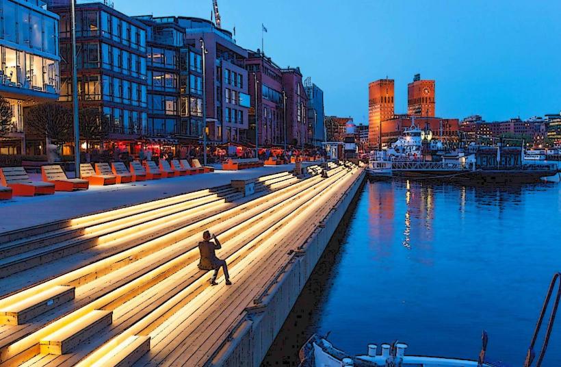
The Oslofjord is directly accessible from Oslo city center, with its inner reaches forming the city's waterfront. Public transport options include local ferries departing from Aker Brygge, providing access to islands such as Hovedøya, Lindøya, and Gressholmen. Bus lines, such as routes 30 and 31, serve coastal areas and peninsulas like Bygdøy, which is approximately 3 kilometers west of the city center. Parking facilities are available at popular beaches and recreational zones, often requiring payment, for example, at Huk on Bygdøy. Major roads like the E18 run along sections of the fjord's western side, offering vehicular access to various points.
Historical & Ecological Origin
Geologically, the Oslofjord is primarily a rift valley, formed by tectonic subsidence rather than glacial erosion, distinguishing it from true fjords further west in Norway. This rift structure was subsequently modified by glacial activity during the Quaternary period. Ecologically, it represents a brackish water environment, supporting a diverse ecosystem of marine species, coastal birds, and characteristic flora adapted to its unique conditions.
Key Highlights & Activities
Boating and kayaking are popular activities for exploring the fjord's islands and coastline. Swimming is possible at numerous designated beaches, including Huk, Ingierstrand, and the island beaches of Langøyene. Fishing is permitted in accordance with local regulations. Visitors can engage in island hopping via public ferries or undertake coastal walks and cycling along established paths.
Infrastructure & Amenities
Restroom facilities are available at major ferry terminals, popular beaches, and on some of the larger islands. Natural shade is provided by the extensive tree cover on the islands and along the mainland shores. Cell phone signal (4G/5G) is generally robust across the accessible areas of the inner fjord. Food vendors, including kiosks and restaurants, operate at popular recreational sites, ferry departure points, and on certain islands, particularly during the summer season.
Best Time to Visit
The months of June through August offer the warmest weather for swimming and water-based activities. May and September provide pleasant temperatures with fewer crowds. For photography, the soft light of early morning or late afternoon is optimal for capturing the fjord's landscapes and islands. Tidal variations in the Oslofjord are minimal and do not significantly impact most recreational activities.
Facts & Legends
Despite its name, the Oslofjord is not a true fjord in the geological sense, as it was formed by a geological rift rather than solely by glacial carving. A practical tip for visitors is to utilize the local ferry system from Aker Brygge to explore the inner islands, such as Hovedøya, which offers historical ruins and quieter natural areas away from mainland crowds.
Nearby Landmarks
- Aker Brygge: 0km East
- Astrup Fearnley Museum of Modern Art: 0.5km West
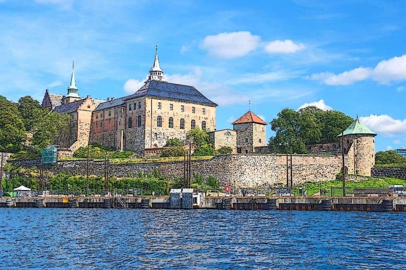
- Akershus Fortress: 1km North-East
- Bygdøy Peninsula: 3km West
- Hovedøya Island: 2km South