Information
Landmark: Pico Bonito National ParkCity: La Ceiba
Country: Honduras
Continent: North America
Pico Bonito National Park, La Ceiba, Honduras, North America
Pico Bonito National Park is a protected area located in the northern region of Honduras, adjacent to the city of La Ceiba.
This park encompasses a significant portion of the Pico Bonito massif, a prominent mountain range.
Visual Characteristics
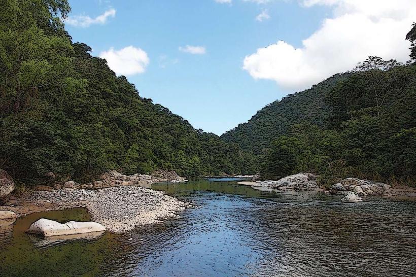
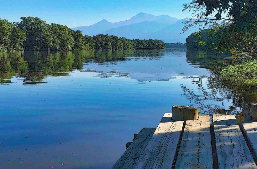
The park's terrain is characterized by steep slopes and deep ravines, covered by dense tropical rainforest. Elevations range from approximately 200 meters to over 2,400 meters above sea level. The vegetation is multi-layered, featuring a high density of broadleaf trees, epiphytes, and ferns. Rivers and streams, such as the Cangrejal River, flow through the park, often with clear, fast-moving water and exposed rock formations.
Location & Access Logistics
Pico Bonito National Park is situated approximately 10 kilometers east of La Ceiba. Access is primarily via the CA-13 highway, turning south onto a gravel road (often referred to as the "Jutiapa road") that leads to the park entrance. The drive from La Ceiba to the park entrance takes approximately 30-45 minutes. Limited parking is available at the main entrance and at designated trailheads. Public transport options directly to the park are scarce; visitors typically arrange private transport or taxis from La Ceiba.
Historical & Ecological Origin
Pico Bonito National Park was established on January 1, 1987, to protect the diverse ecosystems and water resources of the Pico Bonito massif. Ecologically, it is classified as a Neotropical rainforest, situated within the Mesoamerican Biological Corridor. The massif itself is composed of ancient volcanic rock formations, sculpted by erosion over millennia.
Key Highlights & Activities
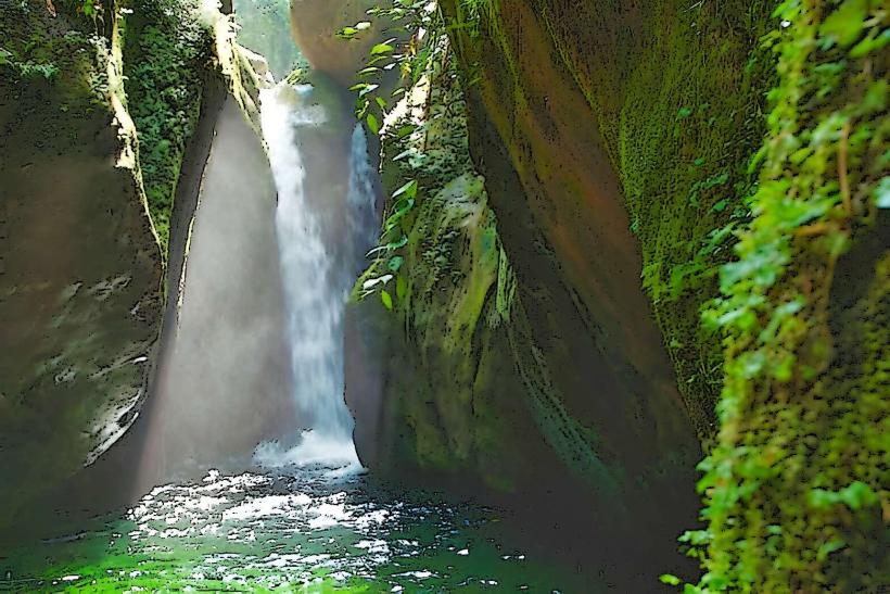
Hiking is a primary activity, with trails ranging in difficulty. The "Waterfall Trail" leads to a series of cascades. The "El Bejuco Trail" offers a more challenging ascent. Birdwatching is significant due to the park's biodiversity. The Cangrejal River provides opportunities for whitewater rafting and kayaking, with commercial operators based near the park entrance. Swimming is possible in designated river sections.
Infrastructure & Amenities
Basic facilities are available at the park entrance, including a visitor center and restrooms. Some areas within the park offer natural shade from the forest canopy. Cell phone signal is intermittent and generally unreliable within the park boundaries. Food vendors are typically located outside the park entrance or in nearby communities along the CA-13 highway.
Best Time to Visit
The dry season, from December to April, generally offers more favorable hiking conditions with less rainfall. The wet season (May to November) sees higher river levels, which can impact trail accessibility and rafting conditions. For photography, early morning and late afternoon provide softer light. No specific tide requirements apply.
Facts & Legends
The park is home to a significant population of jaguars, though sightings are rare. Local folklore speaks of ancient spirits guarding the mountain peaks. A specific tip for visitors is to carry insect repellent, as mosquitoes and other biting insects are prevalent, especially in the lower elevations.
Nearby Landmarks
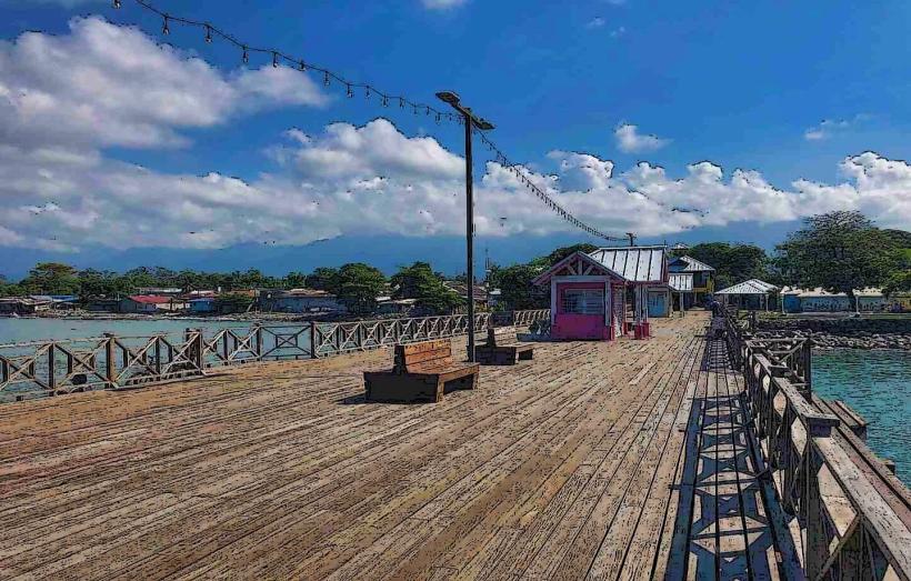
- Cangrejal River (0.5km West)
- La Ceiba City Center (10km West)
- Pico Bonito Lodge (2km West)
- Honduras Coffee Plantation (3km South)
- Cuero y Salado Wildlife Refuge (15km Northwest)