Information
Landmark: Shala RiverCity: Shkoder
Country: Albania
Continent: Europe
Shala River, Shkoder, Albania, Europe
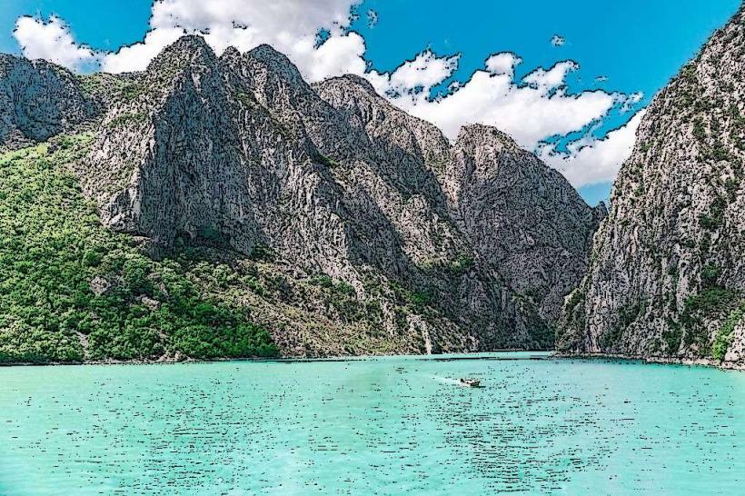
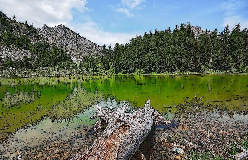
The Shala River (Lumi i Shalës) is a high-alpine waterway originating in the Albanian Alps (Prokletije) and flowing into the Koman Reservoir. Known as the "Thailand of Albania," it is a primary destination for adventure tourism in the Shkodër District due to its extreme water clarity and secluded canyon setting.
Visual Characteristics
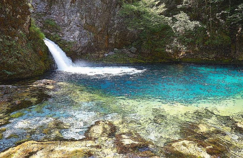
The river is defined by its vibrant turquoise color, resulting from its high mineral content and glacial origins. The riverbed is composed of bright white limestone gravel and large boulders. In its lower reaches near the Koman Lake confluence, the river is flanked by vertical limestone cliffs rising up to 300 meters, densely covered in beech and pine forests. The water remains exceptionally cold, typically staying between 7°C and 10°C even in mid-summer.
Location & Access Logistics
The Shala River is located in the Dukagjin region. It is not accessible by road for tourists.
Access Point: Visitors must travel to the Koman Dam (2 hours from Shkodër via a rugged road).
Boat Transit: From Koman, small wooden motorboats or "long-tail" boats transport visitors upstream for approximately 1 hour to 1.5 hours.
Theth Connection: The upper reaches are accessible via a strenuous 6–7 hour hike from the village of Theth over the Valbona or Shala passes.
Most visitors arrive via organized daily tours departing from Shkodër at 06:30.
Historical & Ecological Origin
The river originates from the Radohima mountain range and flows through the Shala Valley, historically the territory of the Shala tribe, one of the most prominent northern Albanian clans. Geologically, the river has carved a deep karst canyon through Triassic limestone. The area is part of the Alps of Albania National Park and serves as a habitat for the endemic Balkan trout and several rare species of eagles.
Key Highlights & Activities
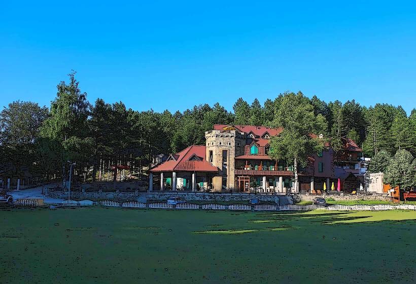
Blini i Gurit të Lekës: This is the primary tourist hub on the river, featuring stone-built guesthouses and riverside lounging areas.
Kayaking & Tubing: Visitors can rent kayaks to explore the narrowest segments of the canyon where the current is minimal.
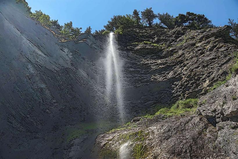
Hiking: Short trails lead from the riverbanks to panoramic viewpoints and small hidden waterfalls.
Swimming: Despite the temperature, swimming in the "natural pools" created by the river's bends is a central activity.
Infrastructure & Amenities
Infrastructure is rustic and seasonal (May–October). There are several small guesthouses and "eco-resorts" made of wood and stone that offer basic lodging and traditional meals (typically fried river trout and local cheese). Public restrooms are limited to those within these private guesthouses. There is no grid electricity; sites rely on solar power or small generators. Cellular signal (4G) is non-existent within the deep canyon sections.
Best Time to Visit
The optimal window is from June to early September. Before June, water levels can be too high and dangerous for small boats; after September, the temperature drops significantly. For photography, the hours between 11:00 and 14:00 are best, as the sun is high enough to reach the canyon floor and illuminate the turquoise water.
Facts & Legends
A verified geographical oddity is that the river water is so pure it is technically potable at its source. Local legend associates the river with Lekë Dukagjini, the prince who codified the Northern Albanian Kanun; a large rock formation in the canyon is named "Guri i Lekës" (Lekë's Stone), where he is said to have held councils.
Nearby Landmarks
Koman Lake: 12.0km South (by boat)
Theth National Park: 15.0km North (via mountain trail)
Shosh Village: 8.0km West
Maja e Harapit: 14.0km North
Cave of the Doves: 2.0km North (accessible by boat)