Information
City: FuerteventuraCountry: Canary Islands
Continent: Europe
Fuerteventura, Canary Islands, Europe
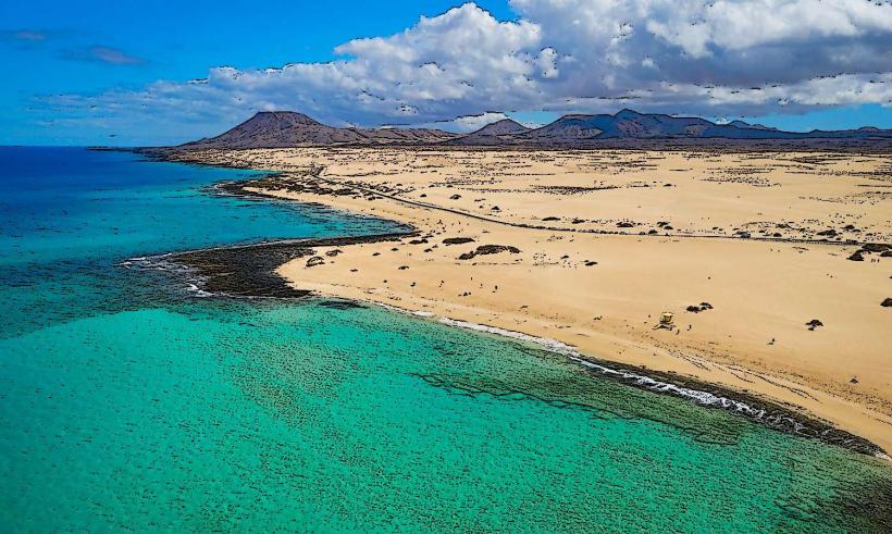
Fuerteventura is the second-largest of the Canary Islands and the oldest geologically. Located only 100 km from the African coast, it is characterized by vast plains, ancient volcanic mounds, and over 150 km of white and golden sand beaches. The entire island was declared a UNESCO Biosphere Reserve in 2009.
Historical Timeline
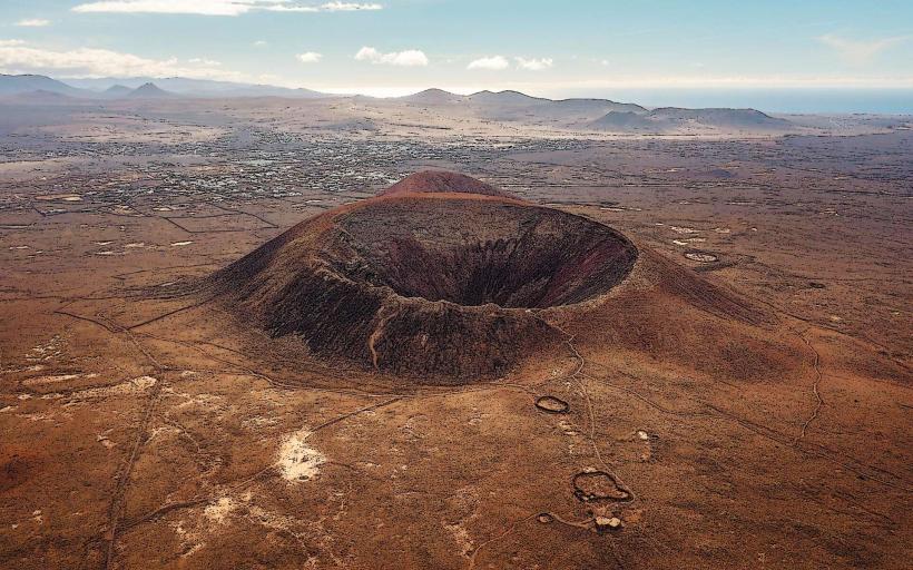
Fuerteventura emerged from the ocean approximately 20 million years ago. It was originally inhabited by the Maho people, who divided the island into two kingdoms (Maxorata and Jandía) separated by a wall. The primary event shaping its modern history was the 1402 conquest by Norman explorer Jean de Béthencourt, who founded the first capital, Betancuria. For centuries, the economy relied on cereal farming and goat herding until the 1960s, when tourism and wind-sports transformed the coastal infrastructure.
Demographics & Population
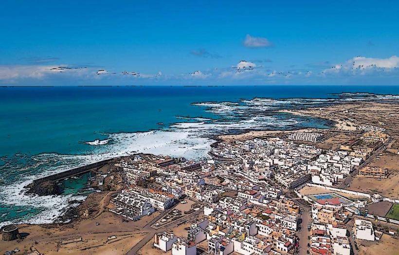
The population is approximately 120,000. It has the lowest population density in the archipelago. The demographic is highly international, with significant German, British, and Italian communities. Puerto del Rosario serves as the administrative capital and main port.
Urban Layout & Key Districts
The island is sparsely populated, with most development concentrated on the northern and southern tips.
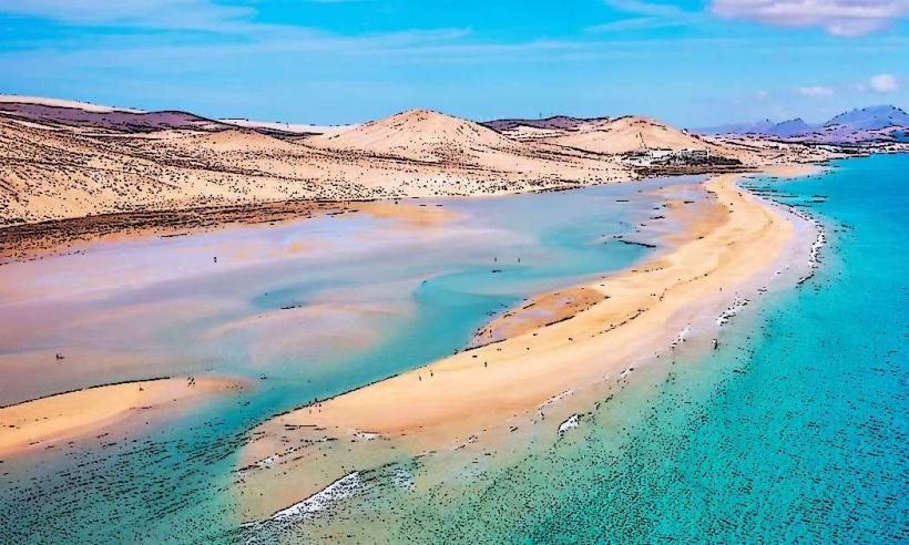
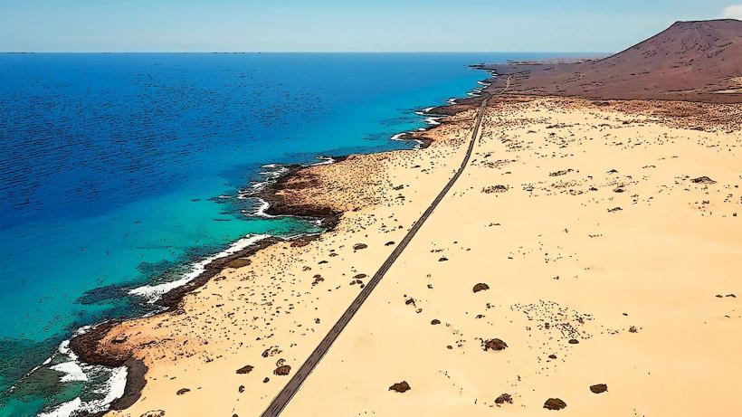
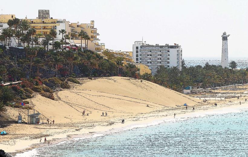
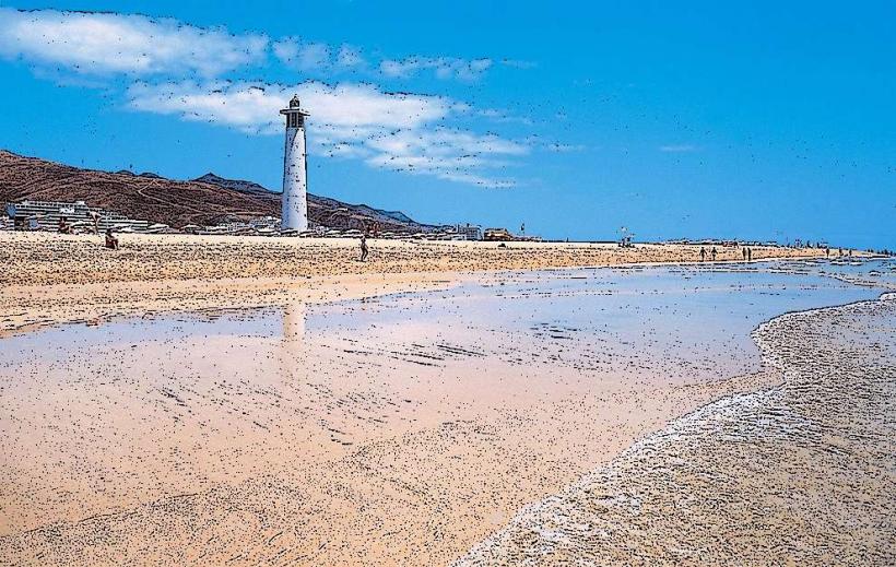
Corralejo (North): A vibrant hub known for its massive sand dunes and proximity to Lanzarote.
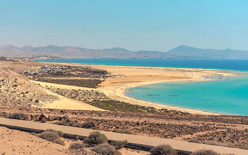
Jandía/Morro Jable (South): A primary tourist zone featuring endless white sand beaches and large-scale resorts.
Caleta de Fuste (East Coast): A family-oriented resort town close to the airport.
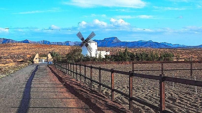
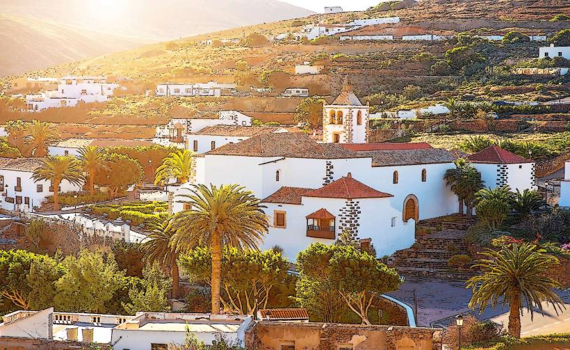
The Interior: Features traditional, wind-swept villages like Betancuria, Antigua, and Pájara.
El Cotillo (Northwest): A former fishing village now popular with surfers and those seeking a quieter atmosphere.
Top Landmarks
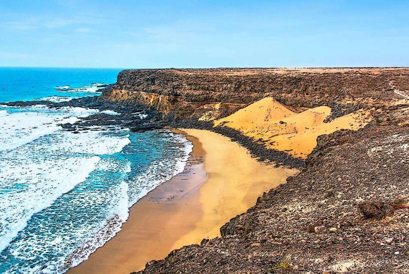
Corralejo Natural Park: 2,600 hectares of spectacular Saharan-like sand dunes (Dunas de Corralejo).
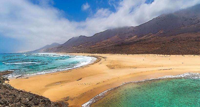
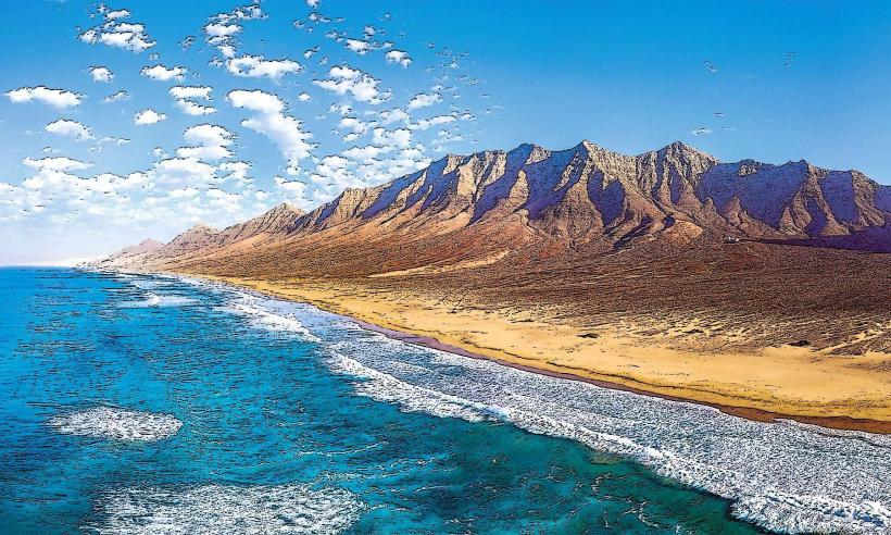
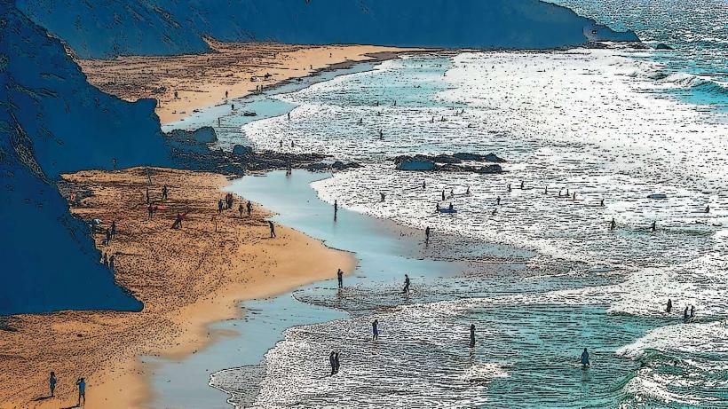
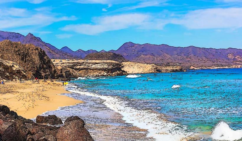
Cofete Beach: A wild, 12 km stretch of untouched beach backed by the jagged Jandía mountains.
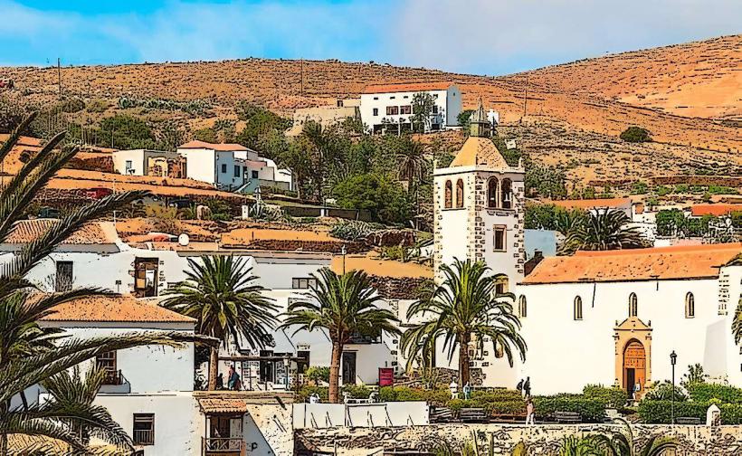
Betancuria: The historic first capital, located in a fertile valley surrounded by mountains.
Montaña de Tindaya: Considered a sacred site by the indigenous inhabitants, featuring ancient foot-shaped engravings.
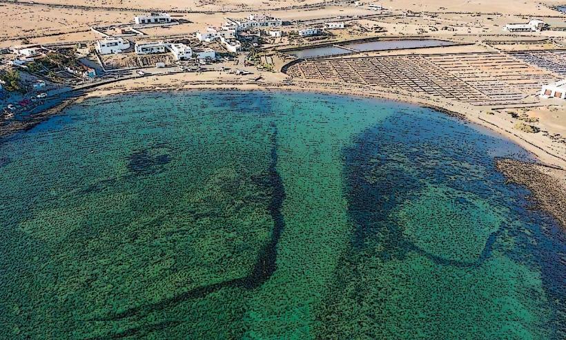
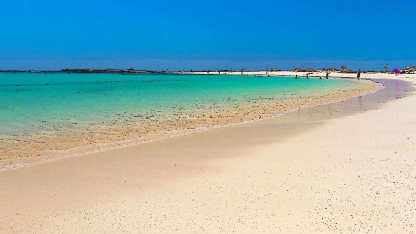
Isla de Lobos: A small, uninhabited volcanic islet accessible by a 15-minute boat ride from Corralejo.
Transportation Network
Air: Fuerteventura Airport (FUE) is located on the east coast, 5 km from the capital.
Roads: The FV-1 (North) and FV-2 (South) are the primary arteries. Driving is the most efficient way to explore, as many scenic spots are remote.
Public Transit: The Thiade bus network (green and white) connects major towns and resorts, though frequency to inland villages is limited.
Sea: Ferries connect Corralejo to Lanzarote (30 mins) and Morro Jable to Gran Canaria (2 hours).
Safety & "Red Zones"
Fuerteventura is exceptionally safe with no "red zones." The primary risks are environmental: the island is extremely windy (Fuerte-ventura translates to "Strong Wind"), which can mask the intensity of the sun and lead to severe burns. Swimming at Cofete or northern "wild" beaches is dangerous due to powerful Atlantic undertows and lack of lifeguards.
Digital & Financial Infrastructure
Fiber-optic internet is standard in major hubs like Corralejo and Puerto del Rosario. Mobile coverage is good along the coast but can be patchy in the mountainous interior. Card acceptance is universal. Fuerteventura benefits from the 7% IGIC tax rate. The currency is the Euro (€).
Climate & Air Quality
The island has a desert-like subtropical climate.
Climate: It receives the least rainfall in the Canaries. Average temperatures range from 18°C in winter to 28°C in summer.
Wind: The Trade Winds are a constant presence, making it a global capital for kitesurfing and windsurfing.
Air Quality: Excellent, though frequently affected by the Calima (Saharan dust storms) which can obscure visibility and increase temperatures.
Culture & Social Norms
The island maintains a rustic, slow-paced "Majorero" culture. Tipping is around 5–10% for service. The economy is heavily tied to Goat Cheese (Queso Majorero), which is globally recognized and protected. Casual dress is standard, though swimwear should be restricted to the beach and pool areas.
Accommodation Zones
Corralejo: Best for surfers, young travelers, and those wanting a mix of beaches and nightlife.
Costa Calma/Morro Jable: Best for sun-seekers and those looking for expansive resort facilities.
El Cotillo: Best for a bohemian vibe and spectacular sunsets.
Local Cost Index
1 Espresso: €1.40 ($1.54)
1 Standard Lunch: €13.00 ($14.30)
1 Car Rental (Daily average): €25.00 ($27.50)
Nearby Day Trips
Lanzarote: Visible from the northern coast; accessible via a short ferry crossing.
Isla de Lobos: Ideal for snorkeling and hiking.
Facts & Legends
A verified historical oddity is that the island was once home to the "Villa Winter," a mysterious mansion in Cofete rumored to have been a secret Nazi base or submarine waypoint during WWII, though it is officially recorded as a farmhouse. Local legend tells of the "Light of Mafasca," a mysterious glowing orb seen by travelers in the desert plains at night, believed to be a wandering soul.