Information
City: LivingstonCountry: Guatemala
Continent: North America
Livingston, Guatemala, North America
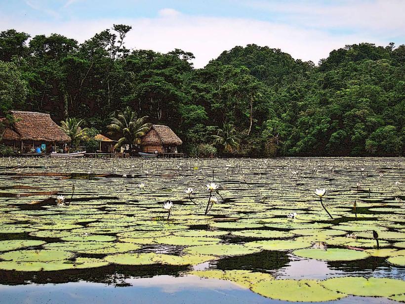
Livingston is a unique municipality in the Izabal Department, situated at the mouth of the Río Dulce on the Amatique Bay. It is the only significant settlement in Guatemala inaccessible by road, functioning as the cultural capital of the Garifuna people and a vital maritime link between the river interior and the Caribbean Sea.
Historical Timeline
The town was founded in 1831 and named after Edward Livingston, a US jurist who authored the "Livingston Codes" adopted by the Guatemalan government. Its primary era of governance began in the mid-19th century when it served as the main port of the Guatemalan Caribbean before the development of Puerto Barrios. The 18th-century arrival of the Garifuna-descendants of West African, Carib, and Arawak peoples-is the primary event that defined the town’s linguistic and cultural separation from the rest of the nation.
Demographics & Population
The population is approximately 18,000. The demographics are a distinct blend of Garifuna (40%), Q'eqchi' Maya (35%), Mestizo (20%), and East Indian (5%). The median age is 22.8 years.
Urban Layout & Key Districts
Livingston is organized on a rising limestone bluff.
The Main Street (Calle Principal): The steep primary artery rising from the municipal dock, containing the majority of shops and services.
Barrio San Felipe: The central district housing the municipal buildings and traditional Garifuna residences.
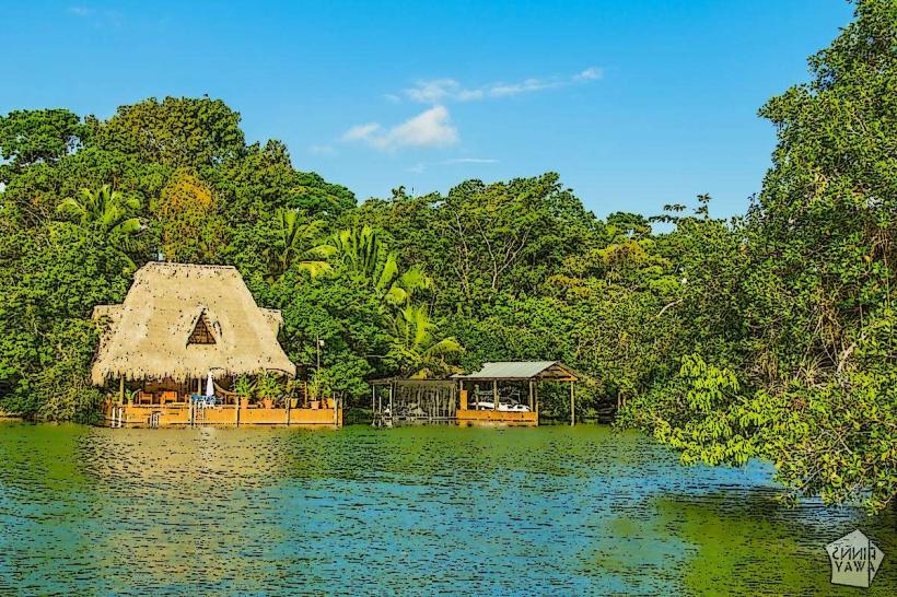
The North Shore: A residential and hotel district extending toward the Seven Altars.
The River Entrance: The southern tip of the town focused on maritime logistics and boat maintenance.
Top City Landmarks
The Municipal Dock: The primary entry point and logistical hub.
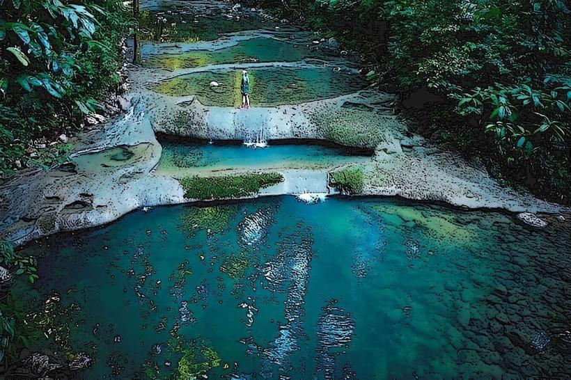
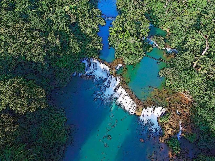
Seven Altars (Siete Altares): A series of freshwater pools and waterfalls on the coast.
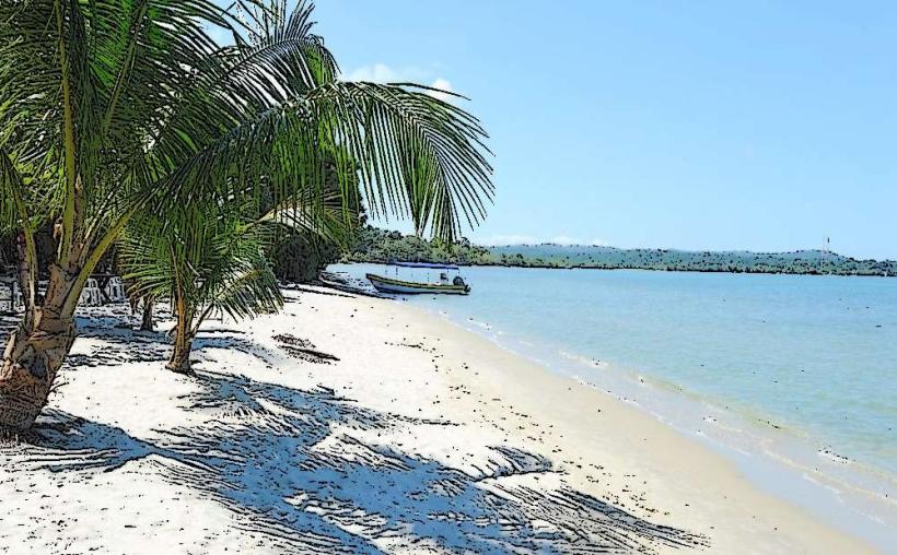
Playa Blanca: A white sand beach located 20 minutes north by boat.
Casa de la Cultura Garifuna: A museum and center dedicated to Afro-Caribbean heritage.
Río Dulce Canyon: The dramatic limestone cliffs bordering the town to the west.
Transportation Network
Movement within the town is conducted entirely on foot or via tuk-tuks. There is no road access to the rest of the country; all arrivals must occur via boat from Puerto Barrios (30 mins) or Río Dulce (1.5 hours). There is no metro or bus system. Uber is non-functional. Traffic density is non-existent as there are no private cars in the town center.
Safety & "Red Zones"
The general safety level is moderate. Visitors should avoid walking on the isolated beaches north of the town center after dark. There are no designated "red zones," but the dock area can be chaotic during ferry arrivals. Common scams include "unlicensed boat captains" promising tours to Belize that lack proper immigration clearances.
Digital & Financial Infrastructure
Average internet speed is 20 Mbps via microwave link and satellite. Main mobile carriers are Tigo and Claro. Card acceptance is low; restricted to high-end hotels and the "Bugamama" restaurant. Cash (Quetzales) is mandatory for almost all transactions. There is only one primary bank (Banrural) with an ATM that frequently fails or runs out of cash; travelers are advised to withdraw funds in Puerto Barrios or Río Dulce before arrival.
Climate & Air Quality
The climate is tropical monsoon. Temperatures range from 23°C to 33°C. Humidity is consistently high, often exceeding 85%. Air quality is exceptional due to the absence of vehicles and the constant Caribbean sea breeze. The primary weather risk involves Atlantic hurricanes and heavy maritime swells that can suspend boat transit.
Culture & Social Norms
Tipping of 10% is appreciated in restaurants. Greetings are social and essential; "Buenas" or "Good morning" (in English) are common. Culture Note: Livingston is the only place in Guatemala where Garifuna is the primary language alongside Spanish and Caribbean English. Dress code is extremely casual. The town is famous for the "Punta" dance and the celebration of Garifuna Settlement Day (November 26).
Accommodation Zones
The Bluff (Town Center): Recommended for cultural immersion and proximity to dining.
Río Dulce Entrance: Recommended for eco-lodges and a quieter, jungle-focused stay.
Local Cost Index
1 Espresso: Q20.00 ($2.60) - rarely available; instant coffee is standard.
1 Standard Lunch (Tapado Seafood Stew): Q110.00 ($14.30)
1 Tuk-Tuk Trip: Q10.00 ($1.30)
Nearby Day Trips
Seven Altars: 5 km (accessible by boat or a long coastal walk).
Puerto Barrios: 22 km by boat (30 mins).
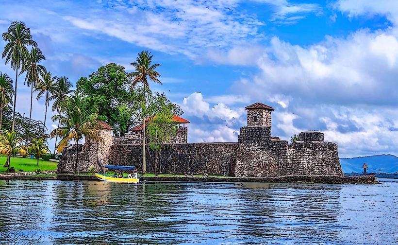
Río Dulce / Castillo de San Felipe: 40 km by boat (1.5 hours).
Punta de Manabique: 30 km by boat (nature reserve).
Facts & Legends
A verified historical oddity: Livingston once served as the official capital of the Izabal Department before the title was moved to Puerto Barrios. A local legend involves the "Duhindu," small forest spirits said to lure children into the jungle near the Río Dulce canyon. Residents also maintain the legend of a sunken Spanish ship at the mouth of the river, which supposedly prevents the water from ever becoming completely fresh, even during the peak of the rainy season.