Information
Landmark: Rio Dulce National ParkCity: Livingston
Country: Guatemala
Continent: North America
Rio Dulce National Park, Livingston, Guatemala, North America
Rio Dulce National Park is a protected area located in the Izabal Department of Guatemala, encompassing a significant portion of the Rio Dulce river system. It is situated between the town of Livingston and the town of Rio Dulce de Guzmán.
Visual Characteristics
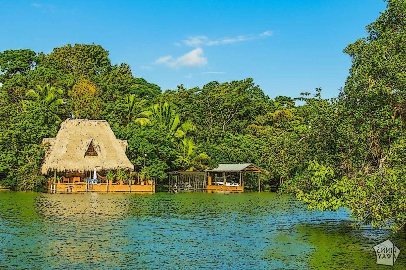
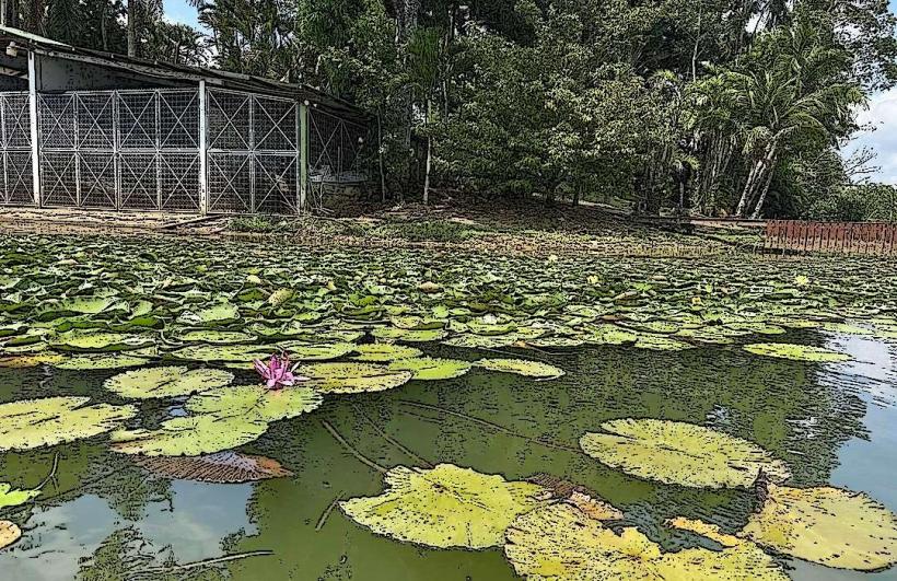
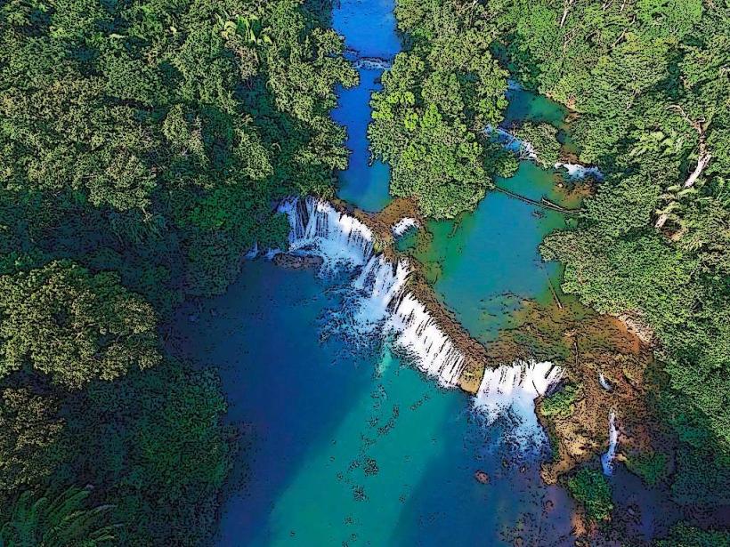
The park features a river canyon with steep, jungle-covered limestone cliffs reaching heights of up to 100 meters. The river itself is approximately 100 meters wide in the canyon section, with water color varying from deep green to brown depending on sediment load. Dense tropical rainforest vegetation, including palms, ceiba trees, and various flowering plants, covers the surrounding terrain. Areas outside the canyon exhibit mangrove swamps and open riverine landscapes.
Location & Access Logistics
The park is accessible primarily by boat from Livingston (approximately 30 minutes by lancha) or from Rio Dulce de Guzmán (approximately 1 hour by lancha). Road access to the park's boundaries is limited. The nearest major road is CA-9, which connects to Rio Dulce de Guzmán. Parking is available at the docks in both Livingston and Rio Dulce de Guzmán. Public transport to these towns involves buses from Guatemala City or other major urban centers.
Historical & Ecological Origin
The Rio Dulce river system is a natural geological formation, carved over millennia by the flow of water from Lake Izabal to the Caribbean Sea. The park was established in 1955 to protect the river canyon's unique ecosystem and biodiversity. Ecologically, it is classified as a tropical rainforest and mangrove ecosystem, supporting a wide array of flora and fauna.
Key Highlights & Activities
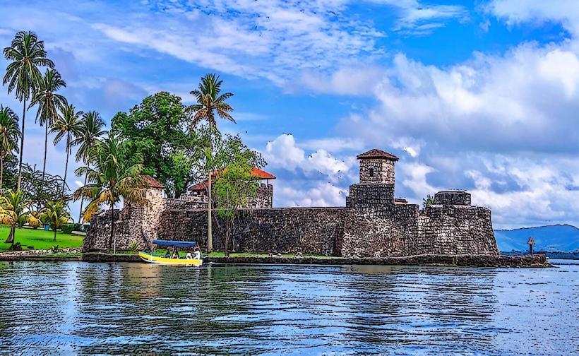
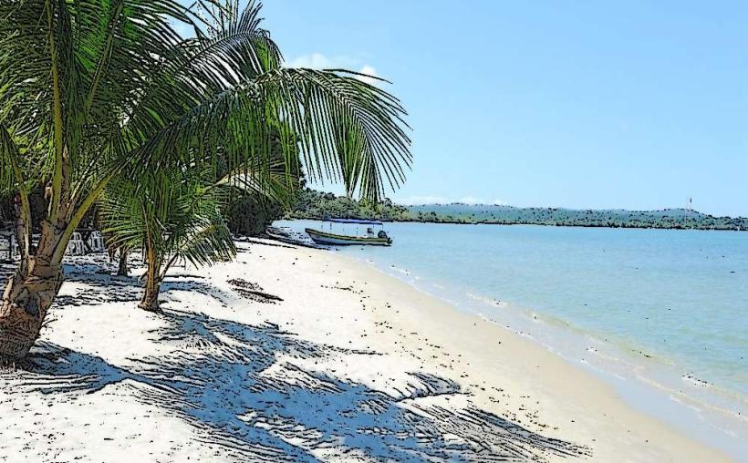
Boat tours through the canyon are the primary activity. Visitors can observe the canyon walls and the river. Stops are made at the Castillo de San Felipe, a 17th-century Spanish fort. Opportunities exist for birdwatching. Kayaking is possible in calmer sections of the river. Swimming is permitted in designated areas.
Infrastructure & Amenities
Restrooms are available at the Castillo de San Felipe and at some riverside restaurants. Shade is provided by the dense tree canopy in the canyon and by structures at designated stops. Cell phone signal (2G/3G) is intermittent within the canyon but generally available in Livingston and Rio Dulce de Guzmán. Food vendors and small restaurants are present at the Castillo de San Felipe and in nearby communities.
Best Time to Visit
The best time of day for photography is mid-morning to early afternoon when sunlight penetrates the canyon. The dry season, from November to April, offers the most pleasant weather with less rainfall. High tide is not a critical factor for river navigation.
Facts & Legends
The Castillo de San Felipe was built to defend against pirate attacks in the Caribbean. Local folklore speaks of river spirits that protect the canyon.
Nearby Landmarks
- Castillo de San Felipe (0.5km West)
- Livingston town center (15km West)
- Finca El Paraiso hot springs (25km South-West)
- Quetzal Biotope Mario Dary (approx. 60km South-West)