Information
City: MissoulaCountry: USA Montana
Continent: North America
Missoula, USA Montana, North America
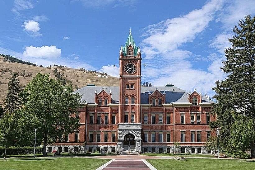
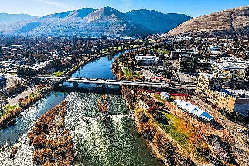
Missoula is the second-largest city in Montana and the seat of Missoula County. Known as the "Garden City" for its dense vegetation and milder climate compared to the rest of the state, it is located at the confluence of five mountain ranges and three rivers (the Clark Fork, the Bitterroot, and the Blackfoot). It is defined by the presence of the University of Montana and its status as a premier center for literature, outdoor recreation, and liberal arts.
Historical Timeline
The area was originally a significant site for the Salish people. It was founded in 1860 as Hellgate Village before being moved and renamed Missoula in 1866. The city grew rapidly as a lumber and regional trading center with the arrival of the Northern Pacific Railway in 1883. In the 20th century, the city transitioned from a timber-dependent economy to a hub for education, healthcare, and research, particularly in forestry and fire sciences.
Demographics & Population
The 2026 estimated population is 78,210 within city limits, with a metropolitan population of approximately 122,000. The demographic is White (88.4%), Hispanic or Latino (4.1%), Two or More Races (3.6%), and American Indian (2.3%). The median age is 33.2 years, significantly influenced by the university student population.
Urban Layout & Key Districts
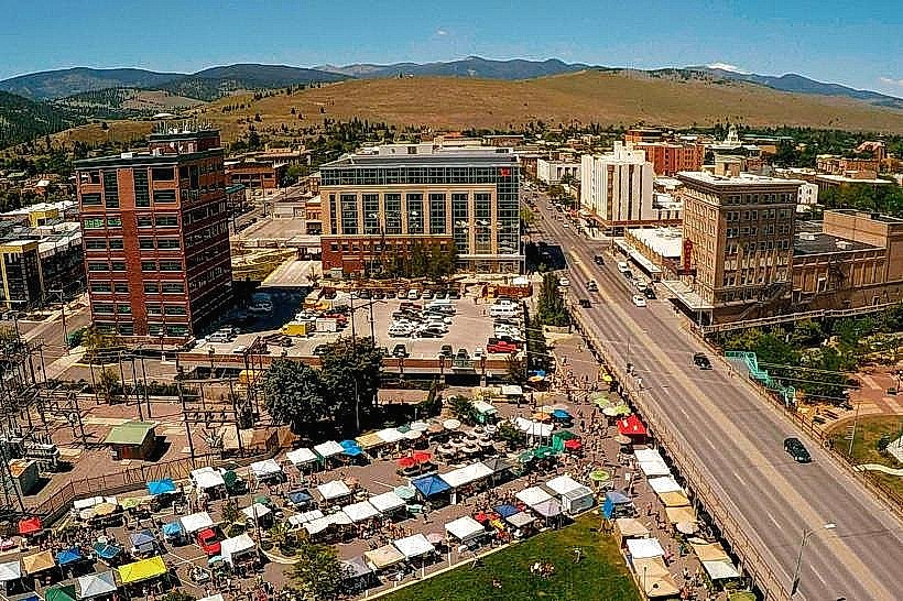
Downtown: Located on the north bank of the Clark Fork River; it is a walkable historic district with a high density of independent bookstores, galleries, and restaurants.
University District: Located south of the river at the base of Mount Sentinel; characterized by historic homes and the University of Montana campus.
The Hip Strip: A trendy section of Higgins Avenue south of the river known for eclectic retail and alternative culture.
Reserve Street: The city's primary commercial bypass on the west side, containing big-box retail and high-volume traffic.
Old Sawmill District: A newly redeveloped mixed-use urban neighborhood on the site of a former lumber mill.
Top City Landmarks
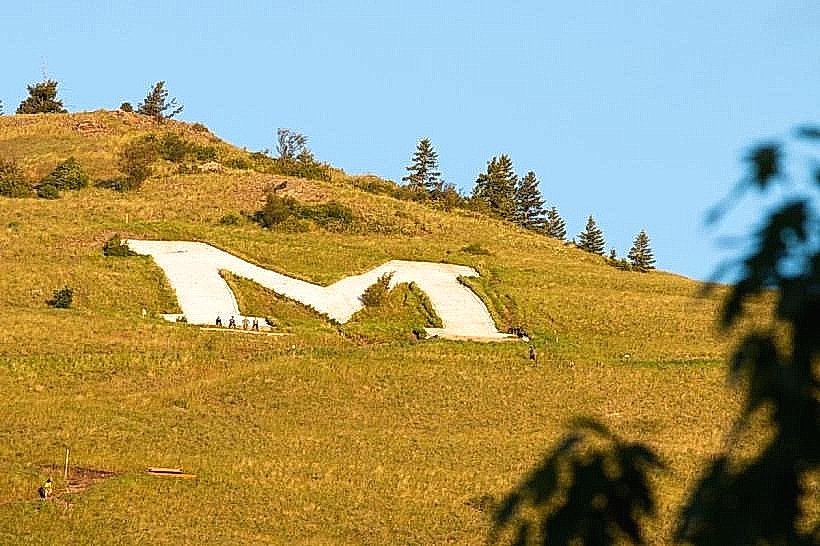
The "M" on Mount Sentinel: A massive concrete letter "M" overlooking the university; the zigzag trail to the top is the city's most popular hike.
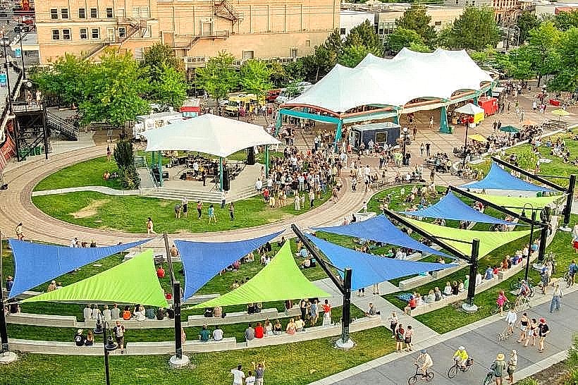
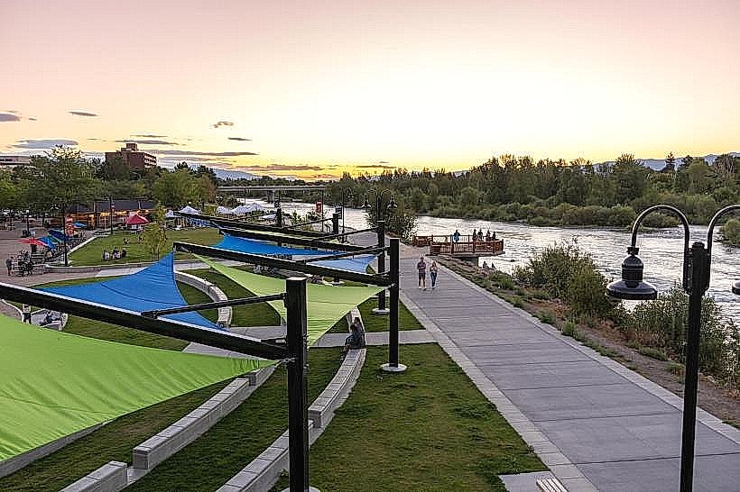
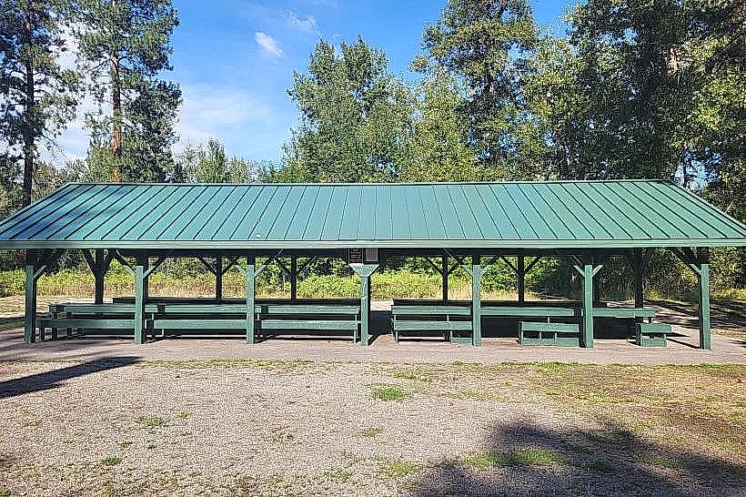
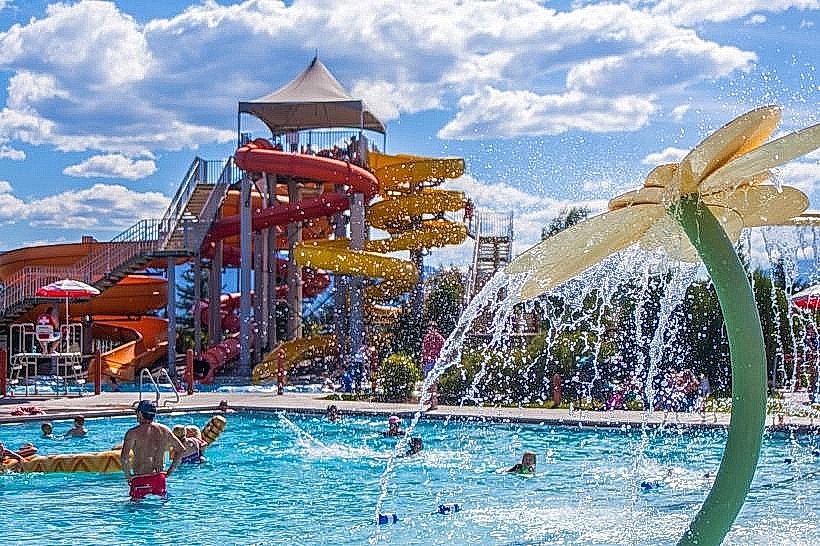
Caras Park: A downtown riverfront park featuring a large pavilion, the "Dragon Hollow" playground, and "Brennan’s Wave" (a man-made whitewater feature for kayakers).
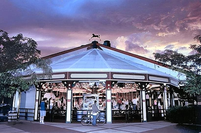
A Carousel for Missoula: A world-class, hand-carved wooden carousel built entirely by local volunteers.
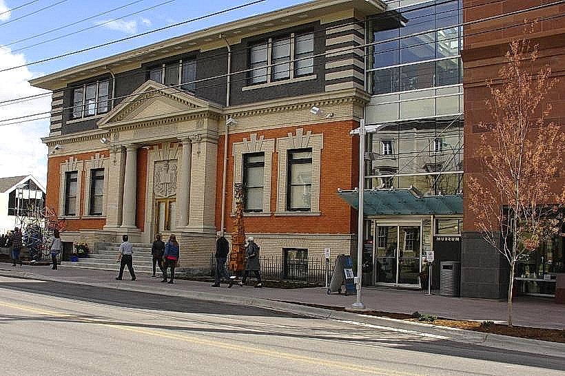
Missoula Public Library: Recently ranked as one of the best libraries in the world, featuring high-tech maker spaces and a children's museum.
Fort Missoula Regional Park: A massive complex housing the Historical Museum at Fort Missoula and extensive athletic facilities.
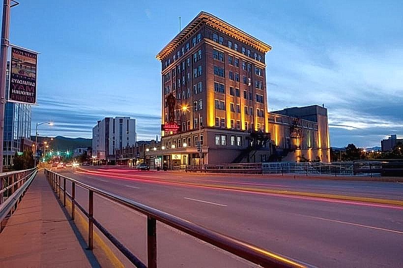
Wilma Theatre: A restored 1921 historic theater that serves as the primary venue for live music and film.
Transportation Network
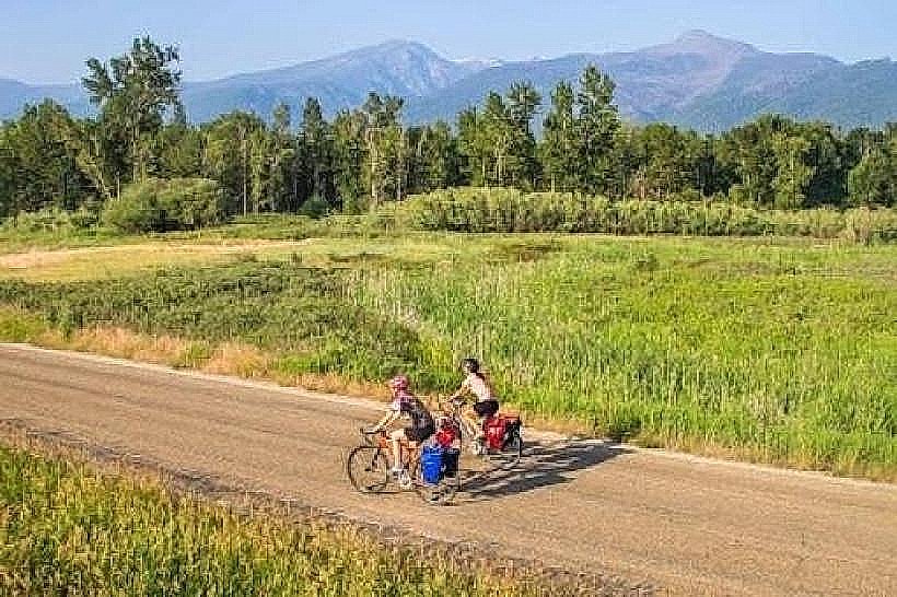
Missoula is served by I-90 and US-93. The city is notable for Mountain Line, a high-frequency, fare-free bus system. Missoula Montana Airport (MSO) provides commercial flights to major U.S. hubs. The city is consistently ranked as one of the most bicycle-friendly cities in the United States, with an extensive network of riverfront trails and dedicated bike lanes.
Safety & Environmental Hazards
The safety level is high. Violent crime is rare.
Property Crime: Rates of bicycle theft are disproportionately high due to the city's high bike volume.
River Safety: The Clark Fork and Blackfoot rivers have dangerous currents and underwater debris; standard caution is required for "tubing" and swimming.
Temperature Inversions: During winter, the surrounding mountains trap cold air and woodsmoke in the valley, leading to periods of poor air quality.
Wildfire Smoke: Late summer can see significant smoke accumulation from regional forest fires.
Digital & Financial Infrastructure
Missoula is a regional tech and research hub. Average internet speeds reach 1 Gbps via Lumen (fiber) and Spectrum. Card acceptance is universal. Major institutions include Clearwater Credit Union and First Security Bank.
Climate & Air Quality
The climate is a transitional semi-arid/humid continental.
Summers: Warm and dry ($12^\circ\text{C}$ to $29^\circ\text{C}$).
Winters: Cold and snowy ($ -9^\circ\text{C}$ to $1^\circ\text{C}$), though significantly more humid than eastern Montana.
Air Quality: Highly variable; "Excellent" for most of the year, but "Unhealthy" during winter inversions or wildfire season.
Culture & Social Norms
The culture is "Mountain Liberal"-a blend of academic intellectualism, environmental activism, and traditional Western outdoor heritage. Tipping of 18–22% is standard. The city has a high concentration of writers and artists per capita. Dress code is "Outdoor Casual" (flannel, fleece, and hiking boots). Alcohol is sold in grocery stores; spirits are sold in state-licensed agency stores.
Accommodation Zones
Downtown: Stay here for boutique hotels and immediate access to dining and the river.
Brooks Street/Southside: Stay here for mid-range national chains.
Reserve Street: Stay here for transportation convenience and big-box proximity.
Local Cost Index
Espresso: $4.75
Standard Lunch: $17.50
Median Home Value: $545,000
Nearby Day Trips
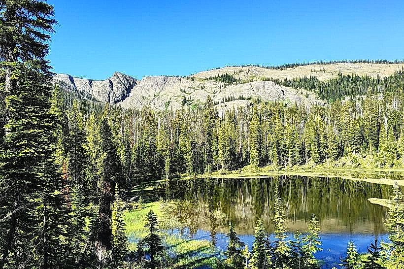
Glacier National Park: 220 km (2.5 hours).
National Bison Range: 75 km (1 hour).
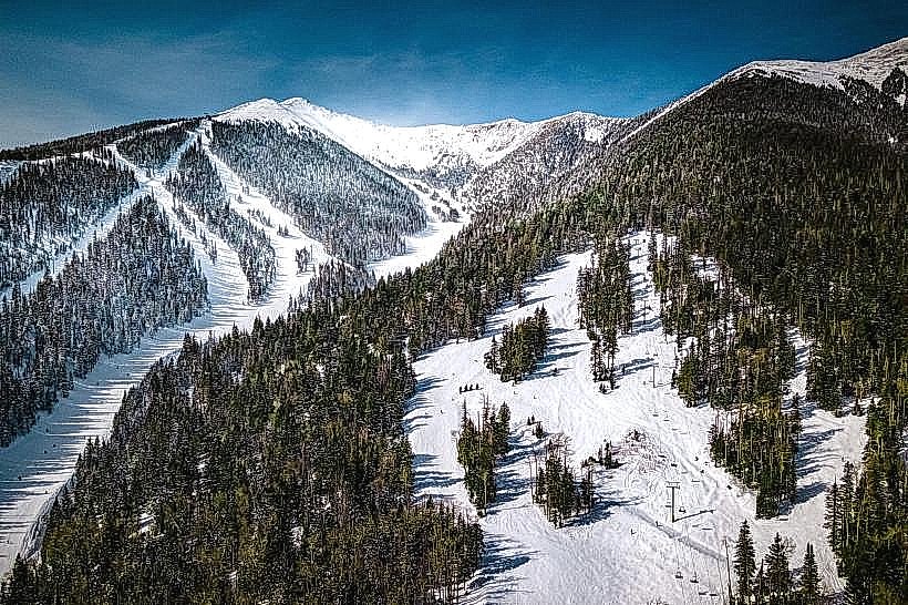
Snowbowl Ski Area: 20 km (25 mins).
Bitterroot Valley: 50 km (45 mins) – Scenic corridor featuring the towns of Stevensville and Hamilton.
Facts & Legends
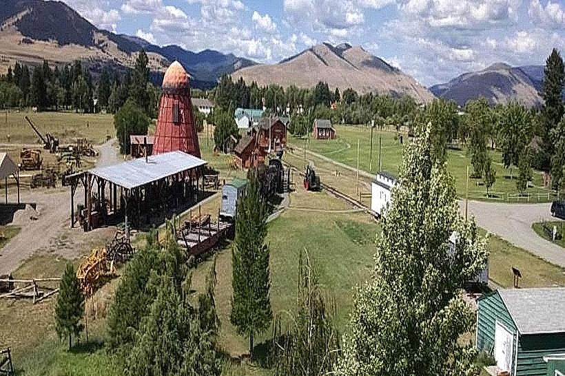
Missoula is the birthplace of the Smokejumpers (forest fire paratroopers); the Aerial Fire Depot and Smokejumper Center is the largest in the U.S. A local legend involves the "Ghost of the Wilma," where an usher is reportedly seen in the upper balcony. Historically, the city is unique for having the first woman elected to the U.S. Congress, Jeannette Rankin, who was a Missoula native.