Information
City: Ometepe IslandCountry: Nicaragua
Continent: North America
Ometepe Island, Nicaragua, North America
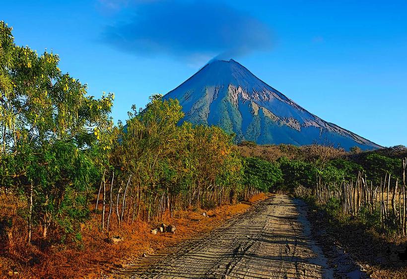
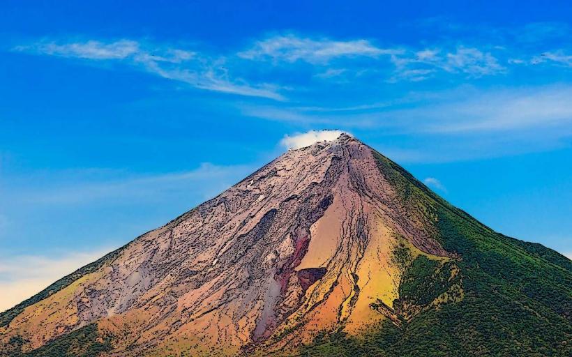
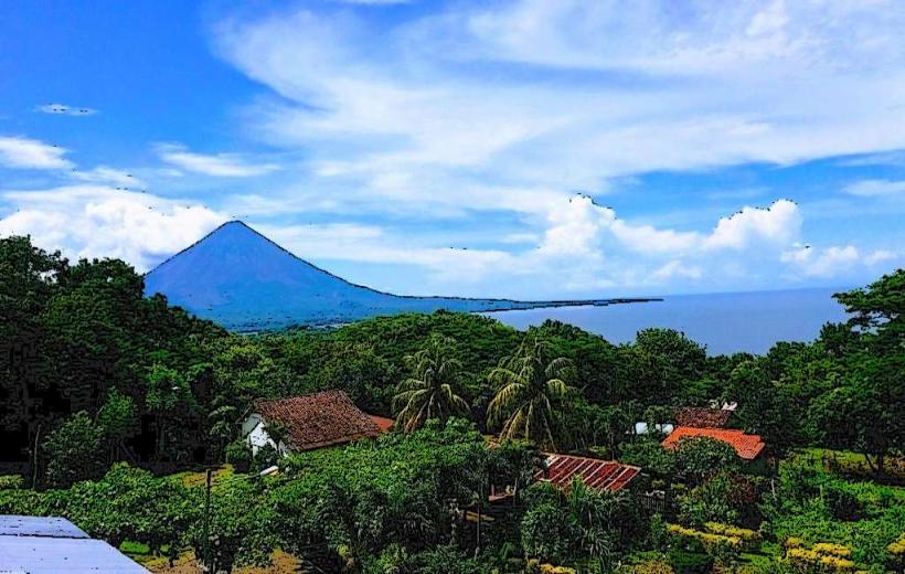
Ometepe Island is a primary ecological and cultural destination in Nicaragua, formed by two volcanoes rising from Lake Nicaragua (Cocibolca). It is located in the department of Rivas and is the largest volcanic island inside a freshwater lake in the world.
Historical Timeline
Ometepe has been inhabited since at least 2000 BCE by indigenous groups including the Nahuatl and Chorotega. Governance has remained under the Nicaraguan central administration since independence from Spain in 1821. The most significant architectural reconstruction occurs periodically following volcanic activity or seismic events. The primary event shaping the current urban form was the 2010 designation of the island as a UNESCO Biosphere Reserve, which regulates development to protect its unique biodiversity and pre-Columbian archaeological sites.
Demographics & Population
The total population is approximately 35,000 residents. The demographics are primarily Mestizo, with deep indigenous roots reflected in local land-use patterns and traditions. The median age is approximately 24.5 years.
Urban Layout & Key Districts
The island is shaped like an hourglass, formed by two volcanic cones connected by a narrow isthmus. The 2 most important districts are Moyogalpa (the primary port and commercial hub, located on the Western shore) and Altagracia (the administrative and cultural center, located on the North-Eastern side).
Top City Landmarks
Concepción Volcano (Active)
Maderas Volcano (Dormant/Cloud Forest)
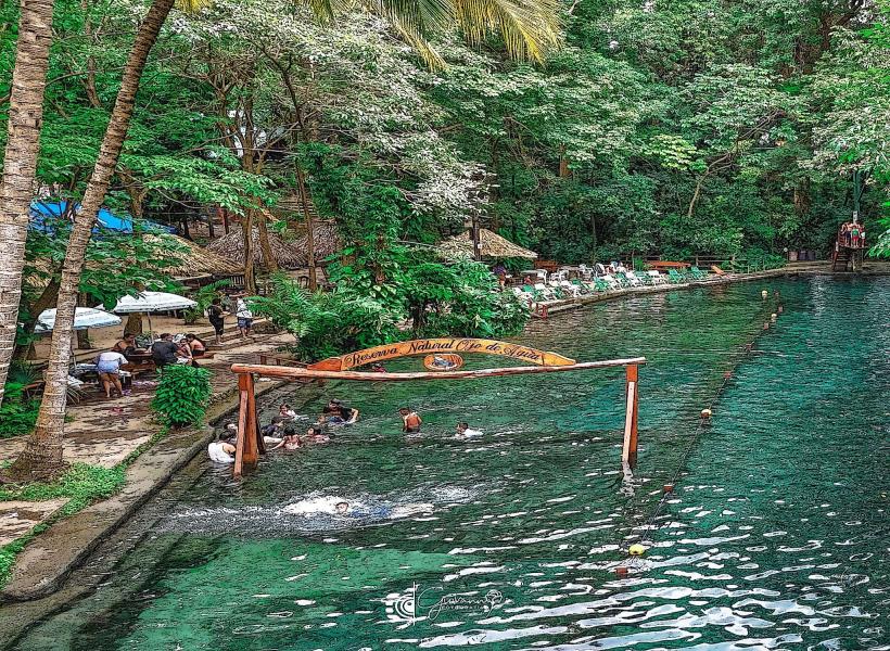
Ojo de Agua (Natural mineral spring)
Charco Verde (Nature reserve and lagoon)
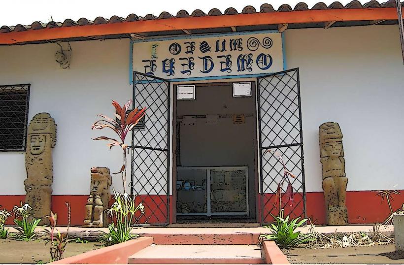
El Ceibo Museum (Archaeological and Numismatic)
Transportation Network
Movement within the island is facilitated by a circular paved road, though many secondary roads remain unpaved. Public transportation consists of chicken buses (converted school buses) that run between Moyogalpa, Altagracia, and Balgüe. There is no metro or rail system. Access to the island is via ferry or lancha from the port of San Jorge in Rivas. Ride-sharing apps do not operate; transport relies on official taxis, motorcycles, and bicycle rentals. Traffic density is very low, consisting mainly of livestock, motorcycles, and bicycles.
Safety & "Red Zones"
The general safety level is very high. There are no designated "red zones." Risks are primarily environmental, such as volcanic activity, flash floods on the slopes of Concepción, or dehydration during hikes. Common scams are rare, but visitors should use authorized guides for volcano trekking to avoid becoming lost in the dense terrain.
Digital & Financial Infrastructure
Internet speeds average 5–15 Mbps, with signal strength varying significantly by topography. Main mobile carriers are Tigo and Claro. Card acceptance is low and limited to larger hotels and restaurants in Moyogalpa; cash (NIO - Córdoba or USD) is mandatory for most transactions. ATMs are located primarily in Moyogalpa and Altagracia; they frequently run out of cash during weekends or holidays.
Climate & Air Quality
Temperatures range from 24°C to 32°C. Air quality is exceptionally high due to the lack of industry and the presence of vast forested areas. Specific weather risks include high winds during the dry season (December–April) and heavy rains that can make unpaved roads impassable during the wet season (May–November).
Culture & Social Norms
Tipping is not mandatory but 10% is appreciated in tourist-facing establishments. Social greetings are a cultural staple; a polite "Buenos días" is expected. Dress code is casual but modest; swimwear should be restricted to springs and beaches. The island is famous for its pre-Columbian petroglyphs and stone statues, which are considered sacred local heritage.
Accommodation Zones
Moyogalpa: Stay here for logistical ease, ferry access, and the highest concentration of services and rentals.
Balgüe / Santa Cruz: Stay here for eco-lodges, organic farms, and access to the Maderas volcano hikes.
Local Cost Index
1 Espresso: 70.00 NIO ($1.90 USD)
1 Standard Lunch (Comida Corriente): 180.00 NIO ($4.90 USD)
1 Ferry Ticket (One way): 50.00 NIO ($1.35 USD)
Nearby Day Trips
San Juan del Sur: 35 km from San Jorge port (45 minutes by car)
Granada: 70 km from San Jorge port (1.5 hours by car)
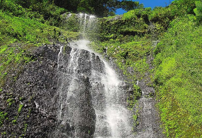
San Ramón Waterfall: Located on the southern slope of Maderas Volcano
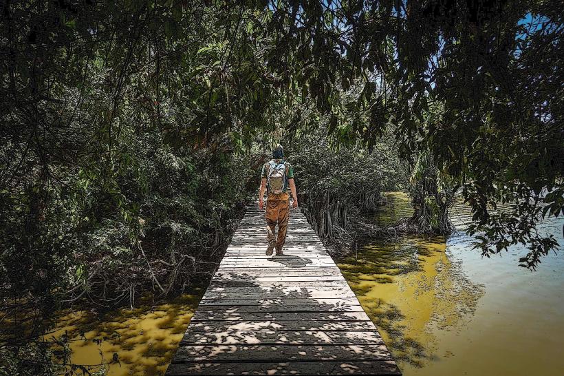
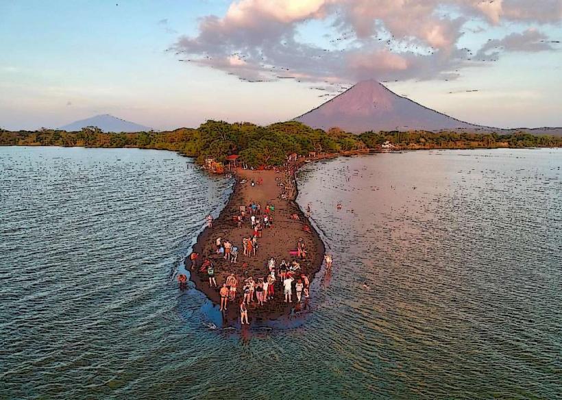
Istian Isthmus: Located between the two volcanoes (accessible by kayak)
Facts & Legends
Ometepe's name is derived from the Nahuatl words "Ome" (two) and "Tepetl" (mountain). A local legend concerns the "Chico Largo" of Charco Verde, a pact-making spirit said to live at the bottom of the lagoon who can transform people into cattle or trees. A verified historical oddity is that the island was a frequent target for Caribbean pirates in the 17th century, who navigated up the San Juan River and across Lake Nicaragua to raid the island's settlements.