Information
City: ThingvellirCountry: Iceland
Continent: Europe
Thingvellir, Iceland, Europe
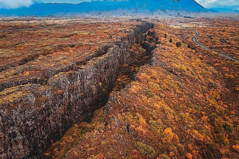
Þingvellir (Thingvellir) National Park serves as the most significant historical and geological site in Iceland. It functions as a UNESCO World Heritage site and a cornerstone of the Golden Circle, characterized by its position within a rift valley where the North American and Eurasian tectonic plates are pulling apart.
Historical Timeline
The site is the birthplace of Icelandic democracy. In 930 AD, the Alþingi (National Assembly) was established here, making it one of the oldest parliaments in the world. The assembly met annually on these plains for over 800 years. The primary event shaping its modern identity was its designation as a National Park in 1928 and its inclusion on the UNESCO World Heritage list in 2004, recognizing its cultural and geological universality.
Demographics & Population
The park has no permanent residential population. It is administered by the Þingvellir Commission. Most staff and park rangers commute from nearby towns such as Selfoss or Reykjavík.
Urban Layout & Key Districts
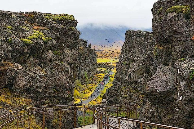
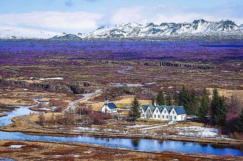
The park is divided into several zones of interest. The Almannagjá Fault is the primary geological artery; the Lögberg (Law Speaker’s Rock) is the historical assembly point; and Þingvallavatn is the adjacent lake, the largest natural lake in Iceland.
Top Landmarks
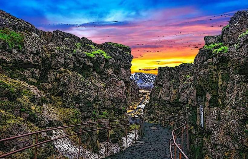
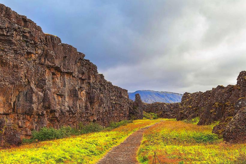
Almannagjá: A massive fissure through which visitors can walk between tectonic plates.
Silfra Fissure: A crystal-clear underwater rift popular for snorkeling and diving.
Öxarárfoss: A picturesque waterfall that flows into the Almannagjá fault.
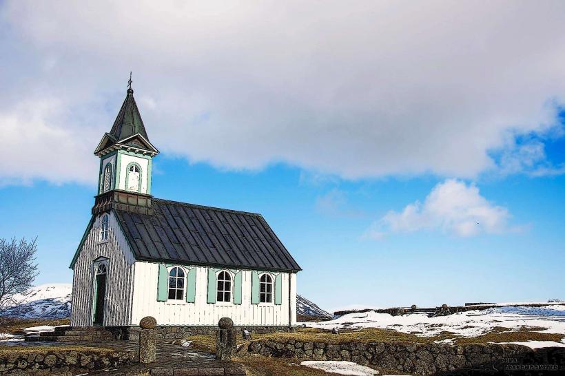
Þingvallakirkja: A historic church and one of the oldest church sites in Iceland.
Lögberg: The specific site where the Lawspeaker recited the laws to the assembly.
Transportation Network
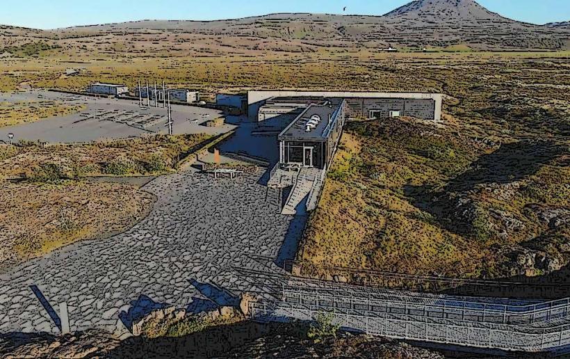
Movement is facilitated by a network of well-maintained pedestrian paths and boardwalks. There is no rail or internal shuttle transit. Visitors arrive via private vehicle or tour bus via Route 36 from Reykjavík (approx. 45 minutes). Parking is centralized at several designated lots (P1 near the visitor center is the largest); parking fees are monitored via license plate recognition and must be paid at kiosks or via the Checkit app.
Safety & "Red Zones"
The safety level is high, provided visitors stay on marked paths.
Fissures: Do not attempt to cross or climb into fissures outside of designated areas.
Weather: The plains are highly exposed; wind speeds can reach dangerous levels.
Silfra: Diving and snorkeling require certified guides and strict adherence to dry-suit protocols due to 2°C water temperatures.
Digital & Financial Infrastructure
Average internet speed is 50–100 Mbps near the visitor centers. The park is 100% cashless. Payments for parking, toilets (P1), and the visitor center exhibition must be made via credit/debit card or mobile payment.
Climate & Air Quality
Temperatures range from -10°C in winter to 15°C in summer. The valley often experiences different weather than Reykjavík, with snow persisting longer into the spring. Air quality is exceptional.
Culture & Social Norms
Tipping is not required. The site is a national shrine; respectful behavior is expected. Removal of rocks, flora, or the stacking of "cairns" (stone piles) is strictly prohibited as it damages the fragile ecosystem and historical landscape.
Accommodation Zones
There are no hotels within the park boundaries.
Camping: Designated campsites are available at Leirar and Vatnskot (seasonal).
Nearby: Hotels and boutique lodges are located in the surrounding Golden Circle area and the town of Laugarvatn (25 minutes away).
Local Cost Index
1 Parking Fee (Standard Car): 1,000 ISK (valid for 24 hours)
1 Interactive Exhibition Entry: 1,200 ISK
1 Snorkeling Tour at Silfra: 18,000 – 25,000 ISK
Nearby Day Trips
Geysir Geothermal Area: 60 km (50 minutes)
Gullfoss Waterfall: 70 km (1 hour)
Kerið Crater: 40 km (35 minutes)
Reykjavík: 45 km (45 minutes)
Facts & Legends
The Öxará river was artificially diverted into the Almannagjá fault in the 10th century to provide water for the Alþingi assembly. Local legend claims the lake is inhabited by a monster, while a verified historical fact is that the tectonic plates at Þingvellir are moving apart at a rate of approximately 2 centimeters per year.