Information
Landmark: Lake ThingvallavatnCity: Thingvellir
Country: Iceland
Continent: Europe
Lake Thingvallavatn, Thingvellir, Iceland, Europe
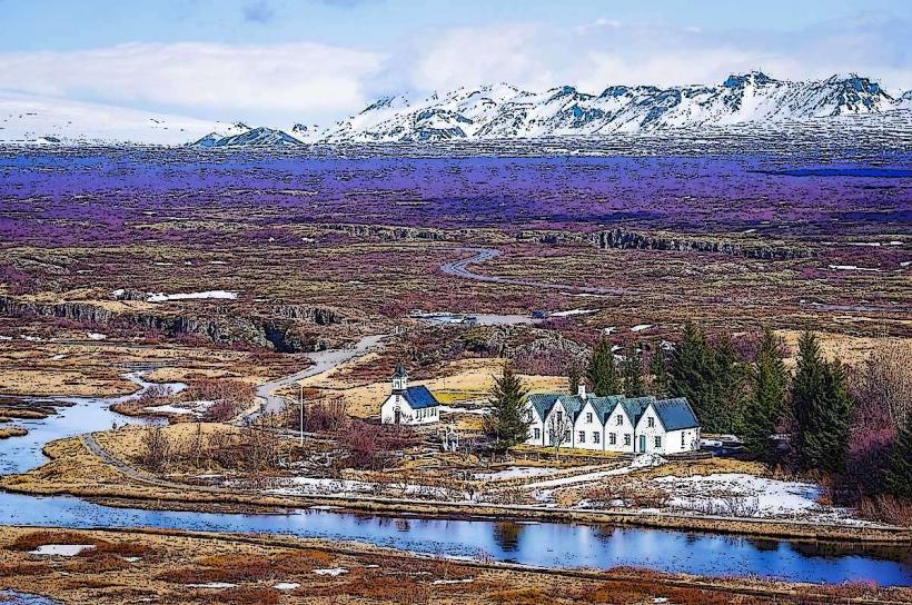
Lake Thingvallavatn is a large rift valley lake situated in southwestern Iceland. It is the largest natural lake in Iceland, located within the Thingvellir National Park.
Visual Characteristics
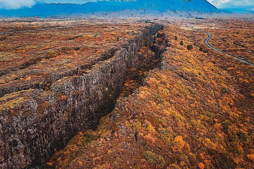
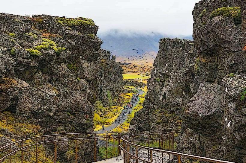
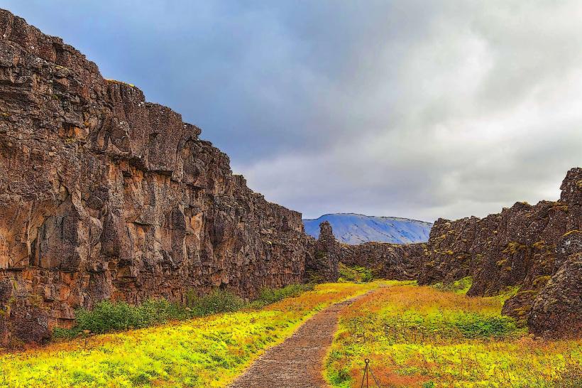
The lake spans approximately 84 square kilometers with a maximum depth of 114 meters. Its waters are exceptionally clear, exhibiting shades of deep blue and green, particularly in areas like the Silfra Fissure. The lake is surrounded by ancient lava fields, characterized by moss-covered basalt formations and sparse vegetation, primarily dwarf birch and willow. The eastern shore features steep, rocky cliffs formed by tectonic plate separation, while the western side slopes more gently.
Location & Access Logistics
Lake Thingvallavatn is located approximately 45 kilometers northeast of Reykjavik. Access is primarily via Route 36, which runs directly through Thingvellir National Park. Multiple designated parking areas are available within the park, including P1 near the visitor center and P5 for Silfra access, requiring a parking fee. Public transport options are limited; scheduled bus services from Reykjavik typically drop off at the main visitor center, requiring further walking or taxi services to specific lake access points.
Historical & Ecological Origin
Lake Thingvallavatn is a geological rift valley lake, formed by the divergence of the North American and Eurasian tectonic plates. Its basin is a result of subsidence and volcanic activity over millions of years, with the last major eruptions occurring approximately 2,000 years ago. The lake's unique ecosystem supports four distinct morphs of Arctic char (Salvelinus alpinus), which have evolved in isolation within its waters, alongside brown trout and stickleback.
Key Highlights & Activities
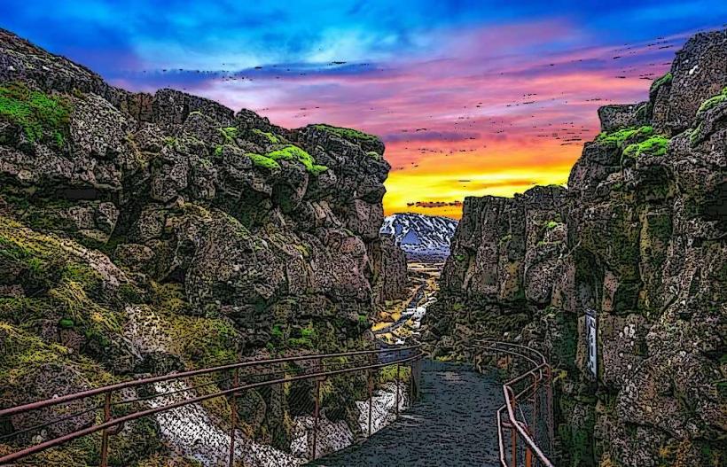
Snorkeling and diving are possible in the Silfra fissure, located at the northern end of the lake, offering visibility exceeding 100 meters between the continental plates. Fishing for Arctic char and brown trout is permitted with a valid permit, particularly from June to September. Hiking trails traverse the lake's perimeter and surrounding national park, including paths along the Almannagjá Gorge. Boat tours are not regularly scheduled on the lake itself, but kayaking is possible in designated areas.
Infrastructure & Amenities
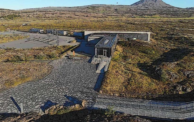
Restrooms are available at the Thingvellir National Park Visitor Center and near the Silfra diving site. Shade is minimal around the lake, primarily provided by small rock formations or sparse vegetation. Cell phone signal (4G/5G) is generally reliable across the main visitor areas and along Route 36. Food vendors and a small cafe are located at the Thingvellir National Park Visitor Center, approximately 2 kilometers from the lake's northern shore.
Best Time to Visit
The best time to visit Lake Thingvallavatn for general exploration and hiking is during the summer months, from June to August, when temperatures are mildest (10-15°C) and daylight hours are extended. For snorkeling and diving in Silfra, conditions are suitable year-round, though water temperatures remain consistently low (2-4°C). Photography is optimal during early morning or late afternoon for softer light, particularly highlighting the geological features and water clarity.
Facts & Legends
The Silfra fissure within Lake Thingvallavatn is the only place in the world where one can dive or snorkel directly between two continental plates, the North American and Eurasian, which drift apart by approximately 2 centimeters per year. This geological phenomenon results in exceptionally pure glacial meltwater filtering through porous lava rock for decades before reaching the fissure, contributing to its unparalleled clarity.
Nearby Landmarks
- Thingvellir National Park Visitor Center: 2km North
- Almannagjá Gorge: 1.5km North
- Öxarárfoss Waterfall: 2.5km North
- Silfra Fissure: 0.5km North
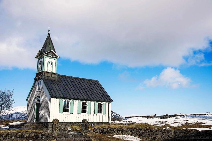
- Thingvellir Church: 2km North