Information
Landmark: Þingvellir Continental Rift ZoneCity: Thingvellir
Country: Iceland
Continent: Europe
Þingvellir Continental Rift Zone, Thingvellir, Iceland, Europe
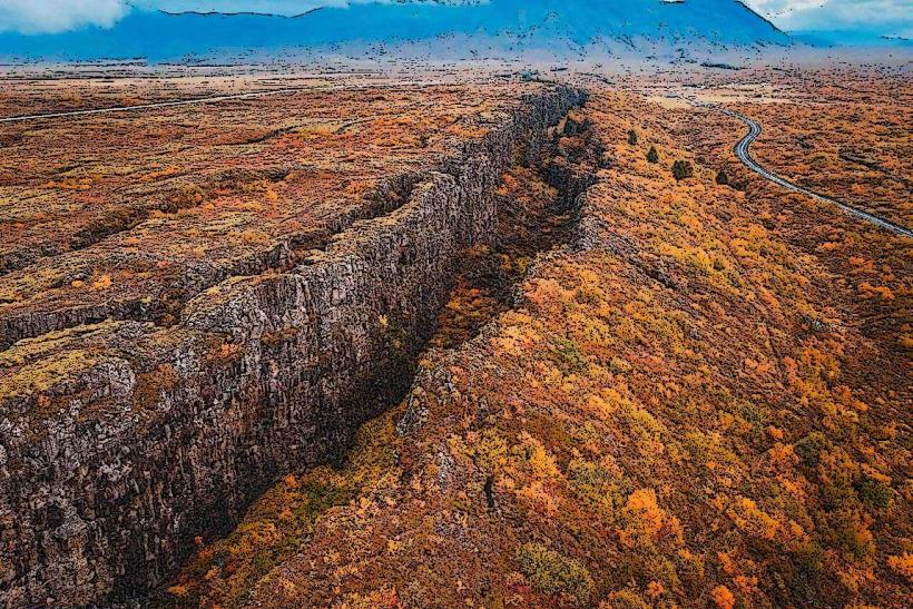
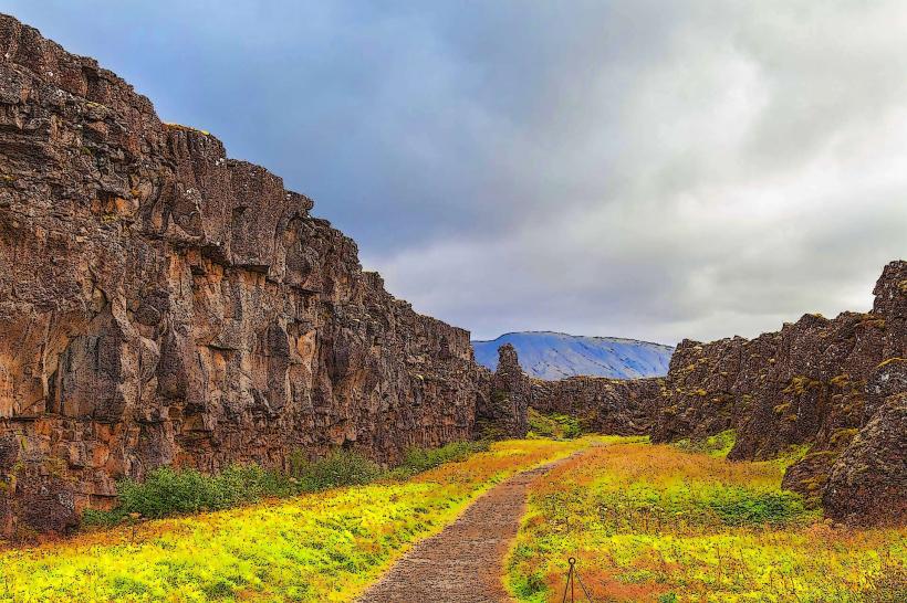
The Þingvellir Continental Rift Zone is a geological site where the North American and Eurasian tectonic plates diverge, and a historical location of Iceland's ancient parliament, the Althing. It is situated within Þingvellir National Park in Thingvellir, Iceland.
Visual Characteristics
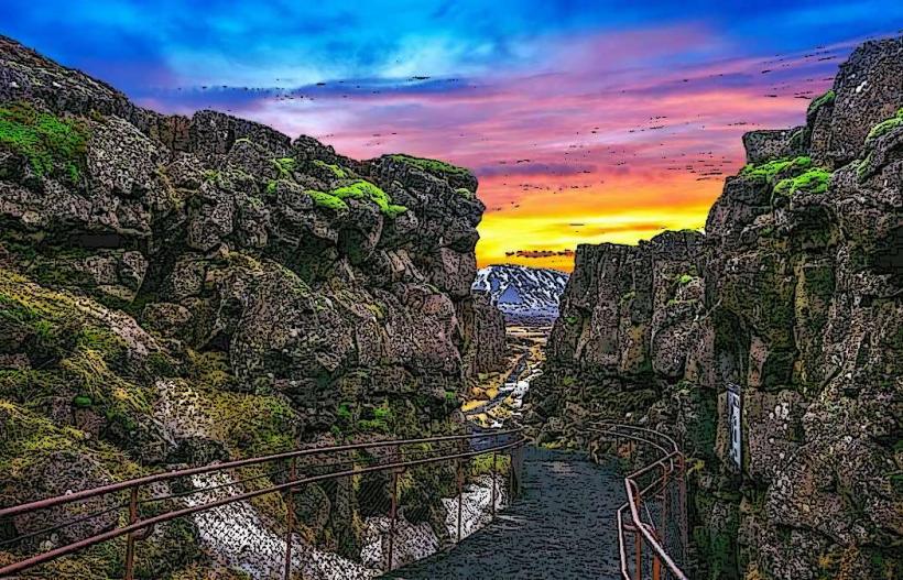
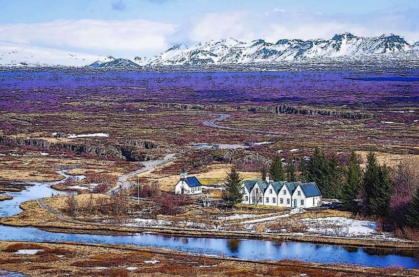
The zone is characterized by a wide rift valley with prominent fissures and gorges, primarily the Almannagjá Gorge, formed by the separation of tectonic plates. Dark volcanic rock and solidified lava fields dominate the landscape. The Öxará river flows through the valley, culminating in the Öxarárfoss waterfall. The Silfra Fissure contains exceptionally clear glacial meltwater, offering visibility exceeding 100 meters. Vegetation is sparse, consisting mainly of mosses, grasses, and dwarf birch.
Location & Access Logistics
The Þingvellir Continental Rift Zone is located approximately 45 kilometers northeast of Reykjavík. Access is primarily via Route 36. Multiple designated parking areas (P1, P2, P5) are available within Þingvellir National Park, with fees typically charged per vehicle. Public transportation directly to the park from Reykjavík is not regularly scheduled; however, numerous tour operators provide bus services from the capital.
Historical & Ecological Origin
Geologically, the rift zone is a visible part of the Mid-Atlantic Ridge, a divergent plate boundary where the North American and Eurasian tectonic plates are pulling apart at an average rate of 2 centimeters per year. This process creates the characteristic graben (rift valley) and associated fissures. Historically, Þingvellir was the site of the Althing, Iceland's national parliament, established in 930 AD and held annually until 1798 AD, making it one of the world's oldest parliamentary institutions.
Key Highlights & Activities
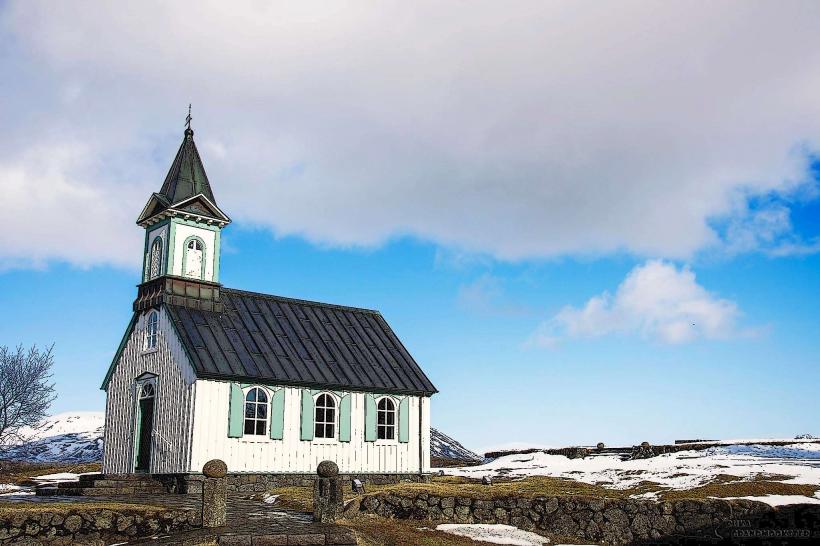
Walking through the Almannagjá gorge allows visitors to traverse between the continental plates. Snorkeling or diving in the Silfra fissure offers a unique experience in crystal-clear water between continents, requiring booking with a certified tour operator. Visiting the Lögberg (Law Rock) provides insight into the historical parliamentary site. Exploring the small Þingvallakirkja church and the adjacent farm is also possible.
Infrastructure & Amenities
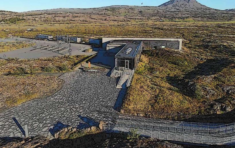
A main visitor center is located near the P1 parking area, offering restrooms, a small cafe, and interpretive exhibits. Additional restrooms are available at other key points within the park. Cell phone signal (4G/5G) is generally reliable throughout the main visitor areas. Food options are limited to the visitor center cafe. Shade is minimal, primarily provided by the rift walls or sparse vegetation.
Best Time to Visit
The summer months, from June to August, offer the mildest weather and longest daylight hours, making them ideal for exploration. For photography, early morning or late afternoon light provides softer illumination on the rift walls and reduces crowds. Snorkeling and diving in Silfra are possible year-round, as the water temperature remains consistently low (2-4°C).
Facts & Legends
The Drekkingarhylur (Drowning Pool) in the Öxará river was historically used for executions of women accused of infanticide or other crimes. The water in the Silfra fissure is glacial meltwater from the Langjökull glacier, filtered through porous lava rock for 30-100 years before emerging, contributing to its extraordinary clarity and purity.
Nearby Landmarks
- Þingvellir Visitor Centre: 0.5km East
- Þingvallakirkja (church): 0.8km South
- Silfra Fissure: 0.7km West
- Öxarárfoss waterfall: 1.5km North
- Drekkingarhylur (Drowning Pool): 0.6km South