Information
Landmark: Tingvellir National ParkCity: Thingvellir
Country: Iceland
Continent: Europe
Tingvellir National Park, Thingvellir, Iceland, Europe
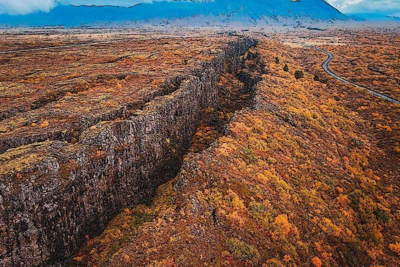
Tingvellir National Park is a UNESCO World Heritage site located in southwestern Iceland, approximately 40-50 km northeast of Reykjavík. It is recognized for its geological features, including the visible rift valley of the Mid-Atlantic Ridge, and its historical significance as the site of Iceland's ancient parliament.
Visual Characteristics
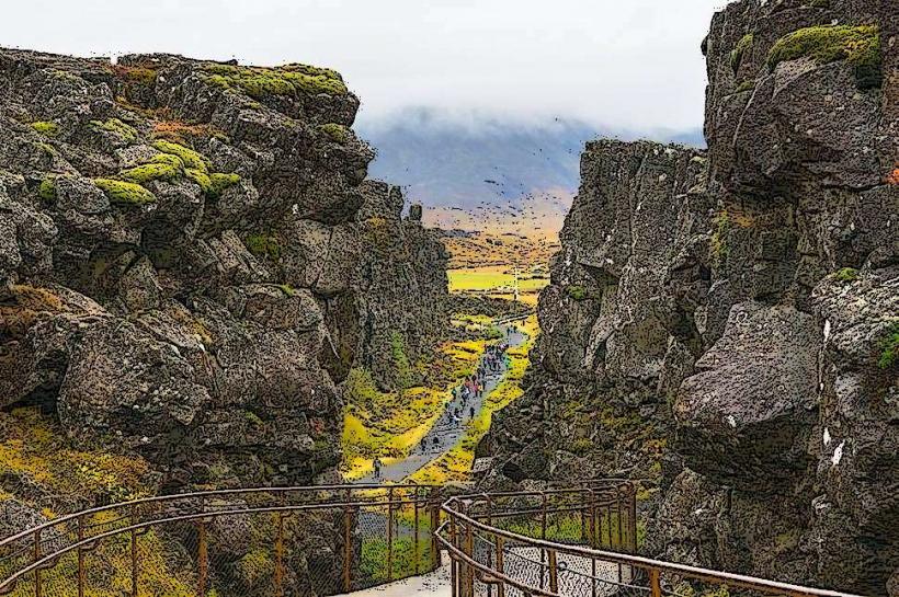
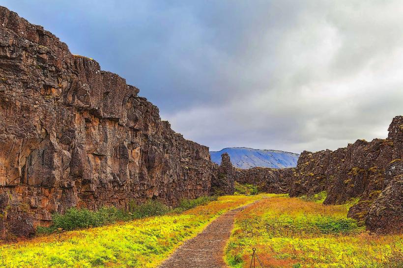
The park is characterized by a prominent rift valley, where the North American and Eurasian tectonic plates diverge. Key features include deep fissures such as Silfra and the Almannagjá gorge, formed by tectonic activity. The landscape comprises extensive lava fields, low-growing vegetation primarily consisting of birch scrub, mosses, and grasses, and the large, clear waters of Þingvallavatn lake. Water in fissures like Silfra exhibits exceptional clarity, often exceeding 100 meters visibility, due to glacial meltwater filtration. Dominant colors are the dark hues of volcanic rock, the greens of moss and grass, and the blue-to-turquoise tones of the water bodies.
Location & Access Logistics
Tingvellir National Park is situated in the municipality of Thingvellir, Iceland. Access is primarily via Route 36 (Þingvallavegur) from Reykjavík. The drive typically takes 45-60 minutes. Multiple designated parking lots (e.g., P1, P2, P5) are available within the park, with fees charged per vehicle. Public transportation options are limited; most visitors arrive by private vehicle or as part of organized tour buses departing from Reykjavík. There are no direct public bus lines for regular commuting to the park.
Historical & Ecological Origin
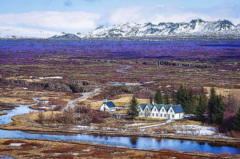
Historically, Tingvellir is the site of the Alþingi, Iceland's national parliament, which was established in 930 AD and convened annually at this location until 1798. It was declared a national park in 1930 to protect the remains of the ancient parliament site and the natural environment. Ecologically and geologically, the park is a rift valley formed by the divergence of the North American and Eurasian tectonic plates, making it a visible part of the Mid-Atlantic Ridge. Þingvallavatn, Iceland's largest natural lake, is also a central feature of the park's ecosystem.
Key Highlights & Activities
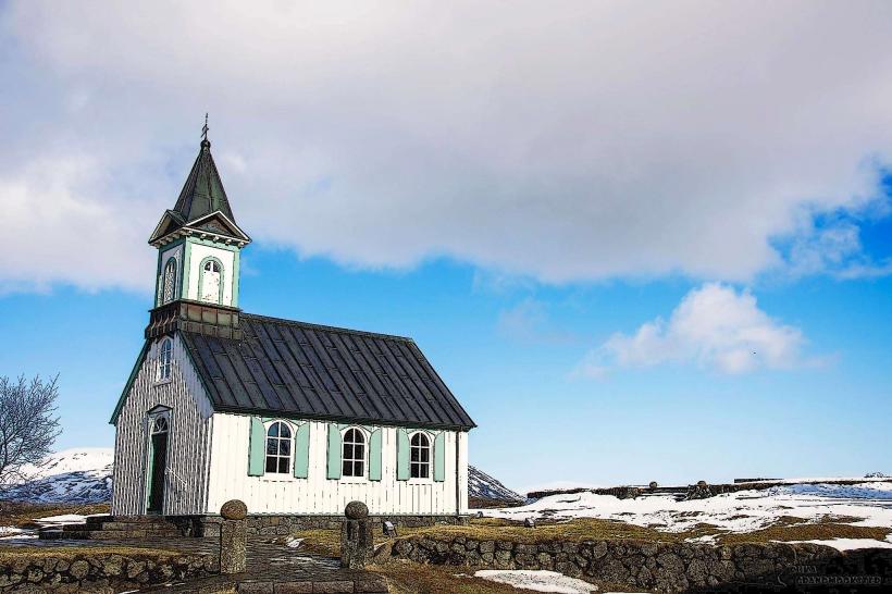
Walking through the Almannagjá gorge provides direct observation of the tectonic rift. Snorkeling or diving in the Silfra fissure is possible, offering a unique experience between two continents (requires booking with a certified tour operator). Visitors can explore the historical site of the ancient parliament, including the Lögberg (Law Rock) and the foundations of old booths. Hiking is available on various marked trails, including paths along the shores of Þingvallavatn. Fishing in Þingvallavatn is permitted with a valid license. The Þingvallakirkja (Thingvellir Church) and the adjacent historical farm are also accessible.
Infrastructure & Amenities
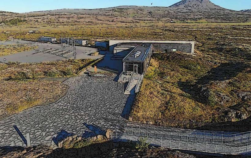
Restrooms are available at the main visitor center (Hakið) and near some of the larger parking areas. Natural shade is limited due to the low-growing vegetation. Cell phone signal (4G/5G) is generally reliable throughout the main visitor areas of the park. A small café and souvenir shop are located at the Hakið visitor center, offering light refreshments and basic provisions. Extensive food vendors are not present within the park itself.
Best Time to Visit
The months of June through August offer the mildest weather and longest daylight hours, making them ideal for general exploration. September and October provide opportunities to observe autumn foliage. Winter visits are possible for viewing the landscape under snow and potential Northern Lights, though temperatures are colder and daylight hours are significantly shorter. For photography, early morning or late afternoon light is optimal for capturing the geological features and avoiding peak crowds, particularly in the Almannagjá gorge. Diving and snorkeling in Silfra are possible year-round due to stable water temperatures, but winter road conditions may impact access.
Facts & Legends
The water in the Silfra fissure is glacial meltwater from the Langjökull glacier, which undergoes a filtration process through porous lava rock for 30-100 years before reaching the fissure. This natural filtration results in the water's exceptional clarity. A historical oddity is the ongoing debate regarding the precise location of the Lögberg (Law Rock), where laws were recited to the public during the Alþingi. While a specific rock formation is traditionally identified, archaeological evidence suggests its exact position may have shifted over centuries.
Nearby Landmarks
- Öxarárfoss waterfall: 0.5km North
- Laugarvatn Fontana Geothermal Baths: 25km East
- Kerið Crater Lake: 30km Southeast
- Geysir Geothermal Area: 60km East
- Gullfoss Waterfall: 70km East