Information
Landmark: Borderlands Scenic AreaCity: Santa Teresa
Country: USA New Mexico
Continent: North America
Borderlands Scenic Area, Santa Teresa, USA New Mexico, North America
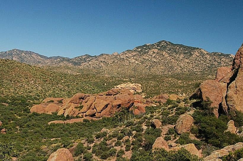
The Borderlands Scenic Area is a protected natural region located in the vicinity of Santa Teresa, New Mexico, USA. It encompasses a significant expanse of desert terrain characterized by varied geological formations and native flora.
Visual Characteristics
The landscape is dominated by arid desert scrub, including creosote bush, mesquite, and various cacti species. Rock formations consist primarily of sandstone and conglomerate, exhibiting erosion patterns indicative of wind and water action. Elevation changes create mesas and arroyos. The predominant color palette is earthy, with browns, tans, and muted greens, punctuated by the occasional bloom of desert wildflowers during favorable conditions.
Location & Access Logistics
The Borderlands Scenic Area is situated approximately 15 kilometers west of the Santa Teresa city center. Access is primarily via State Road 138, which runs along the southern boundary of the area. Unpaved service roads branch off SR 138, providing limited access to interior points. Parking is informal and available at designated pull-offs along SR 138. No public transport services operate directly to the scenic area.
Historical & Ecological Origin
The geological formations within the Borderlands Scenic Area are the result of millions of years of sedimentation and erosion. The area is classified as Chihuahuan Desert, a high-elevation desert ecosystem characterized by its unique plant and animal species adapted to arid conditions. Evidence of historical human activity, including Native American artifacts, has been found in the region, suggesting intermittent use over millennia.
Key Highlights & Activities
Hiking is permitted on designated trails and cross-country. Observation of native flora and fauna is a primary activity. Photography of geological features and desert landscapes is possible. Limited off-road vehicle use is permitted on established routes, subject to local regulations.
Infrastructure & Amenities
No developed infrastructure or amenities are present within the Borderlands Scenic Area. Restrooms, shade structures, and food vendors are not available. Cell phone reception is intermittent and generally unreliable throughout the area.
Best Time to Visit
The optimal time for visiting is during the spring (March to May) and fall (September to November) months, when daytime temperatures are moderate. Mid-morning and late afternoon offer the best natural lighting for photography, avoiding the harsh midday sun. Summer months (June to August) experience extreme heat, making daytime exploration inadvisable.
Facts & Legends
Local folklore suggests that certain rock formations within the area are imbued with spiritual significance by indigenous peoples. A verified historical oddity is the presence of abandoned mining claims dating back to the late 19th century, though no significant mineral deposits were ever commercially extracted.
Nearby Landmarks
- White Sands National Park (35km Northeast)
- Franklin Mountains State Park (40km East)
- El Paso Mission Trail (45km East)
- Organ Mountains-Desert Peaks National Monument (60km Northeast)