Information
Landmark: Hueco Tanks State Historic SiteCity: Santa Teresa
Country: USA New Mexico
Continent: North America
Hueco Tanks State Historic Site, Santa Teresa, USA New Mexico, North America
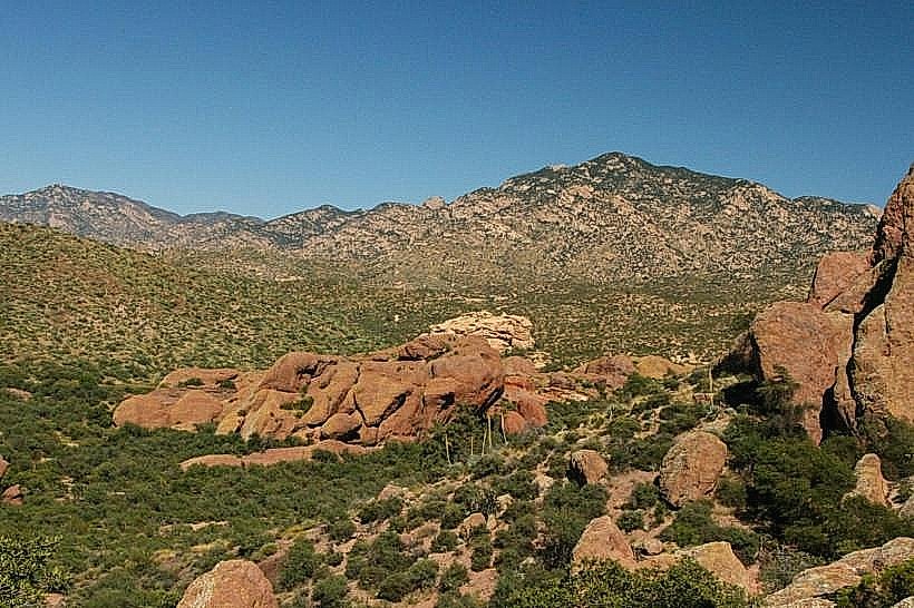
Hueco Tanks State Historic Site is a geological formation located near Santa Teresa, New Mexico. It is recognized for its significant historical inscriptions and unique rock formations.
Visual Characteristics
The site features large, rounded granite boulders and rock formations, characteristic of inselbergs. The rock surfaces exhibit a reddish-brown hue. Vegetation is sparse, consisting primarily of desert scrub, cacti, and drought-resistant grasses. The elevation varies, with some formations reaching significant heights above the surrounding desert floor.
Location & Access Logistics
Hueco Tanks State Historic Site is situated approximately 32 kilometers east of El Paso, Texas, and 16 kilometers east of Santa Teresa, New Mexico. Access is via State Road 180 (also known as Hueco Tanks Road). The site has a designated parking area. Public transport options are not available directly to the site; private vehicle transport is required.
Historical & Ecological Origin
The rock formations at Hueco Tanks are primarily composed of granite and are the result of millions of years of geological erosion. The site is ecologically classified as Chihuahuan Desert scrubland. Historically, Hueco Tanks served as a vital water source and a shelter for indigenous peoples, including the Apache and Jumano tribes, for thousands of years. The site contains thousands of Native American petroglyphs and pictographs, dating back as far as 6,000 years.
Key Highlights & Activities
Activities include hiking on designated trails, rock climbing (bouldering is particularly popular), and viewing the historical rock art. Guided tours focusing on the cultural history and rock art are available. Visitors can explore the various rock formations and natural water tanks (huecos) that give the site its name.
Infrastructure & Amenities
Restrooms are available at the visitor center. Limited shade is provided by rock overhangs and some developed picnic areas. Cell phone signal (4G/5G) is generally unreliable within the park. There are no food vendors on-site; visitors are advised to bring their own provisions.
Best Time to Visit
The best time of day for photography, particularly to capture the rock art and formations, is during the early morning or late afternoon when the sunlight creates distinct shadows. The most favorable months for visiting are from October through April, avoiding the extreme summer heat. High temperatures can exceed 38°C (100°F) during summer months.
Facts & Legends
One notable historical fact is that the site was a crucial stop for travelers and settlers along the Butterfield Overland Mail route in the mid-19th century. A specific tip for visitors is to wear sturdy footwear suitable for uneven terrain and to carry ample water, as the desert environment is arid.
Nearby Landmarks
- Franklin Mountains State Park (25km West)
- El Paso Mission Trail (30km West)
- White Sands National Park (120km North)
- Guadalupe Mountains National Park (150km East)