Information
Landmark: Canyon Rim TrailCity: Twin Falls
Country: USA Idaho
Continent: North America
Canyon Rim Trail, Twin Falls, USA Idaho, North America
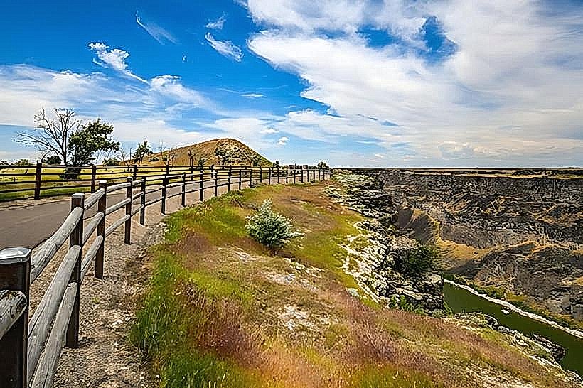
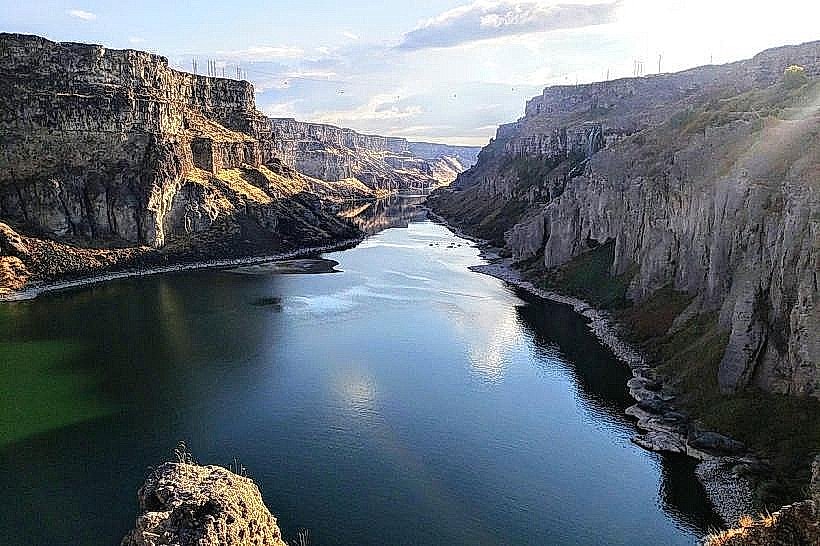
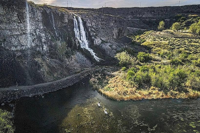
The Canyon Rim Trail is a paved pathway situated along the edge of the Snake River Canyon in Twin Falls, Idaho. It provides elevated viewpoints of the canyon's geological features.
Visual Characteristics
The trail itself is constructed of asphalt, approximately 2 meters wide. It follows the natural contour of the canyon rim. The canyon walls are composed of basalt rock, exhibiting layered strata. Vegetation consists of drought-tolerant grasses, sagebrush, and scattered juniper trees. The Snake River flows at the canyon's base, appearing as a dark ribbon from the rim.
Location & Access Logistics
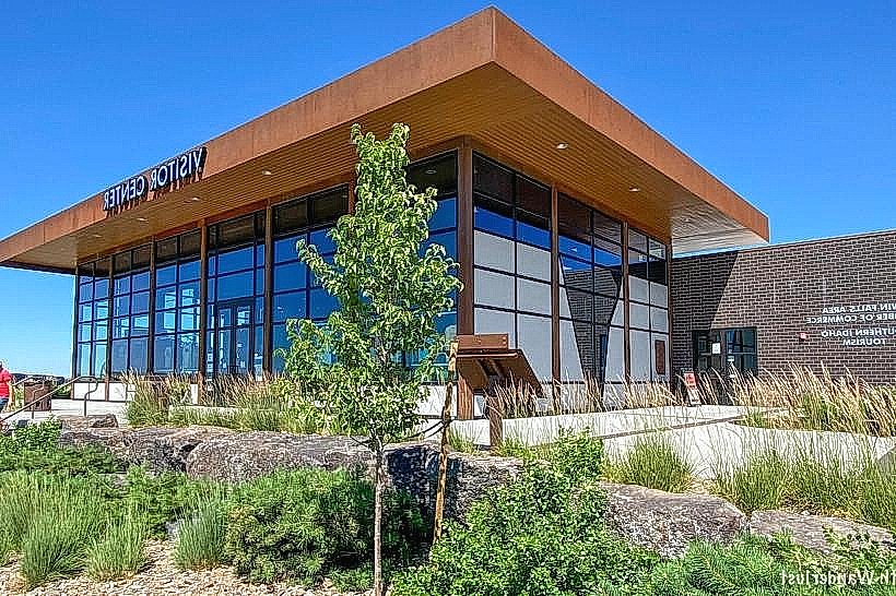
The Canyon Rim Trail is located at the southern edge of Twin Falls, Idaho. Access points are available from the parking areas adjacent to the Perrine Bridge and the Visitor Center. The trail extends approximately 3.2 kilometers (2 miles) east and west from the Visitor Center. Parking is available at designated lots near the Visitor Center and the Perrine Bridge. No public transport directly serves the trail; access requires private vehicle or taxi.
Historical & Ecological Origin
The canyon was formed by the erosive power of the Snake River over millions of years, carving through layers of basalt lava flows. The trail was developed by the City of Twin Falls Parks and Recreation Department, with construction completed in phases starting in the late 20th century, to provide public access and viewing opportunities of the natural landscape.
Key Highlights & Activities
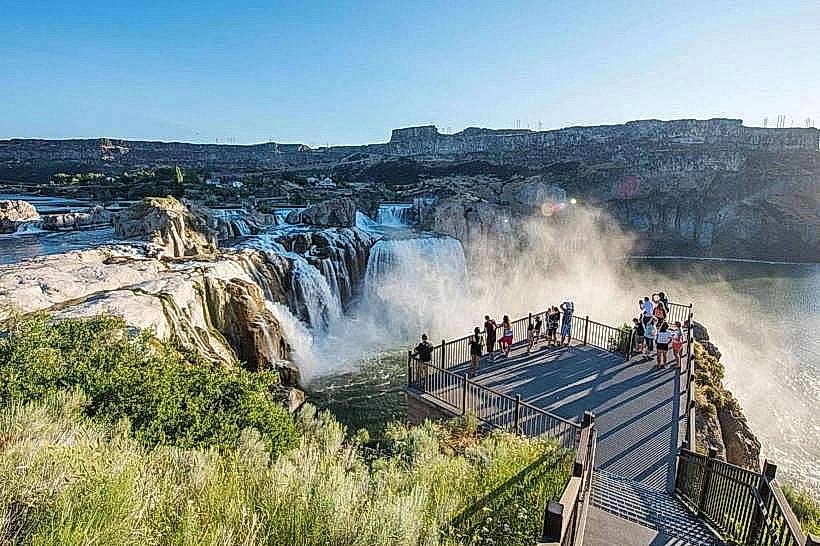
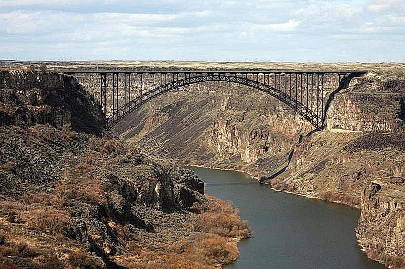
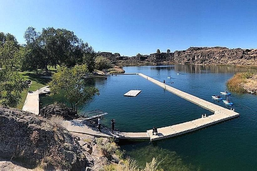
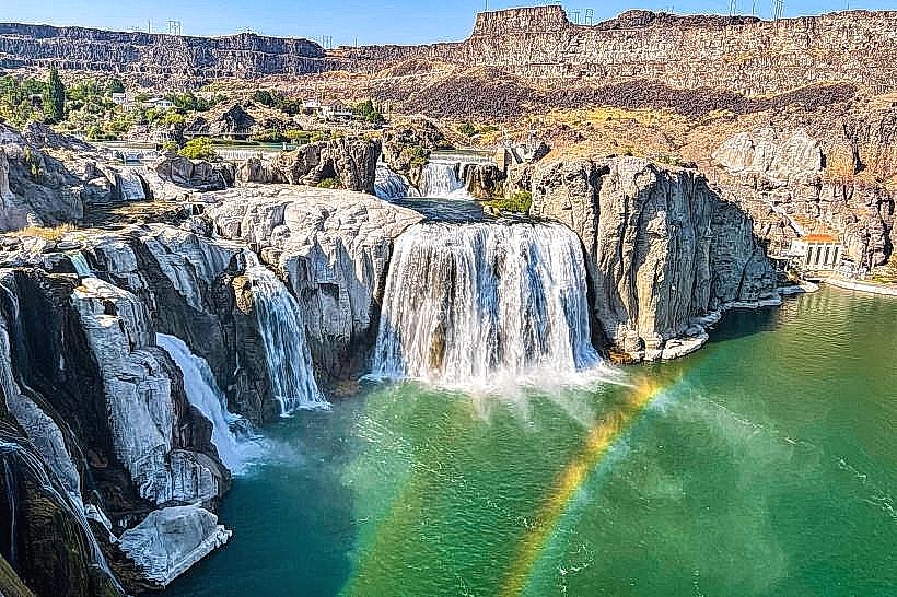
Observation of the Snake River Canyon. Viewing the Perrine Bridge, a notable structure for BASE jumping. Walking or cycling along the paved path. Photography of the canyon and river. Access to viewpoints overlooking the Shoshone Falls (seasonal flow dependent).
Infrastructure & Amenities
Restrooms are available at the Visitor Center and at designated points along the trail. Some sections of the trail are shaded by natural vegetation. Cell phone signal (4G/5G) is generally available along the trail. No food vendors are located directly on the trail; amenities are available in the city center.
Best Time to Visit
For photography, early morning or late afternoon provides optimal lighting conditions due to the angle of the sun. The months of April through October offer the most favorable weather, with daytime temperatures generally ranging from 15°C to 30°C (59°F to 86°F). No tide considerations apply.
Facts & Legends
The Perrine Bridge, which spans the canyon near the trail's western end, is one of only two bridges in the United States where BASE jumping is permitted year-round without a permit. Local lore sometimes speaks of the canyon's depth and the challenging conditions faced by early settlers.
Nearby Landmarks
- Perrine Bridge (0.2km West)
- Twin Falls Visitor Center (0.1km East)
- Shoshone Falls (4.5km East)
- Centennial Park (1.5km North)
- Canyon Springs Golf Course (2.0km Southwest)