Information
Landmark: Capelinhos VolcanoCity: Azores
Country: Portugal
Continent: Europe
Capelinhos Volcano, Azores, Portugal, Europe
The Capelinhos Volcano is a monogenetic ocellated volcano located on the western tip of Faial Island in the Azores. It represents the westernmost point of Europe and is the site of the most recent subaerial volcanic eruption in the Portuguese archipelago.
Visual Characteristics
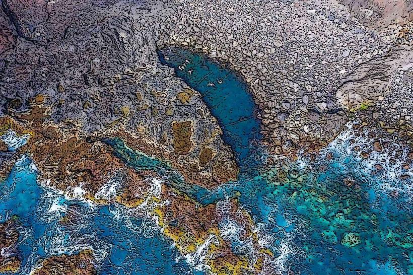
The landscape is a barren, lunar-like desert composed of gray volcanic ash, lapilli, and scoria, contrasting with the surrounding dark basaltic cliffs. The site features a partially buried lighthouse and a jagged volcanic cone that rises approximately $150$ meters above sea level. Coastal erosion has carved vertical sea cliffs and stacks out of the poorly consolidated ash layers, revealing the internal stratigraphy of the tuff cone.
Location & Access Logistics
The volcano is situated at the end of the EN1-1A road, approximately 25 kilometers west of the city of Horta. Access is via private vehicle or taxi, as there is no regular public bus service to the site. A large paved parking area is available at the Capelinhos Lighthouse. Visitors can walk from the parking area onto the ash fields via marked pedestrian paths.
Historical & Ecological Origin
The eruption occurred from September 27, 1957, to October 24, 1958, beginning as a submarine eruption (Surtseyan type) before forming a new island that eventually joined the main coastline of Faial. It was the first eruption in history to be documented by scientists from start to finish. The site is a primary geosite of the Azores UNESCO Global Geopark, serving as a laboratory for primary ecological succession on volcanic substrates.
Key Highlights & Activities
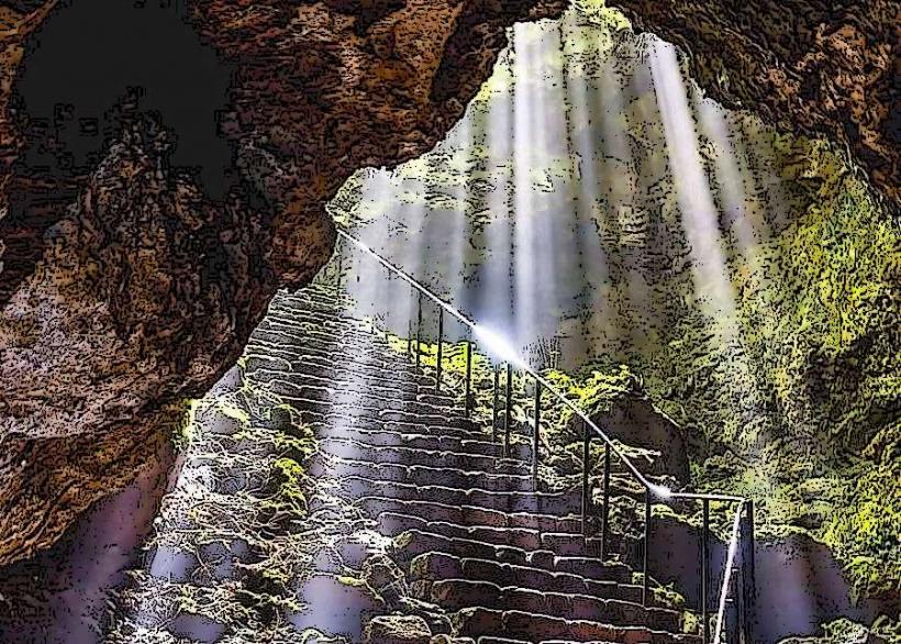
The Capelinhos Volcano Interpretation Centre is an underground museum built beneath the original ash level, featuring exhibits on global tectonics and the 1957 eruption. Visitors can climb the Capelinhos Lighthouse (Farol dos Capelinhos) for an aerial view of the volcanic complex. Hiking the trail along the caldera rim of the nearby Cabeço Verde provides a broader perspective of the island’s volcanic spine.
Infrastructure & Amenities
The interpretation center houses a cafeteria, public restrooms, and a gift shop. 5G cellular coverage is available at the lighthouse and visitor center but may weaken near the water's edge. The area is highly exposed to wind and sun with no natural shade on the ash fields. The museum and lighthouse are wheelchair accessible via elevators and ramps.
Best Time to Visit
The "golden hour" just before sunset is the best time for photography, as the low light emphasizes the textures and contours of the gray ash. Clear weather is necessary to see the neighboring islands of Flores and Corvo. The museum is typically open from 10:00 to 17:00 or 18:00 depending on the season; checking the Faial weather forecast is essential as the site is prone to high winds and Atlantic gales.
Facts & Legends
The eruption caused a significant humanitarian crisis, leading to the "Azorean Refugee Act" signed by John F. Kennedy, which allowed thousands of displaced Faialense residents to emigrate to the United States. A specific tip for visitors is to look for the "bombas vulcânicas" (volcanic bombs)-large, streamlined rocks ejected during the eruption that are scattered across the ash fields.
Nearby Landmarks
Capelinhos Lighthouse: 0.1km East
Porto do Comprido: 0.5km South
Cabeço Verde: 3.2km East
Varadouro Natural Pools: 4.8km Southeast
Caldeira do Faial: 12.0km East