Information
Landmark: Fortress of TsepinaCity: Plovdiv
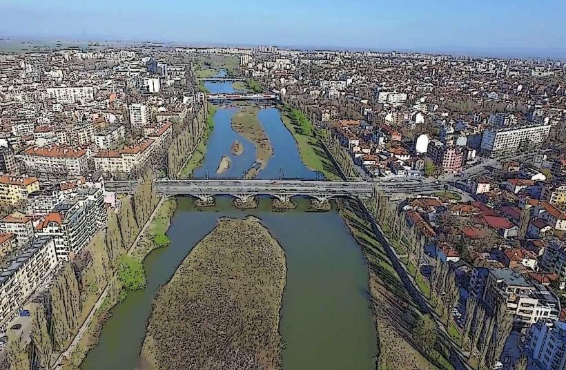
Country: Bulgaria
Continent: Europe
Fortress of Tsepina, Plovdiv, Bulgaria, Europe
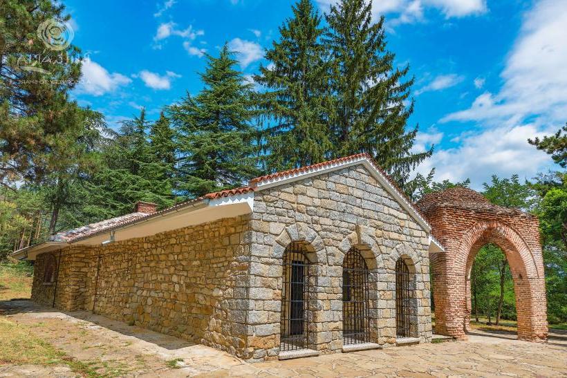
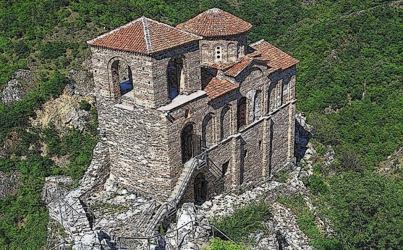
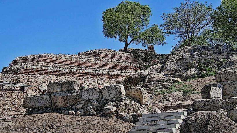
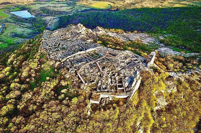
The Fortress of Tsepina is a medieval stronghold located in the Western Rhodope Mountains, approximately 6 km northwest of the village of Dorkovo and 62 km from Plovdiv. Situated at an elevation of 1,136 meters, it served as the capital of Despot Alexius Slav in the 13th century and was considered one of the most impregnable fortresses in the region.
Visual Characteristics
The fortress is built from local rubble stone bound with white mortar and reinforced with "santrachs" (wooden beam networks). It features a 640-meter-long outer wall enclosing 25 decares and an inner citadel (1.5 decares) at the highest point. Notable ruins include a massive 8-meter-high water reservoir that likely supported a donjon tower, the foundations of three medieval churches, and stone residential buildings.
Location & Access Logistics
From Plovdiv, take the road toward Velingrad, then divert to Dorkovo. A 6 km paved asphalt road leads from Dorkovo village to the Tsepina mountain hut. From the hut, a well-marked pedestrian path requires a 10-minute uphill walk to reach the fortifications. Public transport is limited; regional buses reach Dorkovo from Pazardzhik or Rakitovo, but the final stretch to the fortress typically requires a private vehicle or taxi.
Historical & Ecological Origin
The site has been inhabited since the 5th millennium BC, with later Thracian (Bessi tribe) and Roman occupations. The medieval structure reached its zenith between the 11th and 13th centuries. It is famous as the residence of Despot Alexius Slav, who established an autonomous domain here in 1207. Geologically, the fortress sits on a conical marble and limestone peak surrounded by dense coniferous and deciduous forests.
Key Highlights & Activities
Visitors can explore the ruins of the churches and the deep water cisterns, which reached depths of 10 meters. The summit provides panoramic views of the Chepinska Valley and the high Rhodope ridges. A small museum exhibition at the Tsepina hut displays local artifacts, though its hours can be irregular. The site is a popular destination for hikers and history enthusiasts.
Infrastructure & Amenities
Infrastructure is minimal at the ruins. The Tsepina hut at the base provides a resting point. The nearby Pliocene Park in Dorkovo operates a joint ticketing system. There are no restrooms or shops at the fortress walls; these are located at the hut or in Dorkovo village. Cell signal (4G/5G) is generally available due to the high elevation and proximity to local settlements.
Best Time to Visit
Late spring (May–June) and early autumn (September–October) offer the best weather and visibility. The site is open-access and lacks artificial lighting, making the "Golden Hour" before sunset ideal for photography of the stone walls against the mountain landscape. Winter access is possible but may be restricted by snow on the final 6 km road.
Facts & Legends
Legend states that when Princess Margaret-Isabelle, the French wife of Alexius Slav, first saw the fortress, she exclaimed it would be her grave; she died two years later and was buried on a nearby peak. Another account claims the fortress only fell to the Ottomans in 1373 after a nine-month siege when they discovered and cut the secret water conduit using a thirsty mule.
Nearby Landmarks
Pliocene Park Dorkovo – 6km Southeast
Kleptuza Lake (Velingrad) – 15km West
Batak Dam – 15km South
Snezhanka Cave – 16km East
Lepenitsa Cave – 18km Southwest