Information
Landmark: Hvar Fortress (Fortica)City: Hvar
Country: Croatia
Continent: Europe
Hvar Fortress (Fortica), Hvar, Croatia, Europe
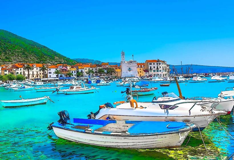
Hvar Fortress, locally known as Fortica or Tvrđava Španjola, is a 16th-century military stronghold situated on a hill 100 meters above the town of Hvar. It is the city's most prominent landmark and provides the primary defensive perspective over the Hvar channel.
Visual Characteristics
The fortress is a massive stone complex featuring four large circular bastions, thick curtain walls, and crenelated battlements. Constructed from local light-colored limestone, it integrates with the natural rocky terrain of the hillside. The interior contains a network of stone corridors, a central courtyard, and several historic structures, including a chapel and a former prison. Its silhouette is a dominant feature of the Hvar skyline, especially when illuminated at night.
Location & Access Logistics
The fortress is located at Ul. Biskupa Jurja Dubokovića 80, 21450, Hvar.
Pedestrian Access: Accessible via a 20–30 minute uphill walk starting from the northern corner of St. Stephen’s Square (Piazza). The route passes through the medieval Porta di Datallo (Gate of Dates) and follows a series of stone stairs and winding paths through Mediterranean gardens.
Vehicle Access: A paved road allows cars and taxis to reach the entrance directly from the bus station area, circling behind the hill to the western side of the fort.
Proximity: Roughly 0.6km from the Hvar Riva (waterfront).
Historical Origin
The site has been fortified since the Illyrian period (pre-500 BC). The Byzantines built a citadel here in the 6th century, and the Venetians began the current structure in 1278. Its name "Španjola" (Spanish) is derived from the Spanish military engineers who contributed to its design in the 14th century.
Strategic Importance: In 1571, the fortress saved nearly the entire population of Hvar when they took refuge inside while the town below was sacked and burned by the Ottoman fleet.
Destruction & Repair: In 1579, a lightning strike ignited the gunpowder warehouse, causing a massive explosion that severely damaged the structure. It was repaired in the early 17th century and later modified by the Austrians in the 19th century.
Key Highlights & Activities
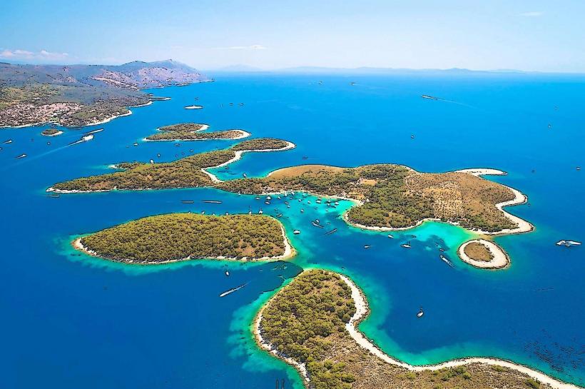
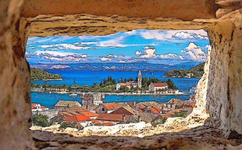
Panoramic Views: The primary attraction is the unobstructed view of Hvar Town’s red roofs, the harbour, and the Pakleni Islands archipelago.
Archaeological Collection: The interior houses a museum featuring a collection of ancient amphorae recovered from the seabed and other artifacts from the Middle Ages.
The Prison: Visitors can descend into the dark, cramped quarters of the former medieval dungeons located in the lower levels.
Terrace Café: An open-air café provides refreshments on the battlements overlooking the sea.
Infrastructure & Amenities
The site is a managed cultural monument with a paid entrance fee.
Facilities: Includes a souvenir shop and public restrooms within the fortress walls.
Connectivity: 5G cellular coverage is stable across the hill.
Accessibility: The walk up is steep and involves many stairs. While the fortress grounds have some level areas, the stairs to the bastions and the dungeon are narrow and irregular.
Best Time to Visit
Sunset: This is the peak time for photography, as the sun sets directly over the Pakleni Islands.
Morning: Early visits (before 10:00) allow for cooler temperatures and fewer crowds from the excursion boats arriving from Split.
Night: The fortress is often open late in the summer, offering a view of the illuminated town below.
Facts & Legends
A historical oddity is that the construction of the fortress was partially funded by the local municipality through a tax on salt. Local legend suggests a network of secret tunnels exists connecting the fortress directly to the Governor's Palace on the waterfront, though only short defensive corridors have been formally documented.
Nearby Landmarks
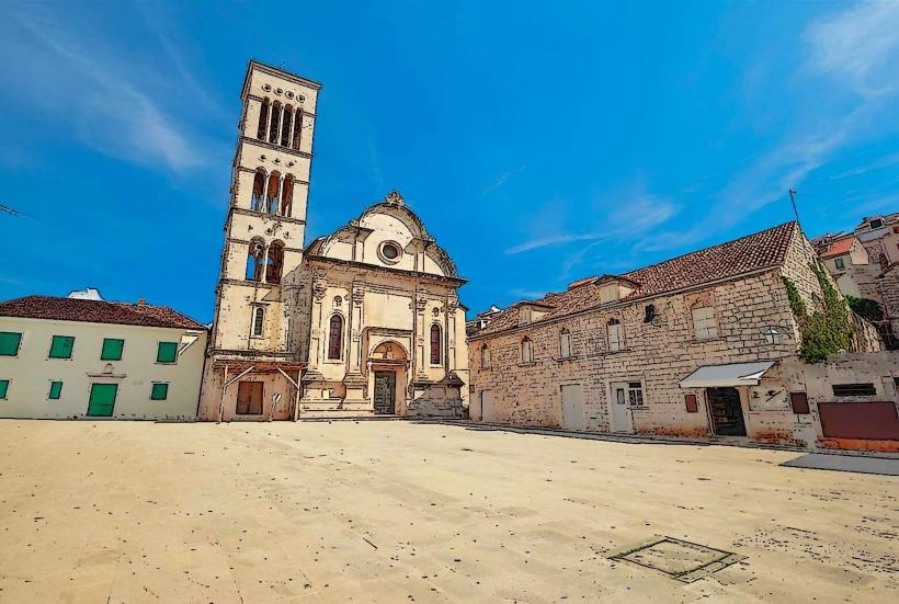
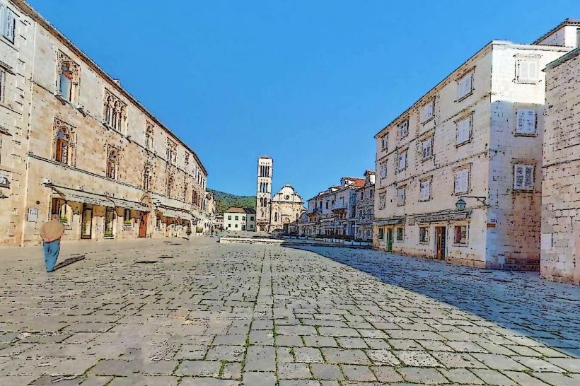
Cathedral of St. Stephen – 0.5km South (at the base of the hill)
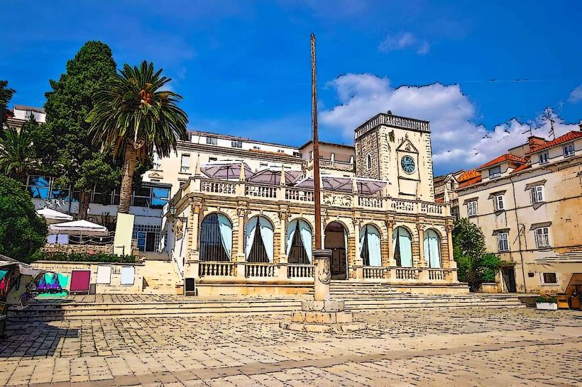
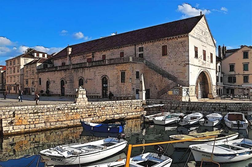
Hvar Public Theatre (Arsenal) – 0.6km South
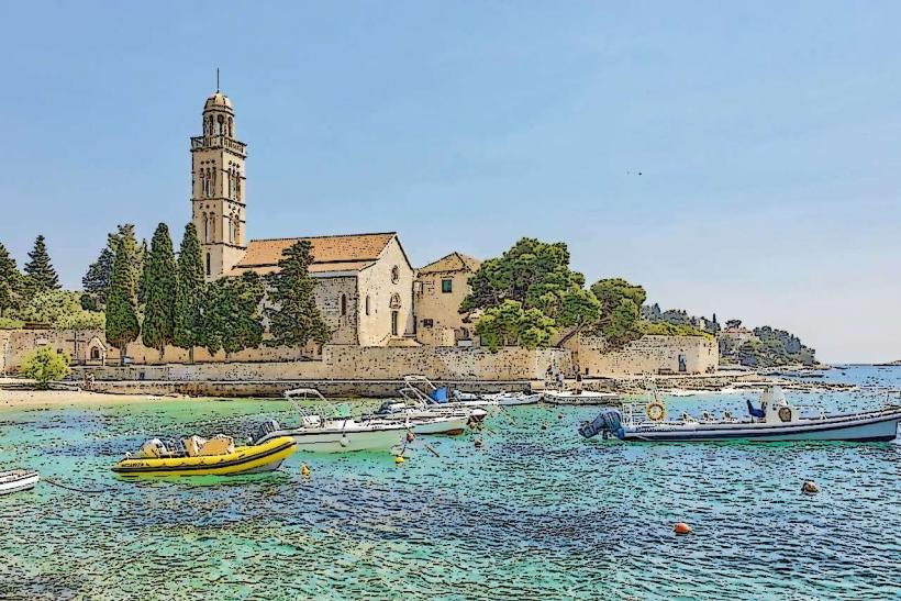
Benedictine Convent – 0.3km South (along the walking path)
Pakleni Islands – Visible directly to the Southwest
Napoleon Fortress (Tvrđava Napjun) – 1.5km Northeast (located on a higher peak)