Information
Landmark: Kaprun High Alpine ReservoirsCity: Zell am See
Country: Austria
Continent: Europe
Kaprun High Alpine Reservoirs, Zell am See, Austria, Europe
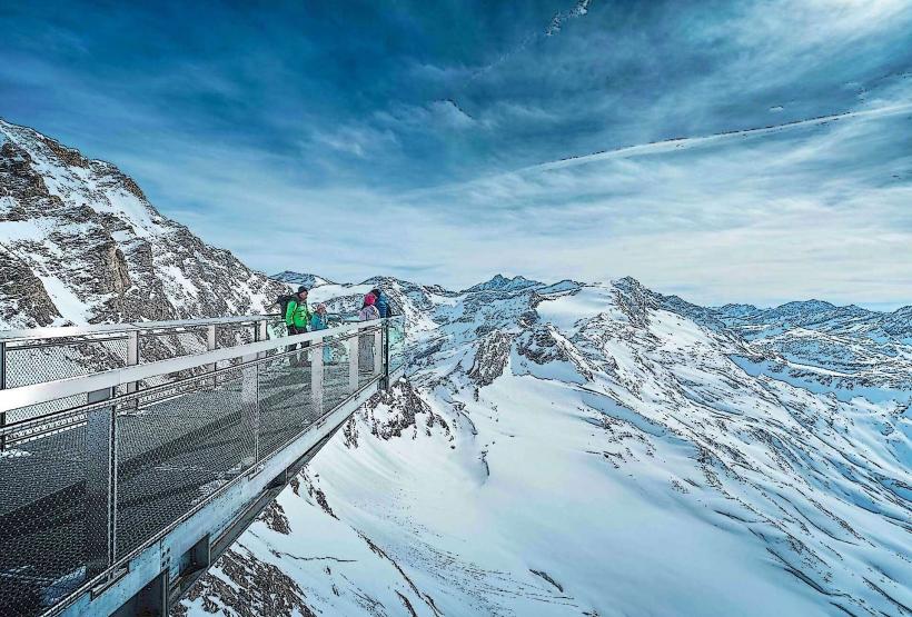
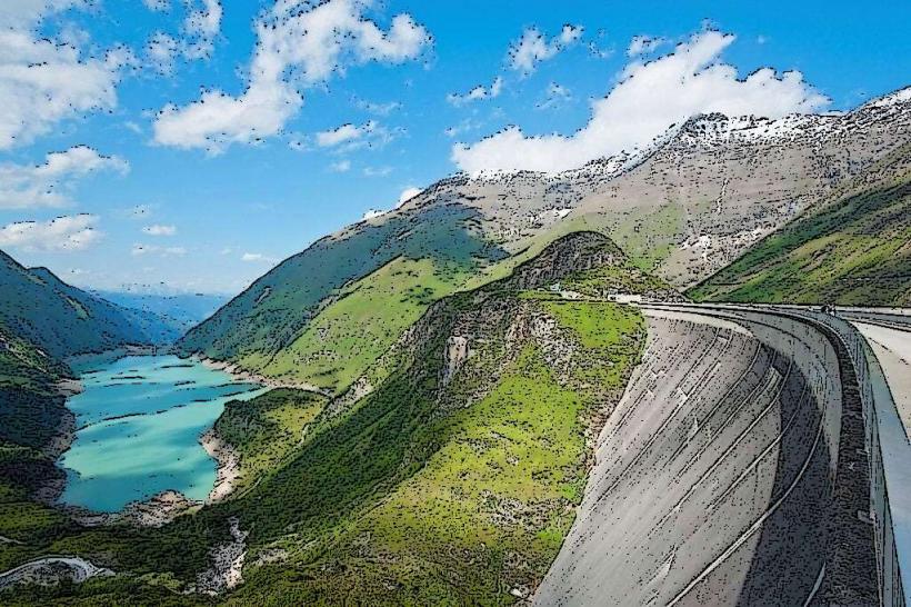
The Kaprun High Alpine Reservoirs consist of two massive artificial lakes, Mooserboden and Wasserfallboden, situated in the Hohe Tauern mountain range. This hydroelectric power plant complex is located at the end of the Kaprun Valley and represents a significant feat of post-war Austrian engineering.
Visual Characteristics
The site is dominated by two massive curved concrete gravity dams: the Moosersperre (107m high, 494m long) and the Drossensperre (112m high). The water exhibits a distinct turquoise or milky blue hue due to "glacial flour" (fine rock particles) from the surrounding glaciers. The terrain is characterized by steep granite rock faces, sparse alpine tundra vegetation, and the presence of the Grossglockner massif in the background.
Location & Access Logistics
The reservoirs are located approximately 15km south of Zell am See. Access requires driving to the Kesselfall-Alpenhaus parking garage at the end of the Kaprun valley road (Kesselfallstraße). From there, visitors must use a transfer system consisting of specialized tunnels buses and the Lärchwand inclined elevator, the largest open-platform diagonal lift in Europe, to reach the high-altitude basins.
Historical & Ecological Origin
Construction began in 1938 but the primary development occurred between 1947 and 1955 using Marshall Plan funding. It was built as a symbol of Austrian reconstruction after WWII. Geologically, the reservoirs are situated in a high-alpine glacial trough, capturing meltwater from the Pasterze and other surrounding glaciers via a system of pressure tunnels.
Key Highlights & Activities
Technical tours are available inside the Moosersperre dam wall to view the interior monitoring systems. The MOBY-Dick climbing via ferrata is located directly on the dam face for experienced climbers. Hiking trails lead to the Höhenburg peak, which offers a panoramic view of both reservoirs simultaneously. The "Electricity and Ice" exhibition provides historical and technical context.
Infrastructure & Amenities
Restrooms and a mountain restaurant (Bergrestaurant Mooserboden) are located at the upper reservoir level at 2,040 meters. 4G/5G cellular signal is available near the main buildings but becomes intermittent on the hiking trails. There is no natural shade in the high-alpine environment. A small visitor center and gift shop are situated at the bus terminus.
Best Time to Visit
The site is only open from late May to mid-October, depending on snow conditions. The best time for photography is midday for clear water colors or early morning for reflections. Due to the altitude (over 2,000m), visitors should check local weather forecasts for fog and sudden temperature drops, regardless of the conditions in the valley.
Facts & Legends
A historical oddity is the "Mythos Kaprun," which refers to the immense national pride associated with the project's completion, despite the dark history of the forced laborers used during the initial construction phases in the 1940s. A memorial at the site commemorates the workers who lost their lives during the construction.
Nearby Landmarks
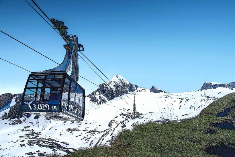
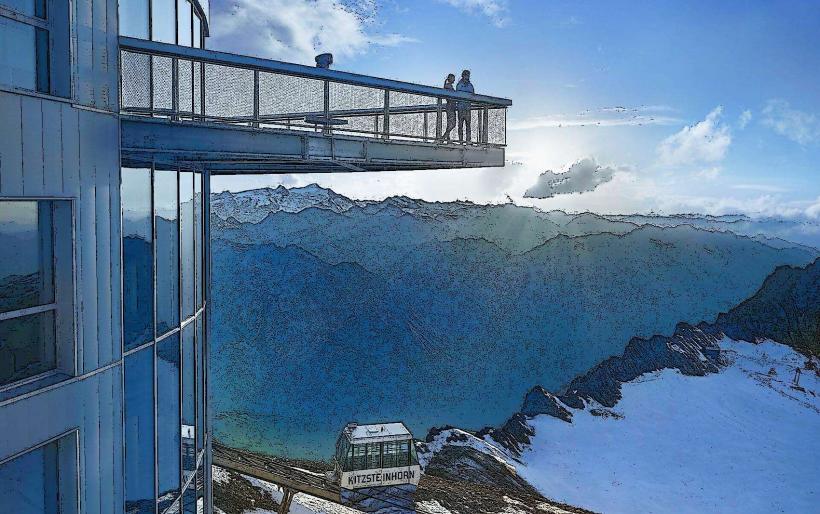
Kitzsteinhorn Glacier – 4.5km Southwest
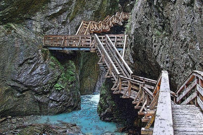
Sigmund Thun Gorge – 7.5km North
Grossglockner High Alpine Road – 12.0km South
Maiskogel Family Mountain – 8.0km North
Tauern Spa Kaprun – 9.5km North