Information
Landmark: Sigmund-Thun-Klamm GorgeCity: Zell am See
Country: Austria
Continent: Europe
Sigmund-Thun-Klamm Gorge, Zell am See, Austria, Europe
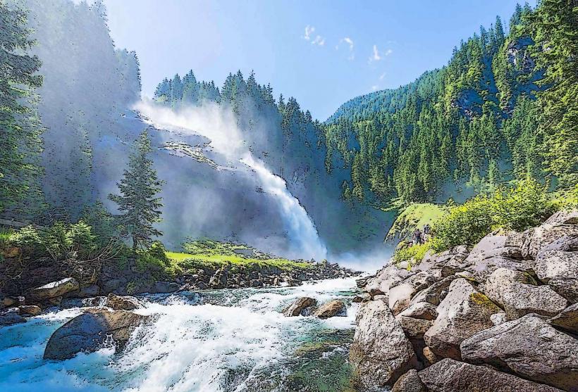
The Sigmund Thun Klamm is a 320-meter-long natural gorge located in Kaprun, approximately 8km south of Zell am See. It was formed by the Kapruner Ache, a glacial stream that has carved through the local mica-schist rock over thousands of years.
Visual Characteristics
The gorge is characterized by narrow, jagged rock walls rising up to 32 meters high. The interior features turbulent turquoise water, swirling potholes, and moss-covered rock faces. The entire length is traversed via a series of wooden walkways, bridges, and stairs bolted directly into the stone. At the southern end, the gorge opens up to the Klammsee, a tranquil emerald-green reservoir.
Location & Access Logistics
The entrance is located at Kesselfallstraße, Kaprun. It is accessible by car via the B311, with a designated free parking area (P1) at the entrance. Public transit is served by Bus Line 660 (Kaprun Sigmund-Thun-Klamm stop). The trail is linear, starting at the lower ticket booth and ending at the Klammsee, from where a return path leads back to the parking lot via the forest.
Historical & Ecological Origin
The gorge was formed approximately 14,000 years ago following the retreat of the last ice age glaciers. The Kapruner Ache gradually eroded the hard rock, creating the deep incision visible today. Historically, the gorge was first made accessible to the public in 1893, named after Count Sigmund von Thun-Hohenstein, the governor of Salzburg. After being closed for decades due to hydroelectric development, the wooden walkways were reconstructed and reopened in 1992.
Key Highlights & Activities
The primary activity is the walk through the gorge, which takes approximately 30–45 minutes. During the summer months, "Klammleuchten" (Gorge Lights) events occur on Friday nights, featuring multicolored LED illumination of the rock walls and waterfalls. The "Klammsee" at the exit offers a circular hiking trail and a fitness course. Information boards throughout the gorge explain the geological process of erosion.
Infrastructure & Amenities
A ticket booth and a small kiosk selling snacks and souvenirs are located at the entrance. Public restrooms are available at both the entrance and near the Klammsee exit. 5G cellular coverage is intermittent inside the deep sections of the gorge but stable at both ends. The wooden walkways are well-maintained but can be slippery; the site is not wheelchair or stroller accessible due to the high number of steps.
Best Time to Visit
The gorge is open seasonally from mid-May to late October. The optimal time for photography is midday when sunlight penetrates the narrow opening to highlight the water's color. High-water conditions following heavy rain or early summer snowmelt make the experience more dramatic. Morning visits are recommended to avoid high pedestrian density during peak summer.
Facts & Legends
A historical oddity is that the gorge was once used for timber floating, where logs were flushed through the narrow passage to the valley below. Today, the water flow is regulated by the hydroelectric plant above; visitors can observe the massive pressure pipes of the power station integrated into the landscape near the gorge exit.
Nearby Landmarks
Klammsee Reservoir – 0.1km South
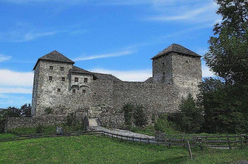
Kaprun Castle – 2.5km Northeast
Maiskogel Family Mountain – 1.0km North
Tauern Spa Kaprun – 3.5km North
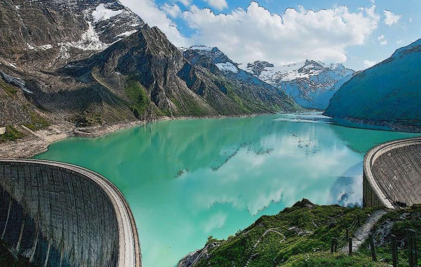
Kaprun High Alpine Reservoirs – 7.5km South