Information
Landmark: Karaburun PeninsulaCity: Vlora
Country: Albania
Continent: Europe
Karaburun Peninsula, Vlora, Albania, Europe
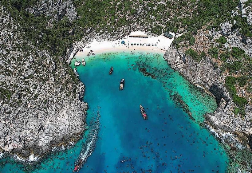
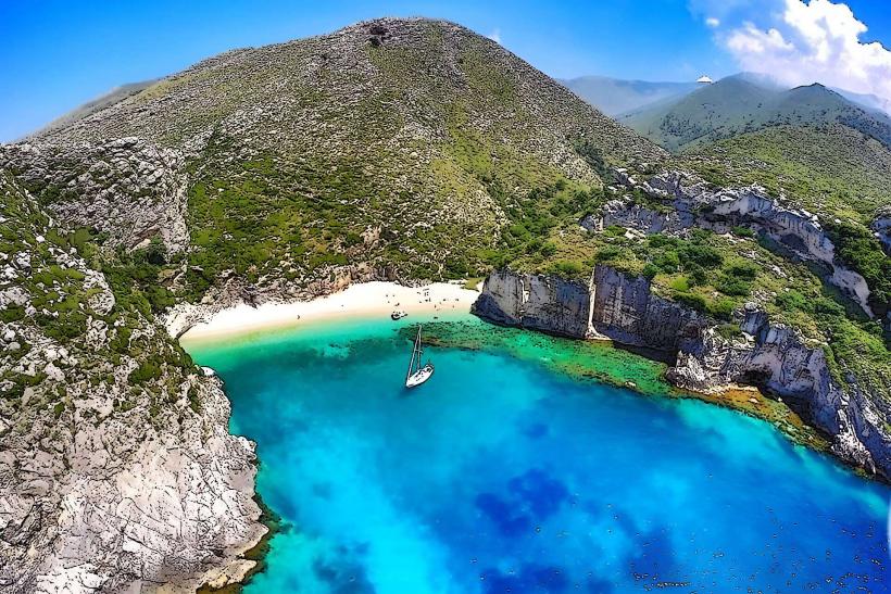
The Karaburun Peninsula is a massive limestone finger of land that separates the Adriatic and Ionian Seas in southwestern Albania. It is the largest peninsula in the country, forming the western boundary of Vlora-bay_vlora" class="underline">Vlora Bay.
Visual Characteristics
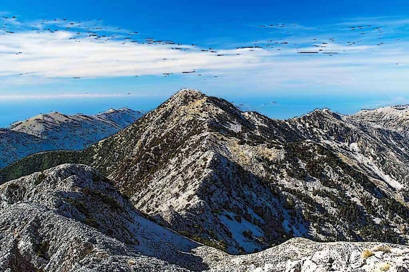
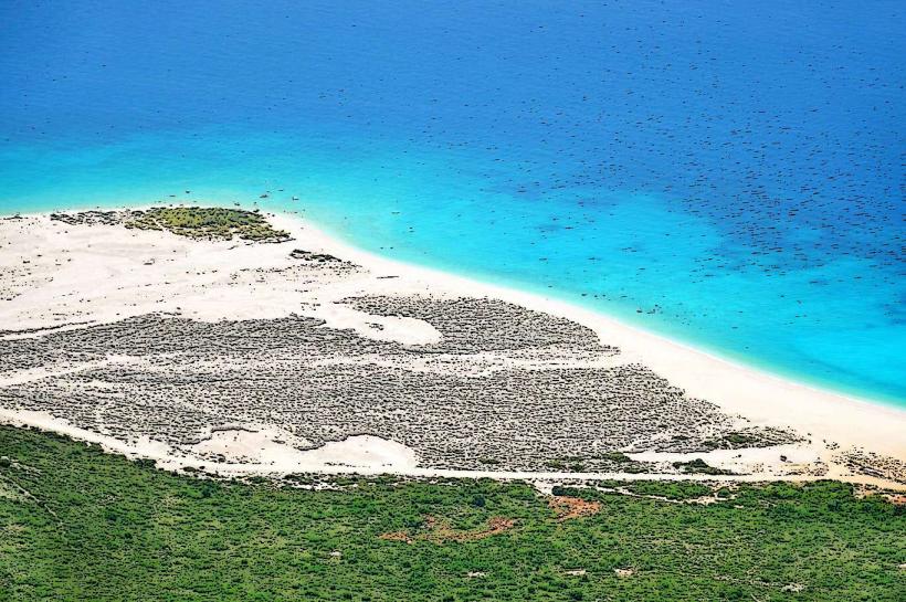
The terrain is dominated by steep, rugged limestone cliffs and barren rocky ridges reaching elevations over 800 meters. Coastal formations include numerous deep-water sea caves, vertical rock faces, and isolated pebbled coves with transparent turquoise water. Vegetation consists primarily of dense Mediterranean macchia, stunted oak trees, and aromatic herbs such as wild thyme and sage.
Location & Access Logistics
The peninsula is located approximately 15km west of Vlora city center. There are no paved roads; access is restricted to boat transport or strenuous hiking trails. Daily boat tours and private water taxis depart from the Vlora Marina or the Teuta pier. The main hiking route originates in Orikum and requires 6 to 8 hours to reach the northern tip, known as Cape Gjuhëz.
Historical & Ecological Origin
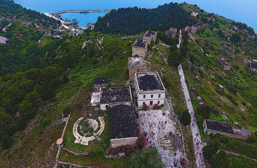
The peninsula is a tectonic formation composed of Mesozoic limestone. Historically, it was a restricted military zone during the Cold War, which prevented urban development and preserved its natural state. It currently forms the terrestrial part of the Karaburun-Sazan Marine Park, established in 2010 to protect its unique biodiversity and underwater archaeological sites.
Key Highlights & Activities
The Haxhi Ali Cave, a massive sea cavern accessible by boat, is a primary destination for exploration. Snorkeling and diving are possible in secluded bays like Grama Bay, where ancient rock inscriptions from sailors are visible on the cliff faces. Hiking the central ridge provides panoramic views of the entire Ionian coastline and Sazan Island.
Infrastructure & Amenities
The peninsula is largely uninhabited and lacks modern infrastructure. There are no public restrooms, paved paths, or permanent food vendors, although seasonal temporary bars operate at Bristan and Dafina bays. Cell phone signal is non-existent in most canyons and western coves. Visitors must carry all necessary water and supplies as there are no freshwater springs.
Best Time to Visit
The optimal window for visiting is between May and September when sea conditions are calm enough for boat transfers. Morning hours are preferred for exploring sea caves to utilize natural light penetration. High winds, particularly the "Bora," can make the western coast inaccessible and dangerous for small vessels.
Facts & Legends
Grama Bay, located on the western side, contains over 1,500 ancient inscriptions dating back to the 4th century BC, left by sailors seeking refuge from storms. Local legend claims that the Haxhi Ali Cave was used by a famous 17th-century Ulcinj pirate of the same name to hide his fleet and ambush Venetian and Ottoman merchant ships.
Nearby Landmarks
Haxhi Ali Cave: 0.1km North (coastal)
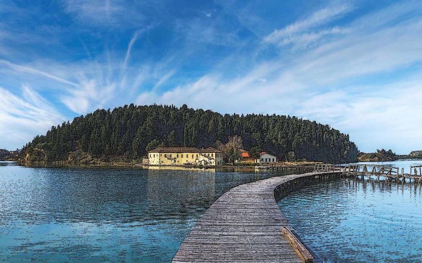
Sazan Island: 4.8km North
Grama Bay: 12.0km South
Karaburun Small Harbor: 2.5km East
Orikum Archaeological Park: 14.0km Southeast