Information
Landmark: Mount Hood National ForestCity: Hood River
Country: USA Oregon
Continent: North America
Mount Hood National Forest, Hood River, USA Oregon, North America
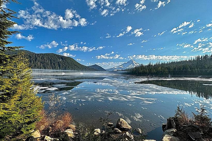
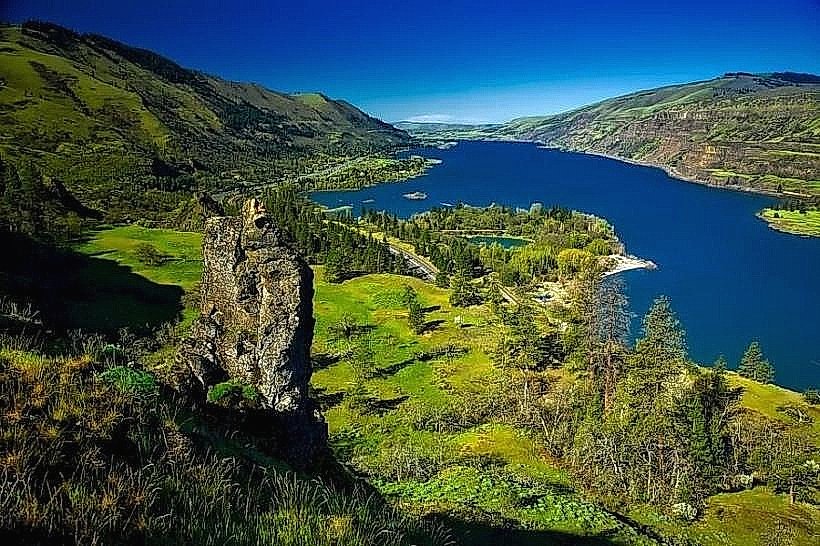
Mount Hood National Forest is a protected area in northern Oregon, USA, encompassing the region surrounding Mount Hood.
Visual Characteristics
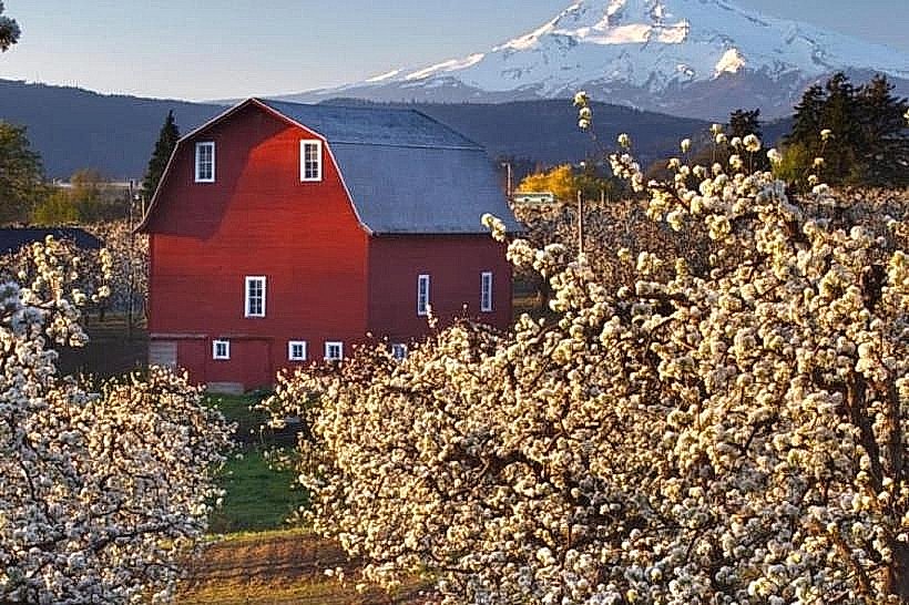
The forest is characterized by dense coniferous vegetation, primarily Douglas fir, western hemlock, and western red cedar. Mount Hood itself is a stratovolcano with a permanent snowpack and glaciers. The elevation ranges from approximately 1,000 feet (300 meters) in the lower valleys to over 11,000 feet (3,350 meters) at the summit. Numerous rivers and streams, such as the Hood River and the Sandy River, flow through the landscape, often with clear, cold water.
Location & Access Logistics
Mount Hood National Forest is located approximately 50 miles (80 kilometers) east of Portland, Oregon. Access is primarily via Interstate 84 East to Exit 62 (Hood River) or Exit 64 (White Salmon, WA, then crossing the Hood River Bridge). State Route 35 (Mount Hood Highway) provides direct access to the mountain's southern and eastern slopes. Forest roads, often unpaved and seasonal, branch off from these main routes. Parking is available at designated trailheads, campgrounds, and recreation sites, with fees often required. Public transport options are limited; the Mount Hood Express bus service operates seasonally to some areas on the mountain's west side.
Historical & Ecological Origin
Mount Hood is a stratovolcano formed by volcanic activity over the past 100,000 years. The surrounding forest is a temperate rainforest ecosystem, shaped by volcanic soil, glacial meltwater, and a high annual precipitation rate. The area was designated as Mount Hood National Forest in 1908, preserving its natural resources and recreational potential. Timber harvesting and mining were historically significant activities in the region.
Key Highlights & Activities
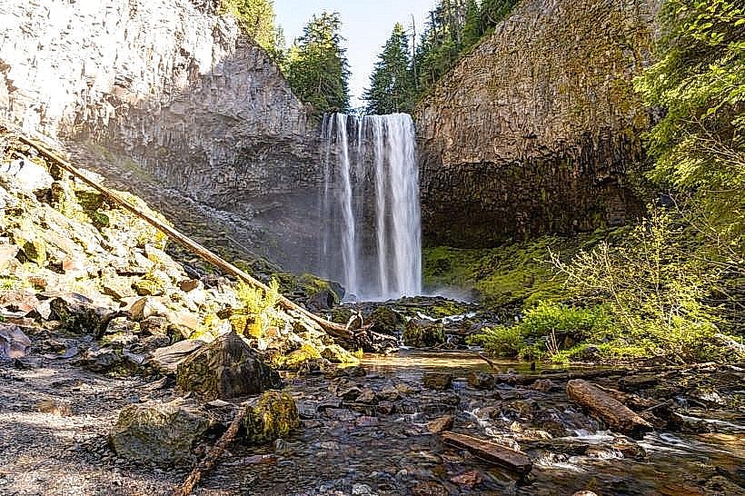
Hiking is a primary activity, with trails ranging from short interpretive walks to multi-day treks. Popular trails include the Timberline Trail, which circumnavigates Mount Hood, and trails leading to waterfalls like Tamanawas Falls. Skiing and snowboarding are available at Timberline Lodge and Mount Hood Meadows during winter months. Camping is permitted at numerous designated campgrounds. Fishing is possible in lakes and streams, subject to regulations. Rock climbing and mountaineering are undertaken on Mount Hood's slopes.
Infrastructure & Amenities
Restrooms are available at developed recreation sites, campgrounds, and visitor centers. Shade is abundant within the forest canopy. Cell phone signal is intermittent and generally poor in remote areas, with 4G/5G coverage limited to developed areas near major roads and ski resorts. Food vendors and services are concentrated in nearby towns like Hood River and Government Camp, with limited options within the forest itself, primarily at ski resort bases.
Best Time to Visit
The best time for hiking and general forest exploration is from late June through October, when snow has receded from most trails. Summer months (July-September) offer the warmest and driest weather. For snow sports, the season typically runs from November to April. Photography is best in the early morning or late afternoon for optimal lighting on the mountain and forest. High tide is not a relevant factor for this inland forest location.
Facts & Legends
Mount Hood is the highest point in Oregon. Local indigenous legends speak of the mountain as a powerful spirit. A specific tip for visitors is to check the Forest Service website for current road conditions and trail closures, as weather and snowpack can significantly impact accessibility, especially outside of peak summer.
Nearby Landmarks
- Timberline Lodge (10km Southwest)
- Trillium Lake (12km Southwest)
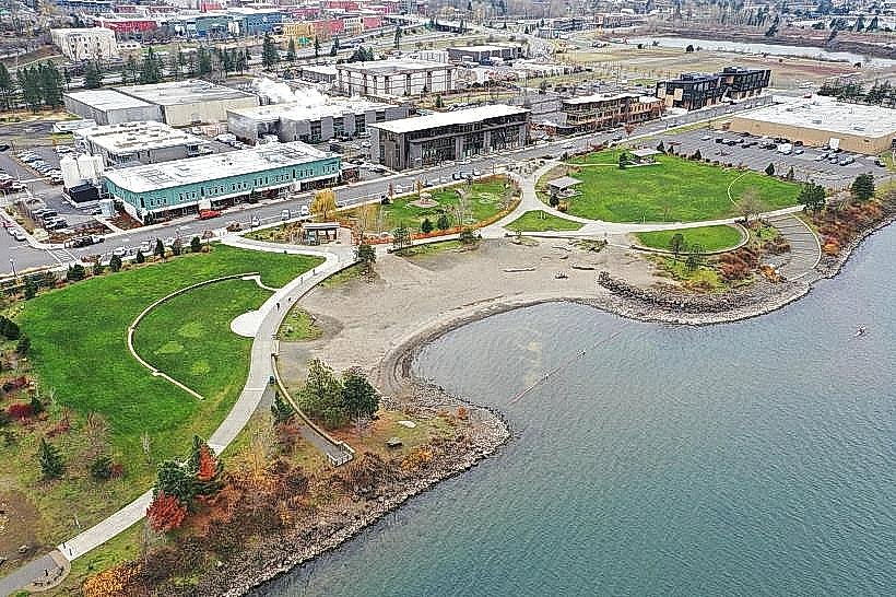
- Hood River Waterfront Park (20km North)
- Multnomah Falls (45km West)
- Columbia River Gorge National Scenic Area (25km Northwest)