Information
Landmark: Ulu Temburong National ParkCity: Temburong
Country: Brunei
Continent: Asia
Ulu Temburong National Park, Temburong, Brunei, Asia
Ulu Temburong National Park is a protected area located in the Temburong District of Brunei. It is the country's first national park, established in 1991.
Visual Characteristics
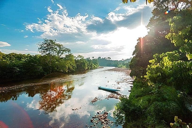
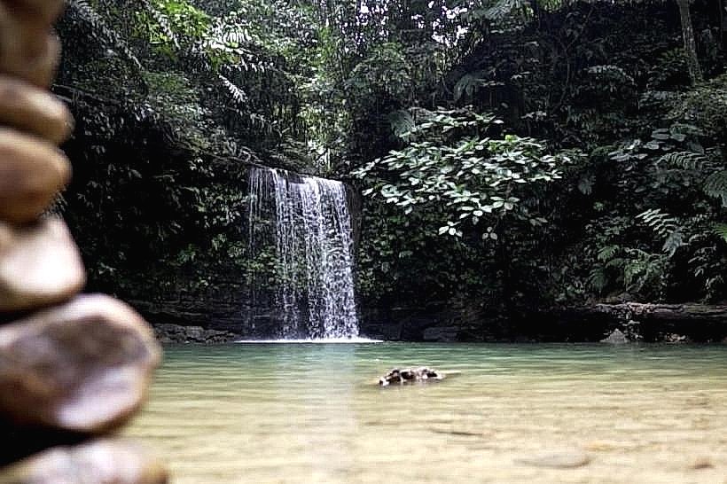
The park is characterized by dense, primary rainforest. Dominant vegetation includes dipterocarp trees, ferns, and various epiphytes. The Temburong River, a significant waterway, flows through the park, exhibiting a brown, sediment-laden appearance due to tannins from decaying organic matter. Elevation varies, with some areas reaching over 1,000 meters.
Location & Access Logistics
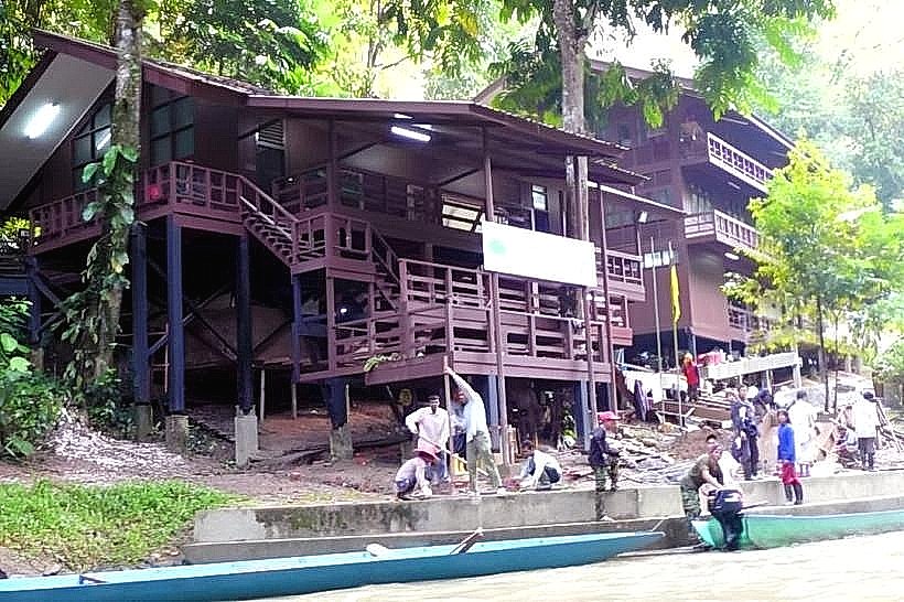
Access to Ulu Temburong National Park is primarily via the Temburong River. From Bandar Seri Begawan, travel to Bangar Town by road (approx. 45 minutes). From Bangar, longboat transfers are required to reach the park headquarters. The journey upriver takes approximately 45 minutes to 1 hour. Private boat hire is available in Bangar. There is no direct road access to the park interior. Parking is available in Bangar town.
Historical & Ecological Origin
Ulu Temburong National Park was gazetted to protect Brunei's remaining primary rainforest. Ecologically, it represents a significant tract of lowland and montane rainforest, supporting a high level of biodiversity. The area has been subject to minimal human impact, preserving its natural state.
Key Highlights & Activities
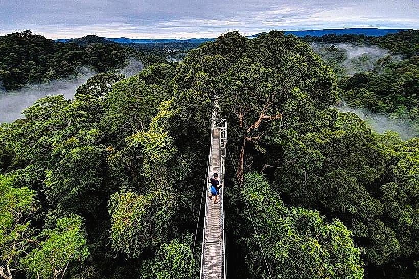
Activities include guided jungle treks along established trails, such as the Canopy Walkway, which offers elevated views of the forest canopy. Boat trips on the Temburong River are available. Observation of wildlife, including various bird species and primates, is possible. Swimming in designated river areas is permitted when conditions are safe.
Infrastructure & Amenities
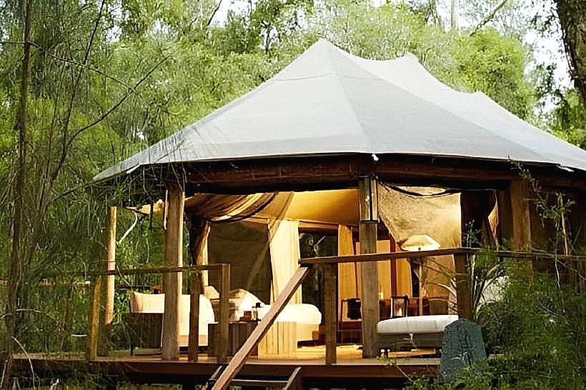
Basic facilities are available at the park headquarters, including restrooms and a small canteen offering local food. Shade is provided by the dense forest canopy. Cell phone signal is generally unreliable within the park interior. Accommodation options are limited to basic lodges or campsites, often requiring advance booking.
Best Time to Visit
The dry season, from March to October, generally offers more favorable conditions for river travel and trekking. The wet season (November to February) can lead to higher river levels and increased rainfall, potentially impacting accessibility and outdoor activities. Early morning hours provide optimal lighting for observing wildlife and for photography.
Facts & Legends
A unique feature of the park is the Canopy Walkway, a series of suspension bridges and platforms that allow visitors to experience the rainforest from a height of approximately 50 meters. Local folklore speaks of forest spirits that protect the ancient trees.
Nearby Landmarks
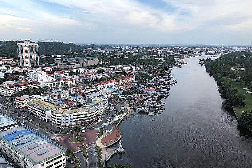
- Bangar Town (10km Southwest)
- Temburong Bridge (15km West)
- Labu Forest Reserve (20km Northwest)