Information
City: Ha GiangCountry: Vietnam
Continent: Asia
Ha Giang, Vietnam, Asia
Ha Giang, Vietnam’s northernmost frontier, is the country’s final stronghold of dramatic karst topography and authentic ethnic minority culture. As of January 21, 2026, the province is navigating its most significant tourism surge to date, having just been ranked as the #1 emerging destination in Asia for the 2026 travel season.
Current Status (January 21, 2026)
Tourism Peak: Following the New Year period, Ha Giang is currently experiencing high visitor density. Localized congestion is reported in heritage sites like Lo Lo Chai due to a surge in private vehicles.
Weather: Peak winter/cold season. Today’s high is 20°C (68°F) with a low of 13°C (55°F). High humidity (90%) and morning fog are persistent, often obscuring visibility on high-altitude passes until midday.
Security: Designated as a Safe Zone. The province is stable and unaffected by the border tensions in northwestern Cambodia.
Infrastructure Note: Travelers are advised that morning fog on the Ma Pi Leng Pass can reduce visibility to under 100 meters; midday travel is recommended for the best views.
Demographics & Population (2026)
The provincial population is estimated at 959,451.
Ethnic Composition: One of the most diverse provinces in Vietnam, with 19 ethnic groups. Nearly 90% of the population are ethnic minorities.
Hmong: ~34% (largest group)
Tay: ~22%
Dao: ~15%
Kinh (Vietnamese): ~12%
Urban vs. Rural: Over 80% of the population remains rural, living in mountain hamlets and valley floors.
Urban Layout & Districts
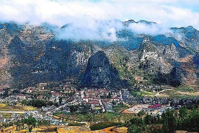
Ha Giang City: The administrative gateway; located in a valley where the Lo and Mien rivers meet.
Dong Van District: The northernmost point and heart of the UNESCO Karst Plateau.
Meo Vac District: Known for its rugged terrain and the famous Sunday livestock market.
Quan Ba District: The "Gateway to the Heaven Gate" and the iconic Twin Mountains.
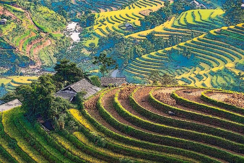
Hoang Su Phi: A western district famous for its steep, high-altitude rice terraces (separate from the main "Loop").
Top Landmarks & Attractions
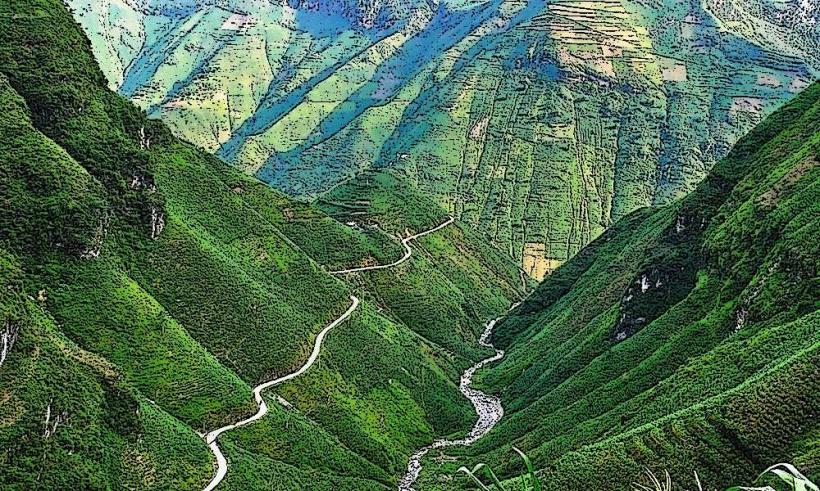
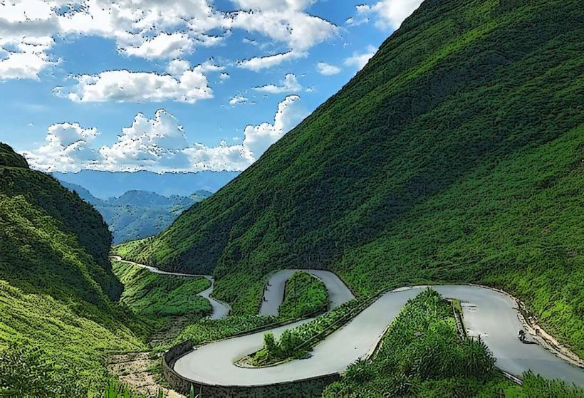
Ma Pi Leng Pass: One of Vietnam’s "Big Four" passes; features a 20km road carved into the side of a cliff 2,000m above sea level.
Dong Van Karst Plateau (UNESCO): A vast landscape of grey limestone. It features a new 120-square-meter observation platform at Ban Phung (expanded in 2025).
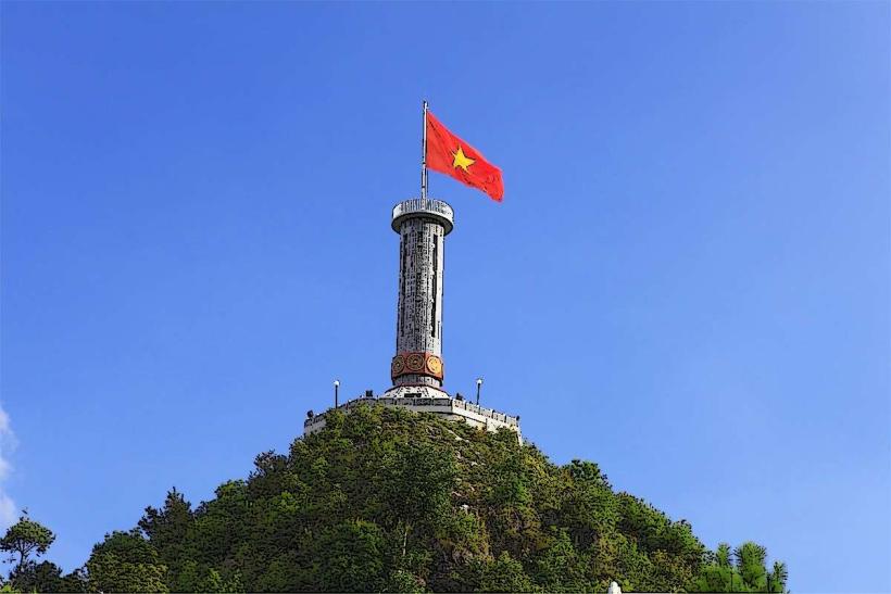
Lung Cu Flag Tower: Marking Vietnam’s northernmost point on Dragon Mountain; the site was upgraded in late 2025 with improved access stairs.
Nho Que River & Tu San Canyon: Visitors can take boat cruises through the 800-meter-deep gorge, Southeast Asia's deepest canyon.
The Hmong King’s Palace (Dinh Vua Meo): A 100-year-old mansion in Sa Phin valley blending Chinese, Hmong, and French architecture.
Lo Lo Chai Village: A preserved traditional village of the Lo Lo people near the Chinese border, currently a major hub for high-end homestays.
Transportation & Infrastructure (2026)
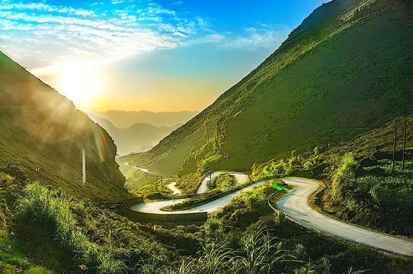
The Ha Giang Loop: The standard 350km circuit starting and ending in Ha Giang City. In 2026, many sections of National Road 4C have been widened, though defensive driving remains mandatory.
Airport Project: As of January 2026, the province is actively pursuing a mixed-use airport project to handle 1 million passengers annually by 2030; however, travel currently remains land-based (approx. 6 hours from Hanoi).
Connectivity: A new 25-meter cantilevered viewing walkway was installed at Thong Nguyen Pass in late 2025 to accommodate the 2026 tourist influx.
Digital: Travelers are increasingly utilizing integrated QR navigation at ethnic villages to minimize cultural disruption and provide localized history.
Local Cost Index (USD)
Motorbike Rental (Daily): $8.00 – $15.00
"Easy Rider" Guide (Daily): $35.00 – $55.00
Homestay (Private Room): $15.00 – $30.00
Bowl of Thang Co (Local specialty): $2.50 – $4.00
Facts & Legends
A verified historical oddity: Ha Giang is known as the "Final Frontier" because it was the last province to be fully integrated into the French colonial administration due to its impenetrable terrain. A local legend regarding the Quan Ba Twin Mountains (Fairy Hills) claims they are the breasts of a fairy who fell in love with a local Hmong man. When she was forced back to heaven, she left her breasts behind to provide milk (water) and a fertile harvest for her children on earth, which locals believe is why the valley remains exceptionally green even during droughts.