Information
Landmark: Dong Van Karst Plateau GeoparkCity: Ha Giang
Country: Vietnam
Continent: Asia
Dong Van Karst Plateau Geopark, Ha Giang, Vietnam, Asia
The Dong Van Karst Plateau Geopark is a protected geological area located in Ha Giang Province, Vietnam. It is characterized by its unique karst topography and rich cultural heritage.
Visual Characteristics
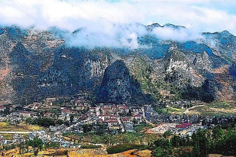
The landscape is dominated by limestone mountains and plateaus, with elevations ranging from 1,000 to 2,000 meters above sea level. Rock formations exhibit diverse shapes, including towers, cones, and arches. Vegetation varies from sparse grasses and shrubs on exposed rock faces to denser forests in valleys and on higher slopes. Rivers and streams carve through the terrain, creating canyons and valleys. Colors are predominantly earthy tones of grey rock, green vegetation, and brown soil, with seasonal variations in vegetation color.
Location & Access Logistics
The geopark is situated in the northernmost part of Ha Giang Province, bordering China. The primary access point is via National Highway 4C, which traverses the plateau. The nearest major city is Ha Giang City, approximately 150 kilometers south of the geopark's core area. Travel from Ha Giang City typically involves a multi-hour drive by car or motorbike. Public transport options are limited to inter-provincial buses that run between Ha Giang City and towns within the geopark, such as Dong Van town. Parking is generally available in designated areas within towns and at specific viewpoints, though it can be informal in more remote locations.
Historical & Ecological Origin
The geological formations of the Dong Van Karst Plateau date back approximately 400 million years, representing a complex history of marine sedimentation, tectonic uplift, and erosion. The plateau is classified as a karst landscape, formed by the dissolution of soluble rocks, primarily limestone, by water. Ecologically, it supports a unique biodiversity adapted to the challenging mountainous environment. Historically, the area has been inhabited by ethnic minority groups, including the Hmong, Tay, and Dao people, for centuries, with evidence of ancient settlements and agricultural practices.
Key Highlights & Activities
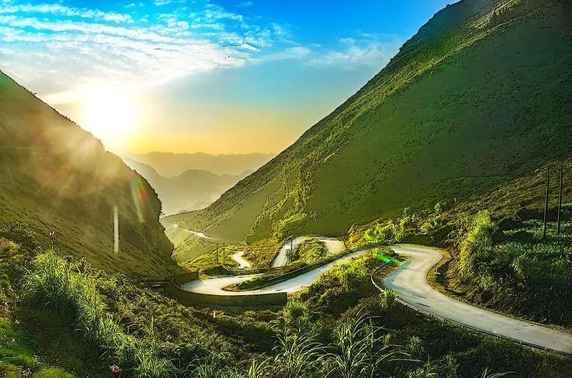
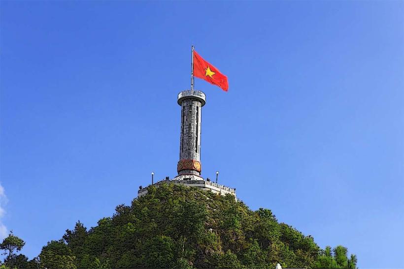
Activities include exploring the Ma Pi Leng Pass, a scenic mountain pass offering panoramic views. Visiting the Lung Cu Flag Tower provides a vantage point over the surrounding landscape and the border region. Exploring traditional ethnic villages allows for observation of local life and architecture. Hiking trails are present, offering opportunities to traverse the karst terrain. Photography is a primary activity due to the distinctive geological features and expansive vistas.
Infrastructure & Amenities
Basic infrastructure is available in towns like Dong Van and Meo Vac, including guesthouses, local eateries, and small markets. Restrooms are typically found at these service points. Shade is naturally provided by rock overhangs and vegetation in certain areas. Cell phone signal (primarily 2G/3G) can be intermittent, especially in remote valleys and higher elevations. Dedicated food vendors are concentrated in town centers; outside of these, food options are limited to local households or small shops.
Best Time to Visit
The best months for visiting are generally from September to November and from March to May, when the weather is more stable and temperatures are moderate. The dry season (October to April) is preferable for outdoor activities. For photography, early morning and late afternoon offer optimal lighting conditions for capturing the contours of the karst landscape. There are no specific tide requirements as the area is inland.
Facts & Legends
A notable geological feature is the presence of fossils embedded within the limestone, indicating the area was once submerged under a ancient sea. Local legends speak of ancient spirits residing within the prominent rock formations, influencing weather patterns and the fortunes of the local communities.
Nearby Landmarks
- Ma Pi Leng Pass (0.1km North)
- Lung Cu Flag Tower (15km North)
- Dong Van Old Town (5km West)
- Hmong King's Palace (6km West)
- Nho Que River (0.5km East)